List of listed buildings in Kirkpatrick Durham, Dumfries and Galloway
This is a list of listed buildings in the civil parish of Kirkpatrick Durham in Dumfries and Galloway, Scotland.
List
| Name | Location | Date Listed | Grid Ref. [note 1] | Geo-coordinates | Notes | LB Number [note 2] | Image |
|---|---|---|---|---|---|---|---|
| Kirkpatrick-Durham, 1 Victoria Street | 55°00′41″N 3°53′52″W | Category B | 10184 |  | |||
| Kirkpatrick-Durham, 45 And 47 Victoria Street | 55°00′41″N 3°53′39″W | Category B | 10185 | | |||
| Kirkpatrick-Durham, 50 Victoria Street | 55°00′42″N 3°53′39″W | Category C(S) | 10187 | | |||
| Walton Park Stables, Dovecot, Horsemill And Walled Garden | 55°01′03″N 3°56′19″W | Category B | 10193 | | |||
| Walton Park Lodge | 55°01′06″N 3°56′05″W | Category B | 10194 | | |||
| Durhamhill House And Flanking Steadings | 55°00′49″N 3°53′31″W | Category B | 9670 | | |||
| Brooklands, Ornamental Walling Opposite Brooklands Lodge | 55°02′08″N 3°51′16″W | Category B | 9666 | | |||
| Corsock, Signpost At Junction Of A712 And B794 | 55°03′35″N 3°55′52″W | Category B | 50001 | | |||
| Brooklands House And Walled Garden | 55°02′18″N 3°51′45″W | Category B | 10176 | | |||
| Kirkpatrick-Durham, St David's Street Schoolhouse | 55°00′50″N 3°53′45″W | Category C(S) | 10183 | | |||
| Kilquhanity School | 55°00′51″N 3°55′55″W | Category B | 9656 | | |||
| Kirkpatrick-Durham Parish Church (Church Of Scotland) And Churchyard | 55°00′32″N 3°53′58″W | Category B | 9657 | | |||
| Kirkpatrick-Durham, Beechgrove | 55°00′51″N 3°53′45″W | Category C(S) | 9658 | | |||
| Brooklands Lodge | 55°02′08″N 3°51′18″W | Category B | 9665 | | |||
| Crocketford, The Toll Cottage | 55°02′09″N 3°49′47″W | Category B | 9669 | | |||
| Old Bridge Of Urr, Signpost At B794 Junction | 54°59′22″N 3°54′44″W | Category B | 50002 | | |||
| Kirkpatrick-Durham 10 Victoria Street, Crown Hotel | 55°00′42″N 3°53′49″W | Category B | 10186 | | |||
| Old Bridge Of Urr | 54°59′20″N 3°54′53″W | Category B | 10190 | | |||
| Old Bridge Of Urr Mill | 54°59′20″N 3°54′49″W | Category A | 10191 | 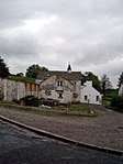 | |||
| Kirkpatrick-Durham, 1 St David's Street, Walton Road, Post Office, Savings Bank And Masonic Hall | 55°00′42″N 3°53′53″W | Category B | 9659 | | |||
| Chipperkyle Stables And Dovecot | 55°00′00″N 3°54′16″W | Category B | 9668 | | |||
| Kirkpatrick-Durham, 52 Victoria Street | 55°00′42″N 3°53′38″W | Category C(S) | 10188 | | |||
| Kirkpatrick-Durham, 54 Victoria Street | 55°00′42″N 3°53′37″W | Category B | 10189 | | |||
| Walton Park | 55°01′03″N 3°56′15″W | Category B | 10192 | | |||
| Chipperkyle House | 54°59′58″N 3°54′11″W | Category B | 9667 | | |||
| Kirkpatrick-Durham, 39 St David's Street | 55°00′49″N 3°53′48″W | Category C(S) | 10182 | | |||
| Glaisters Bridge | 55°06′00″N 3°57′08″W | Category B | 9654 | | |||
| Holmhead | 55°03′48″N 3°55′55″W | Category B | 9655 | | |||
| Durham House (Former Manse) | 55°00′38″N 3°53′58″W | Category B | 9660 | | |||
| Kirkpatrick-Durham 37 St David's Street | 55°00′49″N 3°53′48″W | Category B | 9661 | |
Key
The scheme for classifying buildings in Scotland is:
- Category A: "buildings of national or international importance, either architectural or historic; or fine, little-altered examples of some particular period, style or building type."[1]
- Category B: "buildings of regional or more than local importance; or major examples of some particular period, style or building type, which may have been altered."[1]
- Category C: "buildings of local importance; lesser examples of any period, style, or building type, as originally constructed or moderately altered; and simple traditional buildings which group well with other listed buildings."[1]
In March 2016 there were 47,288 listed buildings in Scotland. Of these, 8 per cent were Category A, and 50 per cent were Category B, with the rest listed at Category C.[2]
Notes
- Sometimes known as OSGB36, the grid reference (where provided) is based on the British national grid reference system used by the Ordnance Survey.
• "Guide to National Grid". Ordnance Survey. Retrieved 2007-12-12.
• "Get-a-map". Ordnance Survey. Retrieved 2007-12-17. - Historic Environment Scotland assign a unique alphanumeric identifier to each designated site in Scotland, for listed buildings this always begins with "LB", for example "LB12345".
References
- All entries, addresses and coordinates are based on data from Historic Scotland. This data falls under the Open Government Licence
- "What is Listing?". Historic Environment Scotland. Retrieved 29 May 2018.
- Scotland's Historic Environment Audit 2016 (PDF). Historic Environment Scotland and the Built Environment Forum Scotland. pp. 15–16. Retrieved 29 May 2018.
| Wikimedia Commons has media related to Kirkpatrick Durham. |
This article is issued from Wikipedia. The text is licensed under Creative Commons - Attribution - Sharealike. Additional terms may apply for the media files.