Dibble Iceberg Tongue
Dibble Iceberg Tongue (65°30′S 135°0′E) is an iceberg tongue at the seaward end of Dibble Glacier Tongue. The names Dibble Glacier and Dibble Glacier Tongue were applied by the Advisory Committee on Antarctic Names (US-ACAN) in 1955, concurrent with G.D. Blodgett's delineation of the features from aerial photographs taken by U.S. Navy Operation Highjump (1946–47). The offshore segment of these two related features was photographed by the Australian National Antarctic Research Expeditions in 1956 and 1959, and the Antarctic Names Committee of Australia subsequently recommended that it be named Dibble Iceberg Tongue. US-ACAN has approved the latter name only for the portion lying seaward of Dibble Glacier Tongue.[1]
| Dibble Iceberg Tongue | |
|---|---|
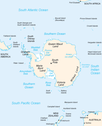 Map of Antarctica, with Wilkes Land slightly to the right | |
 Location of Dibble Iceberg Tongue in Antarctica | |
| Location | Wilkes Land |
| Coordinates | 65°30′00″S 135°00′00″E |
| Thickness | unknown |
| Terminus | Dibble Glacier Tongue |
| Status | unknown |
References
- "Dibble Iceberg Tongue". Geographic Names Information System. United States Geological Survey. Retrieved 2012-01-19.

Dibble Iceberg Tongue
| Types |
| ||||||
|---|---|---|---|---|---|---|---|
| Anatomy |
| ||||||
| Processes | |||||||
| Measurements | |||||||
| Volcanic relations | |||||||
| Landforms |
| ||||||
| |||||||
This article is issued from Wikipedia. The text is licensed under Creative Commons - Attribution - Sharealike. Additional terms may apply for the media files.