Nimrod Glacier
The Nimrod Glacier is a major glacier about 135 km (85 mi) long, flowing from the polar plateau in a northerly direction through the Transantarctic Mountains between the Geologists and Miller Ranges, then northeasterly between the Churchill Mountains and Queen Elizabeth Range, and finally spilling into Shackleton Inlet and the Ross Ice Shelf between Capes Wilson and Lyttelton.
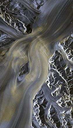
Satelight image

Area map of Nimrod glacier.
It was photographed from the air by USN Operation Highjump, 1946–47. The name, given by US-ACAN, is in association with Shackleton Inlet and is for the Nimrod, the ship of the British Antarctic Expedition (1907–09) under Ernest Shackleton.
See also
External links

This article is issued from Wikipedia. The text is licensed under Creative Commons - Attribution - Sharealike. Additional terms may apply for the media files.