Yakoruda Glacier
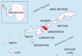
Yakoruda Glacier (Bulgarian: ледник Якоруда, romanized: lednik Yakoruda, IPA: [ˈlɛdnik jakoˈrudɐ]) is a glacier on the west slopes of Dryanovo Heights, Greenwich Island in the South Shetland Islands, Antarctica situated west of Teteven Glacier and northwest of Murgash Glacier. It extends 3.5 km in north-south direction and 2.5 km in east-west direction, is bounded by Greaves Peak, Hrabar Nunatak and Crutch Peaks to the north, Lloyd Hill to the east and Kerseblept Nunatak to the south, and drains westwards into Berende Cove, McFarlane Strait.
| Yakoruda Glacier | |
|---|---|
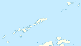
 Location of Greenwich Island in the South Shetland Islands | |
 Location of Yakoruda Glacier in Antarctica  Yakoruda Glacier (Antarctica) | |
| Location | Greenwich Island South Shetland Islands |
| Coordinates | 62°28′30″S 59°56′37″W |
| Length | 2 nmi (4 km; 2 mi) |
| Width | 1 nmi (2 km; 1 mi) |
| Thickness | unknown |
| Terminus | Berende Cove |
| Status | unknown |
The feature is named after the town of Yakoruda in southwestern Bulgaria.
Location
Yakoruda Glacier is centred at 62°28′30″S 59°56′37″W (Bulgarian survey Tangra 2004/05 and mapping in 2005 and 2009).
Maps
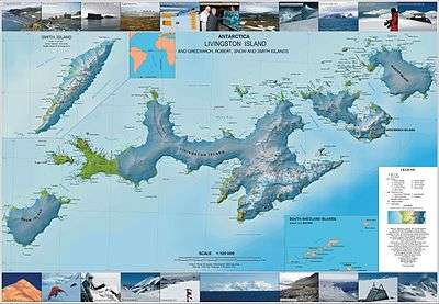
- L.L. Ivanov et al. Antarctica: Livingston Island and Greenwich Island, South Shetland Islands. Scale 1:100000 topographic map. Sofia: Antarctic Place-names Commission of Bulgaria, 2005.
- L.L. Ivanov. Antarctica: Livingston Island and Greenwich, Robert, Snow and Smith Islands. Scale 1:120000 topographic map. Troyan: Manfred Wörner Foundation, 2009. ISBN 978-954-92032-6-4
References
- Yakoruda Glacier. SCAR Composite Antarctic Gazetteer
- Bulgarian Antarctic Gazetteer. Antarctic Place-names Commission. (details in Bulgarian, basic data in English)
External links
- Yakoruda Glacier. Copernix satellite image
This article includes information from the Antarctic Place-names Commission of Bulgaria which is used with permission.