Andrew Glacier
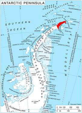
Andrew Glacier (63°53′S 59°40′W) is a glacier 3 nautical miles (6 km) long, flowing northeast into Ognen Cove in Charcot Bay immediately west of the Webster Peaks on Trinity Peninsula, northern Graham Land.
| Andrew Glacier | |
|---|---|
 Location of Trinity Peninsula | |
 Location of Andrew Glacier in Antarctica | |
| Location | Graham Land |
| Coordinates | 63°53′S 59°40′W |
| Length | 3 nmi (6 km; 3 mi) |
| Thickness | unknown |
| Highest elevation | 442 m (1,450 ft) |
| Terminus | Ognen Cove |
| Status | unknown |
History
Andrew Glacier was charted in 1948 by the Falkland Islands Dependencies Survey (FIDS) who named the feature for Dr. James Darby Andrew, medical officer at the FIDS Hope Bay station in 1946–47.[1][2]
Maps
- Antarctic Digital Database (ADD). Scale 1:250000 topographic map of Antarctica. Scientific Committee on Antarctic Research (SCAR). Since 1993, regularly upgraded and updated.
References
- "Andrew Glacier". Geographic Names Information System. United States Geological Survey. Retrieved 2011-05-10.
- Andrew Glacier. SCAR Composite Antarctic Gazetteer.
![]()
This article is issued from Wikipedia. The text is licensed under Creative Commons - Attribution - Sharealike. Additional terms may apply for the media files.