Pirin Glacier
Pirin Glacier (Bulgarian: ледник Пирин, romanized: lednik Pirin, IPA: [ˈlɛdnik ˈpirin]) is the 5.7 km long and 6 km wide glacier situated next east of Chavdar Peninsula on Davis Coast on the Antarctic Peninsula. Situated west of Wright Ice Piedmont, north of Gregory Glacier and east of Samodiva Glacier. Draining north-northwestwards from Boulton Peak to enter Curtiss Bay east of Seaplane Point.
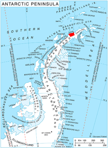
Location of Davis Coast on the Antarctic Peninsula.
The glacier is named after Pirin Mountain in southwestern Bulgaria.
Location
Pirin Glacier is located at 64°05′30″S 60°43′00″W. British mapping in 1978.
Maps
- British Antarctic Territory. Scale 1:200000 topographic map No. 3198. DOS 610 - W 64 60. Tolworth, UK, 1978.
- Antarctic Digital Database (ADD). Scale 1:250000 topographic map of Antarctica. Scientific Committee on Antarctic Research (SCAR). Since 1993, regularly upgraded and updated.
External links
- Pirin Glacier Copernix satellite image
References
- Bulgarian Antarctic Gazetteer. Antarctic Place-names Commission. (details in Bulgarian, basic data in English)
- Pirin Glacier. SCAR Composite Antarctic Gazetteer
This article includes information from the Antarctic Place-names Commission of Bulgaria which is used with permission.
This article is issued from Wikipedia. The text is licensed under Creative Commons - Attribution - Sharealike. Additional terms may apply for the media files.