Nimitz Glacier
The Nimitz Glacier is an Antarctic glacier, 40 nautical miles (74 km; 46 mi) long and 5 nautical miles (9.3 km; 5.8 mi) wide, draining the area about 10 nautical miles (19 km; 12 mi) west of the Vinson Massif and flowing southeast between the Sentinel Range and Bastien Range to enter Minnesota Glacier, in the central Ellsworth Mountains.
| Nimitz Glacier | |
|---|---|
 Location of Ellsworth Mountains in Western Antarctica | |
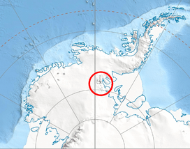
 Location of Nimitz Glacier in Antarctica | |
| Type | tributary |
| Location | Ellsworth Land |
| Coordinates | 78°55′00″S 85°10′00″W |
| Length | 40 nautical miles (74 km; 46 mi) |
| Width | 5 nautical miles (9.3 km; 5.8 mi) |
| Thickness | unknown |
| Terminus | Minnesota Glacier |
| Status | unknown |

Discovered by USN Squadron VX-6 on photographic flights of December 14-December 15, 1959, and mapped by United States Geological Survey from these photos. Named by US-ACAN for Fleet Admiral Chester Nimitz, USN, who as Chief of Naval Operations at the time of Operation Highjump, 1947–1948, made possible that unprecedentedly large and complex Antarctic expedition.
Tributary glaciers
Maps
- Vinson Massif. Scale 1:250 000 topographic map. Reston, Virginia: US Geological Survey, 1988.
- D. Gildea and C. Rada. Vinson Massif and the Sentinel Range. Scale 1:50 000 topographic map. Omega Foundation, 2007.
- Antarctic Digital Database (ADD). Scale 1:250000 topographic map of Antarctica. Scientific Committee on Antarctic Research (SCAR). Since 1993, regularly updated.
References
![]()