Conger Glacier
Conger Glacier (66°2′S 103°33′E) is a glacier 5 nautical miles (9 km) east of Glenzer Glacier, flowing north into the eastern part of the Shackleton Ice Shelf. It was mapped by G.D. Blodgett (1955) from air photos taken by U.S. Navy Operation Highjump (1946–47). It was named by the Advisory Committee on Antarctic Names for Richard R. Conger, Chief Photographer's Mate with U.S. Navy Operation Windmill (1947–48), who assisted in establishing astronomical control stations along the coast from Wilhelm II Coast to Budd Coast.[1]
| Conger Glacier | |
|---|---|
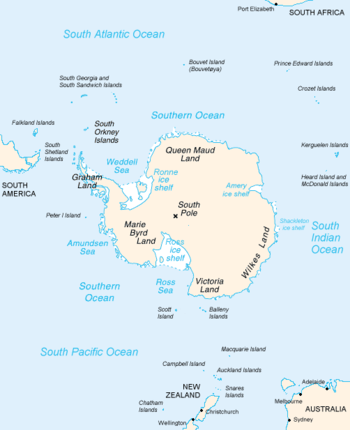 Map of Antarctica, with Wilkes Land slightly to the right | |
 Location of Conger Glacier in Antarctica | |
| Location | Wilkes Land |
| Coordinates | 66°58′00″S 109°00′00″E |
| Length | 5 nautical miles (9.3 km; 5.8 mi) |
| Thickness | unknown |
| Terminus | Shackleton Ice Shelf |
| Status | unknown |
References
- "Conger Glacier". Geographic Names Information System. United States Geological Survey. Retrieved 2011-11-21.

| Types |
| ||||||
|---|---|---|---|---|---|---|---|
| Anatomy |
| ||||||
| Processes | |||||||
| Measurements | |||||||
| Volcanic relations | |||||||
| Landforms |
| ||||||
| |||||||
This article is issued from Wikipedia. The text is licensed under Creative Commons - Attribution - Sharealike. Additional terms may apply for the media files.