Padala Glacier
Padala Glacier (Bulgarian: ледник Падала, romanized: lednik Padala, IPA: [ˈlɛdnik pɐˈdaɫɐ]) is the 5.6 nautical miles (10.4 km; 6.4 mi) long and 2.4 nautical miles (4.4 km; 2.8 mi) wide glacier in Bangey Heights on the east side of the main ridge of north-central Sentinel Range in Ellsworth Mountains, Antarctica. It is situated northwest of Kopsis Glacier and east-southeast of Marsa Glacier. The glacier drains the northeast slopes of Bezden Peak and the southeast slopes of Golemani Peak, flows northeastwards and joins Embree Glacier northwest of Mount Hleven.
| Padala Glacier | |
|---|---|
 Location of Sentinel Range in Western Antarctica | |
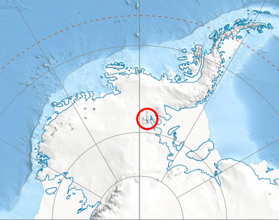
 Location of Padala Glacier in Antarctica | |
| Type | tributary |
| Location | Ellsworth Land |
| Coordinates | 78°02′40″S 85°31′00″W |
| Length | 5.6 nautical miles (10.4 km; 6.4 mi) |
| Width | 2.4 nautical miles (4.4 km; 2.8 mi) |
| Thickness | unknown |
| Terminus | Embree Glacier |
| Status | unknown |

The glacier is named after the settlement of Padala in Western Bulgaria.
Location
Padala Glacier is centred at 78°02′40″S 85°31′00″W. US mapping in 1961 and 1988.
Maps
- Vinson Massif. Scale 1:250 000 topographic map. Reston, Virginia: US Geological Survey, 1988.
- Antarctic Digital Database (ADD). Scale 1:250000 topographic map of Antarctica. Scientific Committee on Antarctic Research (SCAR). Since 1993, regularly updated.
References
- Padala Glacier SCAR Composite Gazetteer of Antarctica
- Bulgarian Antarctic Gazetteer. Antarctic Place-names Commission. (details in Bulgarian, basic data in English)
External links
- Padala Glacier. Copernix satellite image
This article includes information from the Antarctic Place-names Commission of Bulgaria which is used with permission.
| Types |
| ||||||
|---|---|---|---|---|---|---|---|
| Anatomy |
| ||||||
| Processes | |||||||
| Measurements | |||||||
| Volcanic relations | |||||||
| Landforms |
| ||||||
| |||||||