Kleptuza Glacier
Kleptuza Glacier (Bulgarian: ледник Клептуза, romanized: lednik Kleptuza, IPA: [ˈlɛdnik klɛpˈtuzɐ]) is a 6 km long and 6 km wide glacier draining the east slopes of Mount Hector in the Trojan Range and the north slopes of Osterrieth Range on Anvers Island in the Palmer Archipelago, Antarctica. Situated southeast of Thamyris Glacier and west of Altimir Glacier. Flowing northwards to enter Fournier Bay east of Madzharovo Point and west of Studena Point.
| Kleptuza Glacier | |
|---|---|
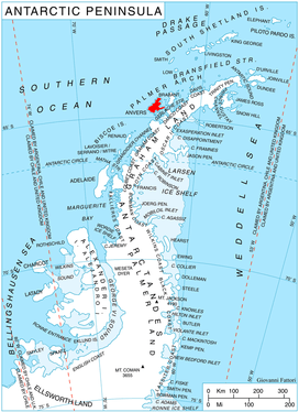 Location of Anvers Island in the Antarctic Peninsula region | |
 Location of Kleptuza in Antarctica | |
| Location | Palmer Archipelago |
| Coordinates | 64°36′S 62°16′W |
| Length | 3 nmi (6 km; 3 mi) |
| Width | 3 nmi (6 km; 3 mi) |
| Thickness | unknown |
| Terminus | Fournier Bay |
| Status | unknown |
The glacier is named after the karst spring of Kleptuza in southern Bulgaria.
Location
Kleptuza Glacier is located at 64°36′00″S 63°16′00″W. British mapping in 1980.
Maps
- British Antarctic Territory. Scale 1:200000 topographic map No. 3217. DOS 610 - W 64 62. Tolworth, UK, 1980.
- Antarctic Digital Database (ADD). Scale 1:250000 topographic map of Antarctica. Scientific Committee on Antarctic Research (SCAR). Since 1993, regularly upgraded and updated.
References
- Kleptuza Glacier. SCAR Composite Gazetteer of Antarctica
- Bulgarian Antarctic Gazetteer. Antarctic Place-names Commission. (details in Bulgarian, basic data in English)
External links
- Kleptuza Glacier. Copernix satellite image
This article includes information from the Antarctic Place-names Commission of Bulgaria which is used with permission.
| Types |
| ||||||
|---|---|---|---|---|---|---|---|
| Anatomy |
| ||||||
| Processes | |||||||
| Measurements | |||||||
| Volcanic relations | |||||||
| Landforms |
| ||||||
| |||||||
This article is issued from Wikipedia. The text is licensed under Creative Commons - Attribution - Sharealike. Additional terms may apply for the media files.