Drygalski Glacier (Antarctica)
Drygalski Glacier (64°43′S 60°44′W) is a broad glacier, 18 nautical miles (33 km; 21 mi) long and 15 miles (24 km) wide at its head, which flows from Herbert Plateau southeast between Ruth Ridge and Kyustendil Ridge, and enters Solari Bay immediately north of Sentinel Nunatak on Nordenskjöld Coast, the east coast of Graham Land, Antarctica. It was discovered in 1902 by the Swedish Antarctic Expedition, under Otto Nordenskiöld, and named "Drygalski Bay" after Professor Erich von Drygalski. The feature was determined to be a glacier by the Falkland Islands Dependencies Survey in 1947.[1]
| Drygalski Glacier | |
|---|---|
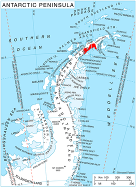 Location of Nordenskjöld Coast | |
 Location of Drygalski Glacier in Antarctica | |
| Location | Graham Land |
| Coordinates | 64°43′S 60°44′W |
| Length | 18 nmi (33 km; 21 mi) |
| Thickness | unknown |
| Terminus | Solari Bay |
| Status | unknown |
References
- "Drygalski Glacier". Geographic Names Information System. United States Geological Survey. Retrieved 2012-01-31.
![]()