Watertown, Connecticut
| Watertown, Connecticut | ||
|---|---|---|
| Town | ||
| ||
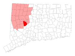 Location in Litchfield County, Connecticut | ||
| Coordinates: 41°37′N 73°7′W / 41.617°N 73.117°WCoordinates: 41°37′N 73°7′W / 41.617°N 73.117°W | ||
| Country | United States | |
| State | Connecticut | |
| NECTA | Waterbury | |
| Region | Central Naugatuck Valley | |
| Incorporated | 1780 | |
| Government | ||
| • Type | Council-manager | |
| • Town manager | Robert Scannell | |
| • Town council |
Raymond F. Primini, Chm.(R) Mary Ann Rosa, Vice Chm. (R) Gary L. Bernier David J. Demirs (D) Richard DiFederico (R) Ed Lopes (R) Joe Polletta (R) Lou Razza (D) K. Duplisse (R) | |
| • Board of Education Commissioners |
Leslie Crotty, Chm. (R) Tom Lambert, Vice Chm. (R) Janelle Wilk, Sec. (R) Robert Makowski (R) Victor Vicenzi, Jr. (R) Cathie Rinaldi (R) Josephine Cavallo-Rosa (D) James C. Gambardella (D) Cheryl Albino (D) | |
| Area | ||
| • Total | 29.6 sq mi (76.7 km2) | |
| • Land | 29.2 sq mi (75.5 km2) | |
| • Water | 0.4 sq mi (1.1 km2) | |
| Elevation | 620 ft (189 m) | |
| Population (2010) | ||
| • Total | 22,514 | |
| • Density | 765/sq mi (298.2/km2) | |
| Time zone | UTC-5 (Eastern) | |
| • Summer (DST) | UTC-4 (Eastern) | |
| ZIP code | 06779, 06795 | |
| Area code(s) | 860 | |
| FIPS code | 09-80490 | |
| GNIS feature ID | 0213527 | |
| Website |
www | |

Watertown is a town in Litchfield County, Connecticut, United States. The population was 22,514 at the 2010 census. The zip code for Watertown is 06795. It is a suburb of Waterbury. It borders the towns of Woodbury, Middlebury, Litchfield, Plymouth, Bethlehem, and Thomaston. The urban center of the town is the Watertown census-designated place, with a population of 3,574 at the 2010 census.[1]
Founding
Around 1657 began the colonization of the area today called Watertown. In that time, the colony was called Mattatock, though it had several variations in spelling through the years.[2] The land where Watertown is now located, having originally belonged to Mattatock, officially changed its name to Watterbury (now Waterbury) by record on March 20, 1695, by consensus of a council. Essentially, the original Colony of Mattatuck, which became Watterbury, then Waterbury in name, comprised a much greater land area than Waterbury does today. The original name for Watertown was Waterbury.[3] Thomas Judd and other families were among the first investors to buy the land as a group. The Town of Watertown was officially incorporated in 1780 under a charter within the United States of America.[4]
Geography
It is in the Eastern Standard time zone. The elevation is 620 feet.
According to the United States Census Bureau, the town has a total area of 29.6 square miles (76.6 km²), of which, 29.1 square miles (75.5 km²) of it is land and 0.4 square miles (1.1 km²) of it (1.45%) is water. Watertown also includes the section known as Oakville, which is often mistaken for a separate town. Although Oakville has its own post office and ZIP code, it does not have a charter or town government of its own. Oakville also receives all of its city services (Police, fire, water and so on) from Watertown.
Demographics
| Historical population | |||
|---|---|---|---|
| Census | Pop. | %± | |
| 1820 | 1,439 | — | |
| 1850 | 1,533 | — | |
| 1860 | 1,587 | 3.5% | |
| 1870 | 1,698 | 7.0% | |
| 1880 | 1,897 | 11.7% | |
| 1890 | 2,323 | 22.5% | |
| 1900 | 3,100 | 33.4% | |
| 1910 | 3,850 | 24.2% | |
| 1920 | 6,050 | 57.1% | |
| 1930 | 8,192 | 35.4% | |
| 1940 | 8,787 | 7.3% | |
| 1950 | 10,699 | 21.8% | |
| 1960 | 14,837 | 38.7% | |
| 1970 | 18,610 | 25.4% | |
| 1980 | 19,489 | 4.7% | |
| 1990 | 20,456 | 5.0% | |
| 2000 | 21,661 | 5.9% | |
| 2010 | 22,514 | 3.9% | |
| Est. 2014 | 22,046 | [5] | −2.1% |
| U.S. Decennial Census[6] | |||
As of the census[7] of 2000, there were 21,661 people, 8,046 households, and 5,994 families residing in the town. The population density was 743.0 people per square mile (286.9/km²). There were 8,298 housing units at an average density of 284.6 per square mile (109.9/km²). The racial makeup of the town was 96.46% White, 0.75% African American, 0.12% Native American, 1.27% Asian, 0.05% Pacific Islander, 0.48% from other races, and 0.87% from two or more races. Hispanic or Latino of any race were 1.87% of the population.
There were 8,046 households out of which 34.7% had children under the age of 18 living with them, 61.7% were married couples living together, 9.4% had a female householder with no husband present, and 25.5% were non-families. 21.7% of all households were made up of individuals and 9.4% had someone living alone who was 65 years of age or older. The average household size was 2.67 and the average family size was 3.13.
In the town, the population was spread out with 24.8% under the age of 18, 6.3% from 18 to 24, 29.9% from 25 to 44, 24.9% from 45 to 64, and 14.1% who were 65 years of age or older. The median age was 39 years. For every 100 females, there were 92.0 males. For every 100 females age 18 and over, there were 90.6 males.
The median income for a household in the town was $59,420, and the median income for a family was $68,761. Males had a median income of $47,097 versus $31,822 for females. The per capita income for the town was $26,044. About 1.1% of families and 2.2% of the population were below the poverty line, including 0.8% of those under age 18 and 3.7% of those age 65 or over.
Transportation
The Route 8 expressway runs through the eastern edge of town, with two exits inside the town. The main routes through the town center are Route 6 running east-west and Route 63 running north-south. Other important highways include Route 73 (a more direct route to Waterbury), and Route 262. Public transportation is provided by buses of Northeast Transportation Company.
Local media
- Waterbury Republican-American, a Waterbury-based independent daily newspaper
- Town Times, Prime Publishers Inc., a local newspaper serving Watertown, Oakville, Bunker Hill in Waterbury, Thomaston and Northfield. Voices, its sister paper, covers Southbury, Middlebury, Oxford, Seymour, Naugatuck, Woodbury, Bethelhem, New Preston, Washington, Washington Depot, Roxbury, Bridgewater, Monroe, Sandy Hook and Newtown.
- Macaroni Kid, an online magazine for families in Watertown[8]
Notable places
- The Taft School, a private boarding school
- Mt. Olivet Cemetery
- Watertown Historical Society
- The Old Burying Ground is a historical cemetery located on the corner of Main Street and French Street. The first body buried there was Hannah Richards Scovill in 1741 and the last was Martha Beardsly in 1938. It is unknown exactly how many bodies are interred there, since record keeping was not precise in the early days. Many graves went unmarked and gravediggers complained that no matter where they dug, they hit previously buried coffins. This overcrowding led to the opening of Evergreen Cemetery on North Street in the 1850s.
- Crestbrook Park Golf Course, public golf course
Notable people
- Rico Brogna, MLB 1st baseman who played for the Detroit Tigers, New York Mets, Philadelphia Phillies, Boston Red Sox, and Atlanta Braves from 1992 to 2001
- Joe Cipriano, television announcer CBS, Fox, radio personality WWCO, WRQX, and KIIS FM
- Erastus L. De Forest (1834–1888), mathematician
- Edward Fitzsimmons Dunne (1853–1937), 31st mayor of Chicago (1905–1907); governor of Illinois (1913–1917) was born in Watertown.
- Benjamin B. Hotchkiss (1826–1885), for whom The Hotchkiss School was named by his widow, was one of the leading American ordnance engineers of his day. He made his money by founding a successful munitions company in France after the American Civil War. He was born in Watertown but in early childhood moved to Sharon.
- Leatherman (1839–1889), drifter within the CT and Hudson River Valley areas, known for his leather clothing.
- Meredith Mallory, former US Congressman
- Chris McKenna, actor featured in State of Affairs, The Young and the Restless, One Life to Live
- Thomas Tessier, American writer of horror novels and short stories, current resident of Watertown
- John Trumbull (1750–1831), American political satirist and poet, was born in Watertown.
- Allen B. Wilson and Nathaniel Wheeler started their Wheeler & Wilson Manufacturing Company there. It was one of the first manufacturers of sewing machines.
References
- ↑ https://www.census.gov/prod/cen2010/cph-2-8.pdf
- ↑ "WATERBURY, CONNECTICUT". JosFamilyHistory.com. Retrieved August 15, 2017.
- ↑ "Full text of "The History of Waterbury, Connecticut: The Original Township Embracing Present Watertown and ..."". archive.org. p. 137. Retrieved August 15, 2017.
- ↑ "Watertown, CT - Brief History of Watertown CT". www.WatertownCT.org. Retrieved August 17, 2017.
- ↑ "Annual Estimates of the Resident Population for Incorporated Places: April 1, 2010 to July 1, 2014". Retrieved June 4, 2015.
- ↑ "Census of Population and Housing". Census.gov. Retrieved June 4, 2015.
- ↑ "American FactFinder". United States Census Bureau. Retrieved 2008-01-31.
- ↑ "Macaroni Kid". Southbury.MacaroniKid.com. Retrieved August 17, 2017.
External links
Municipalities and communities of Litchfield County, Connecticut, United States | ||
|---|---|---|
| Consolidated city | 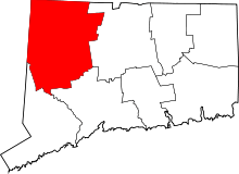 | |
| Towns | ||
| Boroughs | ||
| CDPs |
| |
| Other communities | ||
| Indian reservation | ||
| Topics | |||||||
|---|---|---|---|---|---|---|---|
| States | |||||||
| Major cities | |||||||
| State capitals | |||||||
| Transportation |
| ||||||
| |||||||