Bethlehem Township, Northampton County, Pennsylvania
| Bethlehem Township, Pennsylvania | |
|---|---|
.jpg) Commercial buildings at Butztown | |
.svg.png) Location of Pennsylvania in the United States | |
| Coordinates: 40°40′00″N 75°17′59″W / 40.66667°N 75.29972°WCoordinates: 40°40′00″N 75°17′59″W / 40.66667°N 75.29972°W | |
| Country | United States |
| State | Pennsylvania |
| County | Northampton |
| Area[1] | |
| • Total | 14.60 sq mi (37.82 km2) |
| • Land | 14.43 sq mi (37.38 km2) |
| • Water | 0.17 sq mi (0.45 km2) |
| Elevation | 440 ft (130 m) |
| Population (2010) | |
| • Total | 23,730 |
| • Estimate (2016)[2] | 23,952 |
| • Density | 1,659.65/sq mi (640.81/km2) |
| Time zone | UTC-5 (EST) |
| • Summer (DST) | UTC-4 (EDT) |
| ZIP codes | 18020, 18045 |
| Area code(s) | 610 & 484 |
| FIPS code | 42-095-06096 |
| Website | http://bethlehemtownship.org/ |
Bethlehem Township is a township in Northampton County, Pennsylvania, United States. Bethlehem Township is located in the Lehigh Valley region of the state and is a suburb of Bethlehem, Pennsylvania. It falls within the New York-Newark-Jersey City, NY-NJ-PA Metropolitan Statistical Area, as defined by the United States Office of Management and Budget.
The population of Bethlehem Township was 23,730 at the 2010 census.
Government
Township officials As a Township of the First Class under Pennsylvania law, Bethlehem Township has a five-member Board of Commissioners and a Treasurer. In accordance with the PA First Class Township Code, the Bethlehem Township Board of Commissioners is charged with the general governance of the Township. The Board serves as the legislative body of the township, setting policy, enacting ordinances and resolutions, adopting budgets and levying taxes.
The duties of the Treasurer include, among other responsibilities, the task of collecting certain real estate taxes. The Township Manager is appointed by the Commissioners.
The current elected officials are:
Board of Commissioners:
- Tom Nolan, 1st Ward
- Mike Hudak, 2nd Ward
- John Gallagher, 3rd Ward
- John Merhottein, 4th Ward
- Malissa Davis, At-Large
Geography
According to the United States Census Bureau, the township has a total area of 14.7 square miles (38 km2), of which, 14.6 square miles (38 km2) of it is land and 0.1 square miles (0.26 km2) of it (0.61%) is water. It is drained by the Lehigh River, which separates it from Lower Saucon Township. Its villages include Brodhead, Butztown, Farmersville, Middletown, Prospect Park (also in Palmer Township,) and Wagnerville. Its major roads include east-to-west Highway 22, William Penn Highway, and Freemansburg Road and north-to-south Highway 33, Route 191, Butztown Road/Hecktown Road, Farmersville Road, and Main Street Extension.
Neighboring municipalities
- Lower Saucon Township (south)
- Easton (southeast)
- Palmer Township (east)
- Lower Nazareth Township (north)
- Hanover Township (west)
- Bethlehem (southwest)
- Freemansburg (southwest)
History
The ancient Lenni Lenape or Delaware First Nation peoples lived in the Lehigh River valley. The Lehigh River and its Monocacy Creek and Nancy Run tributaries, provided fertile soil and ample fishing opportunities for the area's inhabitants before the arrival of William Penn, newly named "Proprietor" of the Province of Pennsylvania in 1681.
In 1737, Penn's family negotiated a land purchase from the Lenape, known today as the "Walking Purchase". From this agreement, settlement began by Europeans newly arrived in pre-Revolutionary War Pennsylvania.
The municipality of Bethlehem Township was formed in 1746 as a part of Bucks County.[3] The name of Bethlehem itself originated from the German Moravian Brethren on Christmas Eve in 1741.[4] The township, as originally defined, contained the current township as well as the townships of Upper Nazareth and Lower Nazareth.[5] As shown on a page from the 1874 "Atlas of Northampton County", Upper and Lower Nazareth Townships had been created, but the then-borough of Bethlehem had not yet annexed the areas of Altona and parcels along Center Street (Bath Pike), Linden Street (Nazareth Pike), and Easton Avenue.[6]
Demographics
| Historical population | |||
|---|---|---|---|
| Census | Pop. | %± | |
| 2000 | 21,171 | — | |
| 2010 | 23,730 | 12.1% | |
| Est. 2016 | 23,952 | [2] | 0.9% |
| U.S. Decennial Census[7] | |||
As of the census[8] of 2000, there were 21,171 people, 7,619 households, and 5,889 families residing in the township. The population density was 1,451.7 people per square mile (560.6/km2). There were 7,831 housing units at an average density of 537.0/sq mi (207.4/km2). The racial makeup of the township was 93.27% White, 2.44% African American, 0.07% Native American, 2.20% Asian, 0.01% Pacific Islander, 1.14% from other races, and 0.87% from two or more races. Hispanic or Latino of any race were 3.97% of the population.
There were 7,619 households, out of which 36.2% had children under the age of 18 living with them, 67.4% were married couples living together, 7.4% had a female householder with no husband present, and 22.7% were non-families. 19.2% of all households were made up of individuals, and 8.9% had someone living alone who was 65 years of age or older. The average household size was 2.69 and the average family size was 3.09.
In the township the population was spread out, with 25.1% under the age of 18, 6.4% from 18 to 24, 28.1% from 25 to 44, 25.5% from 45 to 64, and 14.8% who were 65 years of age or older. The median age was 40 years. For every 100 females there were 93.1 males. For every 100 females age 18 and over, there were 89.5 males.
The median income for a household in the township was $60,317, and the median income for a family was $68,427. Males had a median income of $47,363 versus $32,136 for females. The per capita income for the township was $25,141. About 2.2% of families and 2.7% of the population were below the poverty line, including 2.6% of those under age 18 and 4.2% of those age 65 or over.
Education
The township is served by the Bethlehem Area School District, which consists of sixteen elementary schools, four middle schools, and two high schools.[9] The high schools have a considerable enrollment size, Freedom High School has 1,750 currently while Liberty High School is at 3,000[10] as of the 2014-2015 school year. Notre Dame High School, Moravian Academy, and Our Lady of Perpetual Help schools make up the parochial schools.
Colleges and Universities
Community, Junior, and Technical Colleges
Public Charter Schools
Private Schools
High Schools[9]
- Freedom High School
- Liberty High School
Middle Schools[9]
- East Hills Middle School
- Broughal Middle School
- Nitschman Middle School
- Northeast Middle School
Elementary Schools[9]
- Asa Packer
- Calypso
- Clearview
- Donegan
- Farmersville
- Fountain Hill
- Freemansburg
- Governor Wolf
- Hanover
- James Buchanan
- Lincoln
- Marvine
- Miller Heights
- Spring Garden
- Thomas Jefferson
- William Penn
Arts and Culture
Popular Culture
Dwayne Johnson commonly known as 'The Rock' transferred to Freedom High School in 11th grade and rose up in the football team, resulting in the University of Miami offering him a five-year scholarship.[11] Daniel Dae Kim who can be seen as Chin Ho Kelly in Hawaii Five-0 or Jin-Soo Kwon from Lost and various other roles. He was born in Korea but he and his family moved to Bethlehem and he was raised there.[12]
Film
Transformers: Revenge of the Fallen directed by Michael Bay filmed its opening sequence at Bethlehem Steel, a factory that used to produce steel until its closure in 2003. Filming occurred a year prior to the film's release.[13]
Police
There are currently 35 full-time sworn officers who serve and protect the community of over 20,000 residents.[14] Police personnel earned 15 of the township's top 20 salaries in 2006 with the highest-paid officer grossing nearly $78,000, according to figures released by the township in 2007.[15]
Fire and EMS
Bethlehem Township is served by two volunteer fire departments, Bethlehem Township and Nancy Run Fire Companies. Bethlehem Township Volunteer Fire Company Station 17, houses two Engines, one Heavy Rescue, two Utility Vehicles, two ATVs, two Brush Units, Rescue Boat and two command vehicles. This station also provides Emergency Medical Services and offers BLS and ALS capabilities to the township, its fleet consists of six ALS ambulances, rehab trailer and supervisors QRS vehicle. Nancy Run Fire Company Station 14, houses three Engines, one Truck (100ft.) Tower Ladder, one Utility Truck, one Light and Air Truck, and two Command Vehicles. Both departments average more than 900 fire calls annually making them the busiest volunteer fire companies in Northampton county.
Parks and recreation
Bethlehem Township's parks system provides recreation opportunities for its residents through a series of parks, trail systems, and greenways. The two largest parks, Municipal Park on Farmersville Road in the center of the township and the Janet Johnston Housenick and William D. Housenick Memorial Park on Christian Spring Road in the northwestern corner of the township, provide dozens of acres of green space. Municipal Park features a modern recreation facility with tennis and basketball courts, a fitness trail, hardball and softball fields, and other modern amenities. In contrast, the Housenick Park property consists of conserved lands which formed part of the Camel's Hump Farm property of Archibald Johnston, the first mayor of the consolidated city of Bethlehem.
Complementing the active and passive park facilities in the township is the Palmer/Bethlehem Rail Trail, a 7.3-mile [11.7 kilometer] bicycle and walking trail near the north bank of the Lehigh River linking the county seat of Easton to the east with the city of Bethlehem, the largest municipality in the county.[16]
Notes
- ↑ "2016 U.S. Gazetteer Files". United States Census Bureau. Retrieved Aug 14, 2017.
- 1 2 "Population and Housing Unit Estimates". Retrieved June 9, 2017.
- ↑ Bethlehem Township. "Bethlehem Township History". bethlehemtownship.org. Bethlehem Township. Retrieved 3 October 2014.
- ↑ studios, na. "Bethlehem Township - History". www.bethlehemtownship.org. Retrieved 2016-03-18.
- ↑ Henry, Matthew S. (1851). Manuscript History of Northampton County. Philadelphia, Pennsylvania: Historical Society of Pennsylvania. p. 124.
|access-date=requires|url=(help) - ↑ Beers, D.G. (1874). Atlas of Northampton county Pennsylvania. Philadelphia, Pennsylvania: A. Pomeroy and Co. p. 13.
|access-date=requires|url=(help) - ↑ "Census of Population and Housing". Census.gov. Retrieved June 4, 2016.
- ↑ "American FactFinder". United States Census Bureau. Archived from the original on 2013-09-11. Retrieved 2008-01-31.
- 1 2 3 4 "Bethlehem Area School District". www.beth.k12.pa.us. Retrieved 2016-03-09.
- ↑ "LHS Profile, Page 2". www-lhs.beth.k12.pa.us. Retrieved 2016-03-09.
- ↑ "Dwayne Johnson - The Rock Pro Wrestler". www.islandconnections.com. Retrieved 2016-03-18.
- ↑ "Daniel Dae Kim". www.infoplease.com. Retrieved 2016-03-18.
- ↑ Call, The Morning. "You know you're from the Lehigh Valley if you watched filming of a 'Transformers' movie". themorningcall.com. Retrieved 2016-03-18.
- ↑ studios, na. "Bethlehem Township - Police - About Us". www.bethlehemtownship.org. Retrieved 2016-03-09.
- ↑ Cops comprise 15 of top 20 in salary Ziegler, Kristen, The Express-Times, June 16, 2007.
- ↑ "Parks and Trails". Bethlehem Township Parks and Recreation. Bethlehem Township, Pennsylvania. Retrieved 3 October 2014.
External links
Municipalities and communities of Northampton County, Pennsylvania, United States | ||
|---|---|---|
| Cities | 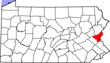 | |
| Boroughs | ||
| Townships | ||
| CDPs | ||
| Unincorporated communities | ||
| Footnotes | ‡This populated place also has portions in an adjacent county or counties | |