Ocean County, New Jersey
| Ocean County, New Jersey | ||
|---|---|---|
| County of New Jersey | ||
| County of Ocean | ||
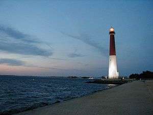 Sunrise at Barnegat Lighthouse on Long Beach Island | ||
| ||
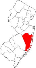 Location in the U.S. state of New Jersey | ||
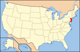 New Jersey's location in the U.S. | ||
| 39°52′N 74°15′W / 39.87°N 74.25°WCoordinates: 39°52′N 74°15′W / 39.87°N 74.25°W | ||
| Founded | 1850[1] | |
| Named for | Atlantic Ocean | |
| Government • Freeholder director |
Gerry P. Little (R, term ends December 31, 2018) | |
| Seat | Toms River[2] | |
| Largest city |
Lakewood Township (population) Jackson Township (area) | |
| Area | ||
| • Total | 915.40 sq mi (2,371 km2) | |
| • Land | 628.78 sq mi (1,629 km2) | |
| • Water | 286.62 sq mi (742 km2), 31.31% | |
| Population | ||
| • (2010) |
576,567[3] 597,943 (2017 est.; 6th in state)[4] | |
| • Density | 936/sq mi (361.5/km2) | |
| Congressional districts | 2nd, 3rd, 4th | |
| Website |
www | |
Ocean County is a county located along the Jersey Shore in the U.S. state of New Jersey. Its county seat is Toms River.[2] Since 1990, Ocean County has been one of New Jersey's fastest-growing counties. As of the 2017 Census estimate, the county's population was 597,943, a 3.7% increase from the 576,567 enumerated in the 2010 United States Census,[4] making Ocean the state's sixth-most populous county.[4][5][6] The 2010 population figure represented an increase of 65,651 (+12.8%) from the 2000 Census population of 510,916,[7] as Ocean surpassed Union County to become the sixth-most populous county in the state. Ocean County was also the fastest growing county in New Jersey between 2000 and 2010 in terms of increase in the number of residents and second-highest in percentage growth.[8] Ocean County was established on February 15, 1850, from portions of Monmouth County, with the addition of Little Egg Harbor Township which was annexed from Burlington County on March 30, 1891.[1] The most populous place was Lakewood Township, with 92,843 residents at the time of the 2010 Census (up 32,491 since 2000, the largest population increase of any municipality in the state), while Jackson Township, covered 100.62 square miles (260.6 km2), the largest total area of any municipality in the county.[9]
Ocean County is located 50 miles (80 km) east of Philadelphia, 70 miles (110 km) south of New York City, and 25 miles (40 km) north of Atlantic City, making it a prime destination for residents of these cities during the summer. As with the entire Jersey Shore, summer traffic routinely clogs local roadways throughout the season.
Ocean County is part of the New York metropolitan area but is also home to many tourist attractions frequently visited by Delaware Valley residents, especially the beachfront communities of Seaside Heights, Long Beach Island, Point Pleasant Beach, as well as Six Flags Great Adventure, which is the home of the world's tallest and second-fastest roller coaster, Kingda Ka. Ocean County is also a gateway to New Jersey's Pine Barrens, one of the largest protected pieces of land on the East Coast.
Ocean County is part of both New York City's and Philadelphia's Media Markets.
Geography
According to the United States Census Bureau, the county had as of the 2010 Census a total area of 915.40 square miles (2,370.9 km2), making it the largest county in New Jersey in terms of total area (ahead of Burlington County's), total 819.84 sq mi of which 628.78 square miles (1,628.5 km2) of land (68.7%) and 286.62 square miles (742.3 km2) of water (31.31%).[9][10]
Much of the county is flat and coastal, with many beaches. The highest point is one of three unnamed hills (one in Jackson Township, the other two in Plumsted Township) that reach at least 230 feet (70 m) in elevation.[11] The lowest elevation in the county is sea level.
It is also home to many beaches on the Jersey Shore, such as Beach Haven, Ship Bottom, Surf City, Harvey Cedars and Barnegat Light.
Adjacent counties
- Monmouth County, New Jersey – north
- Atlantic County, New Jersey – south
- Burlington County, New Jersey – west
National protected area
- Edwin B. Forsythe National Wildlife Refuge covers 47,000 acres (19,000 ha) of coastal habitat in Atlantic and Ocean counties.[12]
Climate and weather
| Toms River, New Jersey | ||||||||||||||||||||||||||||||||||||||||||||||||||||||||||||
|---|---|---|---|---|---|---|---|---|---|---|---|---|---|---|---|---|---|---|---|---|---|---|---|---|---|---|---|---|---|---|---|---|---|---|---|---|---|---|---|---|---|---|---|---|---|---|---|---|---|---|---|---|---|---|---|---|---|---|---|---|
| Climate chart (explanation) | ||||||||||||||||||||||||||||||||||||||||||||||||||||||||||||
| ||||||||||||||||||||||||||||||||||||||||||||||||||||||||||||
| ||||||||||||||||||||||||||||||||||||||||||||||||||||||||||||
In recent years, average temperatures in the county seat of Toms River have ranged from a low of 22 °F (−6 °C) in January to a high of 85 °F (29 °C) in July, although a record low of −19 °F (−28 °C) was recorded in January 1982 and a record high of 105 °F (41 °C) was recorded in July 1999. Average monthly precipitation ranged from 3.30 inches (84 mm) in February to 4.79 inches (122 mm) in March.[13] Areas closer to the coast typically experience more mild winters and cooler summers due to the Atlantic Ocean's influence.
Demographics
| Historical population | |||
|---|---|---|---|
| Census | Pop. | %± | |
| 1850 | 10,032 | — | |
| 1860 | 11,176 | 11.4% | |
| 1870 | 13,628 | 21.9% | |
| 1880 | 14,455 | 6.1% | |
| 1890 | 15,974 | 10.5% | |
| 1900 | 19,747 | 23.6% | |
| 1910 | 21,318 | 8.0% | |
| 1920 | 22,155 | 3.9% | |
| 1930 | 33,069 | 49.3% | |
| 1940 | 37,706 | 14.0% | |
| 1950 | 56,622 | 50.2% | |
| 1960 | 108,241 | 91.2% | |
| 1970 | 208,470 | 92.6% | |
| 1980 | 346,038 | 66.0% | |
| 1990 | 433,203 | 25.2% | |
| 2000 | 510,916 | 17.9% | |
| 2010 | 576,567 | 12.8% | |
| Est. 2017 | 597,943 | [4] | 3.7% |
| Historical sources: 1790–1990[14] 1970–2010[9] 2000[7] 2010[3] 2000–2010[15] | |||
Census 2010
As of the 2010 United States Census, there were 576,567 people, 221,111 households, and 149,250 families residing in the county. The population density was 917 per square mile (354/km2). There were 278,052 housing units at an average density of 442.2 per square mile (170.7/km2). The racial makeup of the county was 90.98% (524,577) White, 3.15% (18,164) Black or African American, 0.17% (966) Native American, 1.75% (10,081) Asian, 0.02% (129) Pacific Islander, 2.46% (14,165) from other races, and 1.47% (8,485) from two or more races. Hispanic or Latino of any race were 8.29% (47,783) of the population.[3]
There were 221,111 households out of which 26.7% had children under the age of 18 living with them, 53.9% were married couples living together, 9.8% had a female householder with no husband present, and 32.5% were non-families. 27.8% of all households were made up of individuals, and 16.4% had someone living alone who was 65 years of age or older. The average household size was 2.58 and the average family size was 3.16.[3]
In the county, the population was spread out with 23.4% under the age of 18, 7.5% from 18 to 24, 22.2% from 25 to 44, 25.9% from 45 to 64, and 21% who were 65 years of age or older. The median age was 42.6 years. For every 100 females there were 92 males. For every 100 females ages 18 and older there were 88.3 males.[3]
Census 2000
As of the 2000 United States Census[16] there were 510,916 people, 200,402 households, and 137,876 families residing in the county. The population density was 803 people per square mile (310/km²). There were 248,711 housing units at an average density of 151/km² (391/sq mi). The racial makeup of the county was 93.05% White, 2.99% Black or African American, 0.14% Native American, 1.28% Asian, 0.02% Pacific Islander, 1.24% from other races, and 1.29% from two or more races. 5.02% of the population were Hispanic or Latino of any race.[7][17] Among those who listed their ancestry, 25.3% were of Italian, 23.6% Irish, 18.7% German, 8.8% Polish and 8.5% English ancestry according to Census 2000.[17][18]
There were 200,402 households out of which 28.10% had children under the age of 18 living with them, 56.40% were married couples living together, 9.20% had a female householder with no husband present, and 31.20% were non-families. 27.00% of all households were made up of individuals and 16.50% had someone living alone who was 65 years of age or older. The average household size was 2.51 and the average family size was 3.06.[7]
In the county, the population was spread out with 23.30% under the age of 18, 6.60% from 18 to 24, 26.00% from 25 to 44, 21.90% from 45 to 64, and 22.20% who were 65 years of age or older. The median age was 41 years. For every 100 females, there were 90.40 males. For every 100 females age 18 and over, there were 86.40 males.[7]
The median income for a household in the county was $46,443, and the median income for a family was $56,420. Males had a median income of $44,822 versus $30,717 for females. The per capita income for the county was $23,054. About 4.8% of families and 7.0% of the population were below the poverty line, including 10.0% of those under age 18 and 5.6% of those age 65 or over.[17][19]
As of the 2000 Census, Mantoloking was the wealthiest community in the state of New Jersey with a per capita money income of $114,017 as of 1999.[20]
Government
Ocean County is governed by a Board of Chosen Freeholders consisting of five members, elected on an at-large basis in partisan elections and serving staggered three-year terms of office, with either one or two seats coming up for election each year as part of the November general election.[21] At an annual reorganization held in the beginning of January, the board chooses a Director and a Deputy Director from among its members. In 2016, freeholders were paid $30,000 and the freeholder director was paid an annual salary of $31,000.[22]
As of 2018, Ocean County's Freeholders (with party affiliation, term-end year and residence listed in parentheses) are:[23][24][25]
- Freeholder Director Gerry P. Little (R, term as freeholder ends and as freeholder director ends December 31, 2018, Surf City)[26]
- Freeholder Deputy Director John C. Bartlett Jr. (R, term as freeholder and as deputy director ends 2018, Pine Beach)[27]
- Virginia E. Haines (R, 2019, Toms River)[28]
- John P. Kelly (R, 2019, Eagleswood Township)[29]
- Joseph H. Vicari (R, 2020, Toms River)[30]
Pursuant to Article VII Section II of the New Jersey State Constitution, each county in New Jersey is required to have three elected administrative officials known as "constitutional officers." These officers are the County Clerk and County Surrogate (both elected for five-year terms of office) and the County Sheriff (elected for a three-year term).[31] Constitutional officers, elected on a countywide basis are:[24]
- County Clerk Scott M. Colabella (R, 2020, Barnegat Light)[32][33][34]
- Sheriff Michael Mastronardy (R, 2019; Toms River)[35][36]
- Surrogate Jeffrey Moran (R, 2018, Beachwood)[37][38]
The Ocean County Prosecutor is Bradley D. Billhimer who was nominated by Governor of New Jersey Philip D. Murphy. Prosecutor Billhimer was sworn in by New Jersey Attorney General Gurbir Grewal on October 12, 2018.[39]
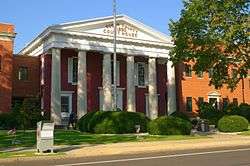
Ocean County constitutes Vicinage 14 of the New Jersey Superior Court and is seated at the Ocean County Courthouse Complex in Toms River; the Assignment Judge for Vicinage 14 is Marlene Lynch Ford.[40][41]
The 2nd, 3rd and 4th Congressional Districts cover the county.[42][43][44] New Jersey's Second Congressional District is represented by Frank LoBiondo (R, Ventnor City).[45] New Jersey's 3rd Congressional District is represented by Tom MacArthur (R, Toms River).[46] New Jersey's Fourth Congressional District is represented by Christopher Smith (R).[47]
The county is part of the 9th, 10th, 12th and 30th Districts in the New Jersey Legislature.[48][49] For the 2018–2019 session (Senate, General Assembly), the 9th Legislative District of the New Jersey Legislature is represented in the State Senate by Christopher J. Connors (R, Lacey Township) and in the General Assembly by DiAnne Gove (R, Long Beach Township) and Brian E. Rumpf (R, Little Egg Harbor Township).[50][51] For the 2018–2019 session (Senate, General Assembly), the 10th Legislative District of the New Jersey Legislature is represented in the State Senate by James W. Holzapfel (R, Toms River Township) and in the General Assembly by Gregory P. McGuckin (R, Toms River Township) and David W. Wolfe (R, Brick Township).[52][53] For the 2018–2019 session (Senate, General Assembly), the 12th Legislative District of the New Jersey Legislature is represented in the State Senate by Samuel D. Thompson (R, Old Bridge Township) and in the General Assembly by Robert D. Clifton (R, Matawan) and Ronald S. Dancer (R, Plumsted Township).[54][55] For the 2018–2019 session (Senate, General Assembly), the 30th Legislative District of the New Jersey Legislature is represented in the State Senate by Robert Singer (R, Lakewood Township) and in the General Assembly by Sean T. Kean (R, Wall Township) and Ned Thomson (R, Wall Township).[56][57]
Ocean County operates the Ocean County Southern Service Center in Manahawkin.[58] This Center offers access to all of the Ocean County government services without the need for residents to travel to the county seat some 20 miles to the north.
Politics
Ocean County is one of the few Republican strongholds in New Jersey.
Doug Forrester carried Ocean County by 12 points in the 2005 New Jersey gubernatorial election, winning every municipality but Lakewood Township and South Toms River In the 2004 U.S. Presidential election, Republican George W. Bush carried the county by a 21.2% margin over Democrat John Kerry.[59] In 2008, the county voted for Republican John McCain by an 18.4% margin over Democrat Barack Obama, making it McCain's second-strongest county in New Jersey behind Sussex County, with Obama winning the Garden State by 15.5% margin over McCain,[60] who carried Ocean County's every municipality except South Toms River.[61] The last Democratic presidential candidate to win Ocean County was Bill Clinton in 1996, however, the last Democrat to win a majority in the county was Lyndon Johnson in 1964.
As of March 23, 2011, there were a total of 364,597 registered voters in Ocean, of which 74,795 (20.5%) were registered as Democrats, 103,517 (28.4%) were registered as Republicans and 186,089 (51.0%) were registered as Unaffiliated. There were 196 voters registered to other parties.[62] Among the county's 2010 Census population, 63.2% were registered to vote, including 82.6% of those ages 18 and over.[62][63]
In the 2008 presidential election, Republican John McCain received 58.4% of the vote here (160,677 cast), ahead of Democrat Barack Obama with 40.1% (110,189 votes) among the 276,544 ballots cast by the county's 380,712 registered voters, for a turnout of 72.6%.[64] In the 2004 presidential election, Republican George W. Bush received 60.1% of the vote here (154,204 ballots cast), outpolling Democrat John Kerry with 38.9% (99,839 votes) among the 257,364 ballots cast by the county's 353,085 registered voters, for a turnout percentage of 72.9.[65] The vote totals were significantly down in 2012 due to damage and displacement caused by Hurricane Sandy just days before the election.
| Year | Republican | Democratic | Third parties |
|---|---|---|---|
| 2016 | 64.7% 179,079 | 31.5% 87,150 | 3.8% 10,496 |
| 2012 | 58.2% 146,475 | 40.6% 102,300 | 1.2% 3,079 |
| 2008 | 58.4% 160,677 | 40.1% 110,189 | 1.5% 4,111 |
| 2004 | 60.1% 154,204 | 38.9% 99,839 | 1.0% 2,424 |
| 2000 | 48.8% 105,684 | 47.2% 102,104 | 4.0% 8,605 |
| 1996 | 40.8% 82,830 | 46.4% 94,243 | 12.8% 25,903 |
| 1992 | 44.4% 95,984 | 34.9% 75,431 | 20.7% 44,828 |
| 1988 | 65.4% 124,587 | 33.8% 64,474 | 0.8% 1,497 |
| 1984 | 70.2% 124,391 | 28.8% 51,012 | 1.0% 1,710 |
| 1980 | 62.5% 98,433 | 29.8% 46,923 | 7.8% 12,212 |
| 1976 | 56.9% 77,875 | 41.2% 56,413 | 1.8% 2,493 |
| 1972 | 72.4% 77,979 | 25.7% 27,710 | 1.8% 1,978 |
| 1968 | 53.9% 41,995 | 34.5% 26,909 | 11.6% 9,059 |
| 1964 | 40.8% 25,985 | 57.9% 36,892 | 1.3% 837 |
| 1960 | 60.6% 31,430 | 38.8% 20,113 | 0.7% 355 |
| 1956 | 74.8% 28,033 | 25.0% 9,367 | 0.2% 79 |
| 1952 | 72.8% 23,490 | 26.8% 8,660 | 0.4% 117 |
| 1948 | 70.4% 16,740 | 26.8% 6,366 | 2.8% 661 |
| 1944 | 63.3% 13,317 | 36.5% 7,683 | 0.2% 32 |
| 1940 | 60.4% 13,394 | 39.5% 8,762 | 0.1% 26 |
| 1936 | 52.8% 11,293 | 46.3% 9,889 | 0.9% 190 |
| 1932 | 57.0% 10,513 | 40.7% 7,508 | 2.4% 439 |
| 1928 | 73.2% 12,301 | 26.5% 4,452 | 0.3% 54 |
| 1924 | 71.0% 8,677 | 21.2% 2,594 | 7.8% 951 |
| 1920 | 74.8% 6,840 | 23.4% 2,138 | 1.8% 161 |
| 1916 | 61.3% 3,386 | 37.6% 2,076 | 1.2% 65 |
| 1912 | 18.6% 919 | 37.6% 1,858 | 43.8% 2,163 |
| 1908 | 65.2% 3,326 | 32.0% 1,634 | 2.8% 145 |
| 1904 | 65.9% 3,666 | 30.7% 1,709 | 3.3% 185 |
| 1900 | 65.8% 3,182 | 29.2% 1,413 | 5.0% 240 |
| County CPVI: R+15 | |||
| Year | Republican | Democratic | Third parties |
|---|---|---|---|
| 2017 | 62.1% 98,135 | 35.8% 56,582 | 2.2% 3,446 |
| 2013 | 75.7% 125,781 | 22.8% 37,930 | 0.1% 2,536 |
| 2009 | 65.6% 124,238 | 28.4% 53,761 | 6.0% 11,317 |
| 2005 | 54.2% 93,693 | 41.6% 71,953 | 4.2% 7,242 |
| 2001 | 47.1% 77,726 | 51.3% 84,538 | 1.6% 2,690 |
| 1997 | 53.8% 84,897 | 36.7% 57,944 | 9.6% 15,076 |
| 1993 | 51.4% 87,943 | 45.7% 78,132 | 2.9% 4,879 |
| 1989 | 42.1% 62,700 | 56.1% 83,587 | 1.8% 2,669 |
| 1985 | 73.7% 90,670 | 25.2% 30,948 | 1.2% 1,455 |
| 1981 | 59.5% 78,757 | 39.3% 52,036 | 1.2% 1,610 |
In the 2009 gubernatorial election, Republican Chris Christie received 65.6% of the vote here (124,238 ballots cast), ahead of Democrat Jon Corzine with 28.4% (53,761 votes), Independent Chris Daggett with 4.8% (9,068 votes) and other candidates with 1.2% (1,955 votes), among the 193,186 ballots cast by the county's 371,066 registered voters, yielding a 52.1% turnout.[68]
Education
Ocean County College is the two-year community college for Ocean County, one of a network of 19 county colleges statewide. The school is in Toms River and was founded in 1964.[69]
Georgian Court University in Lakewood Township is a private Roman Catholic Sisters of Mercy college, which opened in 1908 on the former winter estate of millionaire George Jay Gould I, son of railroad tycoon Jay Gould. Lakewood is also home to Beth Medrash Govoha, a Haredi Yeshiva with 5,000 students, making it one of the largest yeshivas in the world.[70]
Stockton University has a campus located in Manahawkin offering undergraduate and graduate college of the arts, sciences and professional studies of the New Jersey state system of higher education.[71]
The state's largest suburban school district, Toms River Regional Schools, is located in the county.[72] Toms River is also home to Ocean County's only Roman Catholic High School, Monsignor Donovan High School, operated by the Roman Catholic Diocese of Trenton, which also has six elementary schools located in the county.[73]
In addition to multiple public high schools, the county has an extensive vocational high school program, known as the Ocean County Vocational Technical School district. In addition to its campuses in Brick, Toms River, Waretown, and Jackson, it contains two magnet schools:[74]
- Marine Academy of Technology and Environmental Science (MATES)
- OCVTS Performing Arts Academy – Theater, Dance, and Vocal
Attractions
Ocean County has an extensive stretch along the Atlantic Ocean, including the Jersey Shore communities and oceanfront boardwalk resorts of Seaside Heights and Point Pleasant Beach.
Six Flags Great Adventure, America's largest Six Flags theme park, is home to the world's tallest and formerly fastest roller coaster, Kingda Ka. The park also contains Six Flags Hurricane Harbor, New Jersey's largest water park, and the 2,200-acre (890 ha) Six Flags Wild Safari, the largest drive-thru animal safari outside of Africa.[75]
Forty miles of barrier beaches form the Barnegat and Little Egg Harbor Bays, offering ample watersports. It also is home of the Tuckerton Seaport, a 40-acre (160,000 m2) maritime history village in Tuckerton. In addition to being the northeast gateway to New Jersey's Pine Barrens, Ocean County is also home to several state parks:
- Barnegat Lighthouse State Park covers 32 acres (13 ha) surrounding Barnegat Lighthouse at the northern tip of Long Beach Island.[76]
- Island Beach State Park has 3,000 acres (1,200 ha) of coastal dunes.[77]
- Double Trouble State Park includes 8,000 acres (3,200 ha) of land in the New Jersey Pine Barrens.[78]
- Brendan T. Byrne State Forest includes 37,000 acres (15,000 ha) and was formerly known as Lebanon State Forest.[79]
- Forked River State Marina[80]
Ocean County is home to the Ocean County Mall in Toms River, featuring a gross leasable area of 898,000 square feet (83,400 m2).[81] FirstEnergy Park opened in 2001 with 6,588 reserved seats and is home of the Lakewood BlueClaws, the Class A-affiliate of the Philadelphia Phillies.[82]
Media
The Asbury Park Press provides daily news coverage of the county as does The Press of Atlantic City.[83] Micromedia Publications publishes six weekly local newspapers in the county; their seventh covers Howell Township, New Jersey in Monmouth County, New Jersey.[84]
92.7 WOBM provides news, traffic and weather updates.
Infrastructure
Roads and highways
Ocean County has various major roads that pass through. State routes that go through include Route 13, Route 35, Route 37, Route 70, Route 72, Route 88, and Route 166. Other major routes that pass through are U.S. Route 9, the Garden State Parkway and Interstate 195 (I-195 is the only Interstate to pass through Ocean County, solely in Jackson Township).
The county had a total of 2,958.5 miles (4,761.2 km) of roadways, of which 2,164.2 miles (3,482.9 km) are maintained by the municipality, 615.5 miles (990.6 km) by Ocean County and 140.19 miles (225.61 km) by the New Jersey Department of Transportation and 38.59 miles (62.10 km) by the New Jersey Turnpike Authority.[85]
Public transportation
Train
NJ Transit's (NJT) North Jersey Coast Line railway line, which serves New York Penn Station, passing through Middlesex and Monmouth counties, offering service at the Bay Head and Point Pleasant Beach stations, located at the northernmost corner of the county.[86] The Monmouth Ocean Middlesex Line is a passenger rail project proposed by NJT to serve he northern central part of the county. Southern Ocean County is also located about than 25 miles to the Atlantic City Line which provides service to Philadelphia.
Bus
Bus service is provided on NJ Transit bus routes 130-139 and from Lakewood Bus Terminal on the U.S. Route 9 corridor. Expanded use Route 9 BBS (bus bypass shoulder lanes) is under study.
Ocean Ride is a county wide system with 12 regular routes, many serving Ocean County Mall, which acts as transfer hub.[87][88] Of these routes, only the OC 10 (Lavallette to Toms River) operates Monday-Saturday, with the OC 4 (Point Pleasant to Lakewood) operating Monday-Friday. All other routes run 2–3 days a week.
Municipalities
Municipalities in Ocean County (with 2010 Census data for population, housing units and area in square miles) are:[89] Other, unincorporated communities in the county are listed alongside their parent municipality (or municipalities).[90] Most of these areas are census-designated places that have been created by the United States Census Bureau for enumeration purposes within a Township.[9] The numbers in parentheses stand for the numbers on the map.
.png)
| Municipality (map index) | Municipal type |
Population | Housing units |
Total area |
Water area |
Land area |
Pop. density |
Housing density |
Unincorporated communities / notes |
|---|---|---|---|---|---|---|---|---|---|
| Barnegat Light (6) | borough | 574 | 1,282 | 0.85 | 0.12 | 0.73 | 785.1 | 1,753.6 | |
| Barnegat (29) | township | 20,936 | 9,085 | 40.78 | 6.41 | 34.38 | 609.0 | 264.35 | Barnegat CDP (2,817), Howardsville, Ocean Acres (part; 925 of 16,142), Warren Grove |
| Bay Head (16) | borough | 968 | 1,023 | 0.70 | 0.12 | 0.58 | 1,662.8 | 1,757.3 | |
| Beach Haven (2) | borough | 1,170 | 2,667 | 2.32 | 1.34 | 0.98 | 1,196.0 | 2,726.2 | |
| Beachwood (12) | borough | 11,045 | 3,826 | 2.85 | 0.00 | 2.85 | 3,878.4 | 1,343.5 | |
| Berkeley Township (26) | township | 41,255 | 23,818 | 56.00 | 13.13 | 42.86 | 962.5 | 555.7 | Bayville (20,512), Cedar Beach, Crossley, Glen Cove, Holiday City-Berkeley (13,884), Holiday City South (3,689), Holiday Heights (2,099), Holly Park, Pelican Island, Silver Ridge (1,133) |
| Brick (23) | township | 75,072 | 33,677 | 32.32 | 6.60 | 25.72 | 2,919.4 | 1,309.6 | Adamston, Breton Woods, Burrsville, Herbertsville, Laurelton, Osbornsville, Parkway Pines |
| Eagleswood (31) | township | 1,603 | 760 | 18.86 | 2.80 | 16.06 | 99.8 | 47.3 | West Creek |
| Harvey Cedars (5) | borough | 337 | 1,214 | 1.19 | 0.63 | 0.56 | 604.6 | 2,178.0 | |
| Island Heights (10) | borough | 1,673 | 831 | 0.91 | 0.30 | 0.61 | 2,738.3 | 1,360.2 | |
| Jackson (21) | township | 54,856 | 20,342 | 100.62 | 1.38 | 99.24 | 552.7 | 205.0 | Bennetts Mills, Cassville, Harmony, Holmeson (part; 5,231), Jackson Mills, Prospertown, Vista Center (3,689), Whitesville |
| Lacey Township (27) | township | 27,644 | 11,573 | 98.53 | 15.27 | 83.26 | 332.0 | 139.0 | Aserdaten, Barnegat Pines, Forked River (5,244), Lanoka Harbor |
| Lakehurst (19) | borough | 2,654 | 943 | 1.01 | 0.09 | 0.91 | 2,900.8 | 1,030.7 | |
| Lakewood (22) | township | 92,843 | 26,337 | 24.98 | 0.41 | 24.58 | 3,777.7 | 1,071.6 | Lakewood CDP (53,805), Leisure Village (4,400), Leisure Village East (4,217) |
| Lavallette (14) | borough | 1,875 | 3,207 | 0.95 | 0.15 | 0.81 | 2,319.2 | 3,966.8 | |
| Little Egg Harbor (33) | township | 20,065 | 10,324 | 73.05 | 25.69 | 47.37 | 423.6 | 218.0 | Mystic Island (8,493), Nugentown, Parkertown Warren Grove, West Tuckerton |
| Long Beach (32) | township | 3,051 | 9,216 | 22.04 | 16.59 | 5.44 | 560.5 | 1,693.0 | High Bar Harbor, Loveladies, North Beach Haven (2,235) |
| Manchester (25) | township | 43,070 | 25,886 | 82.69 | 1.07 | 81.62 | 527.7 | 317.2 | Bullock, Cedar Glen Lakes (1,421), Cedar Glen West (1,267), Crestwood Village (7,907), Leisure Knoll (2,490), Leisure Village West (3,493), Pine Lake Park (8,707), Pine Ridge at Crestwood (2,369), Ridgeway, Roosevelt City, Wheatland, Whiting |
| Mantoloking (15) | borough | 296 | 535 | 0.64 | 0.26 | 0.39 | 767.9 | 1,387.9 | |
| Ocean Gate (9) | borough | 2,011 | 1,203 | 0.45 | 0.01 | 0.45 | 4,490.3 | 2,686.1 | |
| Ocean Township (28) | township | 8,332 | 4,291 | 32.04 | 11.49 | 20.56 | 405.3 | 208.8 | Brookville, Waretown (1,569) |
| Pine Beach (11) | borough | 2,127 | 903 | 0.62 | 0.00 | 0.61 | 3,465.4 | 1,471.2 | |
| Plumsted Township (20) | township | 8,421 | 3,067 | 40.15 | 0.44 | 39.71 | 212.1 | 77.2 | Archertown, Brindletown, New Egypt (2,512) |
| Point Pleasant (18) | borough | 18,392 | 8,331 | 4.17 | 0.68 | 3.49 | 5,272.1 | 2,388.1 | |
| Point Pleasant Beach (17) | borough | 4,665 | 3,373 | 1.74 | 0.32 | 1.43 | 3,270.1 | 2,364.4 | Clark's Landing |
| Seaside Heights (8) | borough | 2,887 | 3,003 | 0.75 | 0.13 | 0.62 | 4,662.9 | 4,850.2 | |
| Seaside Park (7) | borough | 1,579 | 2,703 | 0.77 | 0.12 | 0.65 | 2,429.4 | 4,158.7 | |
| Ship Bottom (3) | borough | 1,156 | 2,066 | 1.00 | 0.29 | 0.71 | 1,620.6 | 2,896.3 | |
| South Toms River (13) | borough | 3,684 | 1,160 | 1.23 | 0.06 | 1.17 | 3,146.7 | 990.8 | |
| Stafford Township (30) | township | 26,535 | 13,604 | 54.88 | 9.03 | 45.85 | 578.8 | 296.7 | Beach Haven West (3,896), Cedar Run, Manahawkin (2,303), Mayetta, Ocean Acres (part; 15,217 of 16,142), Warren Grove |
| Surf City (4) | borough | 1,205 | 2,566 | 0.92 | 0.17 | 0.75 | 1,616.5 | 3,442.4 | |
| Toms River (24) | township | 91,239 | 43,334 | 52.88 | 12.40 | 40.49 | 2,253.5 | 1,070.3 | Cattus Island, Chadwick Beach Island, Dover Beaches North (1,239), Dover Beaches South (1,209), Gilford Park, Pelican Island, Silverton |
| Tuckerton (1) | borough | 3,347 | 1,902 | 3.80 | 0.44 | 3.36 | 995.1 | 565.5 | |
| Ocean County | county | 576,567 | 278,052 | 915.40 | 286.62 | 628.78 | 917.0 | 442.2 |
See also
Footnotes
- 1 2 Snyder, John P. The Story of New Jersey's Civil Boundaries: 1606-1968, Bureau of Geology and Topography; Trenton, New Jersey; 1969. p. 201. Accessed January 21, 2013.
- 1 2 New Jersey County Map, New Jersey Department of State. Accessed July 10, 2017.
- 1 2 3 4 5 DP1 - Profile of General Population and Housing Characteristics: 2010 Demographic Profile Data for Ocean County, New Jersey, United States Census Bureau. Accessed March 25, 2016.
- 1 2 3 4 QuickFacts - Ocean County, New Jersey; New Jersey; United States, United States Census Bureau. Accessed March 24, 2018.
- ↑ Annual Estimates of the Resident Population: April 1, 2010 to July 1, 2017 - 2017 Population Estimates, United States Census Bureau. Accessed March 24, 2018.
- ↑ GCT-PEPANNCHG: Estimates of Resident Population Change and Rankings: July 1, 2016 to July 1, 2017 - State -- County / County Equivalent from the 2017 Population Estimates for New Jersey, United States Census Bureau. Accessed March 24, 2018.
- 1 2 3 4 5 DP-1 - Profile of General Demographic Characteristics: 2000; Census 2000 Summary File 1 (SF 1) 100-Percent Data for Ocean County, New Jersey, United States Census Bureau. Accessed January 23, 2013.
- ↑ NJ Labor Market Views Archived 2013-09-20 at the Wayback Machine., New Jersey Department of Labor and Workforce Development, March 15, 2011. Accessed October 6, 2013.
- 1 2 3 4 New Jersey: 2010 - Population and Housing Unit Counts; 2010 Census of Population and Housing, p. 6, CPH-2-32. United States Census Bureau, August 2012. Accessed August 29, 2016.
- ↑ Census 2010 U.S. Gazetteer Files: New Jersey Counties, United States Census Bureau, Backed up by the Internet Archive as of June 11, 2012. Accessed October 6, 2013.
- ↑ New Jersey County High Points, Peakbagger.com. Accessed October 5, 2013.
- ↑ Edwin P. Forsythe National Wildlife Refuge, United States Fish and Wildlife Service. Accessed October 24, 2017. "Welcome to the Edwin B. Forsythe National Wildlife Refuge, where more than 47,000 acres of southern New Jersey coastal habitats are actively protected and managed for wildlife and for you."
- 1 2 Monthly Averages for Toms River, New Jersey, The Weather Channel. Accessed October 13, 2012.
- ↑ Forstall, Richard L. Population of states and counties of the United States: 1790 to 1990 from the Twenty-one Decennial Censuses, pp. 108–109. United States Census Bureau, March 1996. ISBN 9780934213486. Accessed October 6, 2013.
- ↑ U.S. Census Bureau Delivers New Jersey's 2010 Census Population Totals, United States Census Bureau, February 3, 2011. Accessed February 5, 2011.
- ↑ American FactFinder, United States Census Bureau. Accessed September 4, 2014.
- 1 2 3 Tables DP-1 to DP-4 from Census 2000 for Ocean County, New Jersey, United States Census Bureau, backed up by the Internet Archive as of July 6, 2008. Accessed October 1, 2013.
- ↑ DP-2 - Profile of Selected Social Characteristics: 2000 from the Census 2000 Summary File 3 (SF 3) - Sample Data for Ocean County, New Jersey, United States Census Bureau. Accessed September 30, 2013.
- ↑ DP-3 - Profile of Selected Economic Characteristics: 2000 from Census 2000 Summary File 3 (SF 3) - Sample Data for Ocean County, New Jersey, United States Census Bureau. Accessed September 30, 2013.
- ↑ Money Income (1989 and 1999) and Poverty (1999) New Jersey, Counties and Municipalities, New Jersey State Data Center, April 2003. Accessed October 1, 2013.
- ↑ Freeholder History, Ocean County, New Jersey. Accessed October 24, 2017.
- ↑ Gallo Jr., Bill. "Which N.J. county freeholders are paid the most?", NJ.com, March 11, 2016. Accessed October 25, 2017. "Freeholder director: $31,000; Other freeholders: $30,000"
- ↑ Board of Chosen Freeholders, Ocean County, New Jersey. Accessed October 13, 2018.
- 1 2 2018 Ocean County & Municipal Elected Officials, Ocean County, New Jersey, updated September 16, 2018. Accessed October 13, 2018.
- ↑ County Directory, Ocean County, New Jersey. Accessed October 13, 2018.
- ↑ Freeholder Deputy Director Gerry P. Little, Ocean County, New Jersey. Accessed October 13, 2018.
- ↑ Freeholder Director John C. Bartlett Jr., Ocean County, New Jersey. Accessed October 13, 2018.
- ↑ Freeholder Virginia E. "Ginny" Haines, Ocean County, New Jersey. Accessed October 13, 2018.
- ↑ Freeholder John P. Kelly, Ocean County, New Jersey. Accessed October 13, 2018.
- ↑ Freeholder Joseph H. Vicari, Ocean County, New Jersey. Accessed October 13, 2018.
- ↑ New Jersey State Constitution (1947), Article VII, Section II, Paragraph 2, New Jersey Department of State. Accessed October 26, 2017.
- ↑ County Clerk, Ocean County, New Jersey. Accessed October 21, 2017.
- ↑ Biography of Scott M. Colabella, Office of the County Clerk. Accessed October 21, 2017.
- ↑ Members List: Clerks, Constitutional Officers Association of New Jersey. Accessed October 22, 2017.
- ↑ Sheriff Michael Mastronardy, Ocean County Sheriff's Office. Accessed October 21, 2017.
- ↑ Members List: Sheriffs, Constitutional Officers Association of New Jersey. Accessed October 22, 2017.
- ↑ County Surrogate Jeffrey W. Moran, Ocean County, New Jersey. Accessed October 21, 2017.
- ↑ Members List: Surrogates, Constitutional Officers Association of New Jersey. Accessed October 22, 2017.
- ↑ Hopkins, Kathleen. "New Ocean County prosecutor once proposed at the courthouse", Asbury Park Press, October 12, 2018. Accessed October 13, 2018. "Flanked by Alyn and their two daughters, Mackenzie, 14, and Riley, 11, Billhimer was sworn in by state Attorney General Gurbir S. Grewal as Ocean County prosecutor.... Billhimer, a 48-year-old Democrat who was a criminal defense attorney for almost two decades, was sworn in privately Tuesday by Gov. Phil Murphy as the county's chief law-enforcement officer, succeeding former Prosecutor Joseph Coronato."
- ↑ Local Courthouse Addresses Archived 2016-04-08 at the Wayback Machine., New Jersey Courts. Accessed June 27, 2016.
- ↑ Ocean Vicinage, New Jersey Courts. Accessed October 21, 2017.
- ↑ 2012 Congressional Districts by County, New Jersey Department of State Division of Elections. Accessed October 6, 2013.
- ↑ Plan Components Report, New Jersey Department of State Division of Elections, December 23, 2011. Accessed October 6, 2013.
- ↑ Congressional Districts, Ocean County, New Jersey. Accessed January 14, 2014.
- ↑ Directory of Representatives: New Jersey, United States House of Representatives. Accessed January 5, 2012.
- ↑ Tom MacArthur Biography, United States House of Representatives. Accessed January 7, 2015.
- ↑ Directory of Representatives: New Jersey, United States House of Representatives. Accessed January 5, 2012.
- ↑ 2011 Legislative Districts by County, New Jersey Department of State Division of Elections. Accessed October 6, 2013.
- ↑ State Legislative Districts, Ocean County, New Jersey. Accessed January 14, 2014.
- ↑ Legislative Roster 2018-2019 Session, New Jersey Legislature. Accessed January 22, 2018.
- ↑ District 9 Legislators, New Jersey Legislature. Accessed January 22, 2018.
- ↑ Legislative Roster 2018-2019 Session, New Jersey Legislature. Accessed January 22, 2018.
- ↑ District 10 Legislators, New Jersey Legislature. Accessed January 22, 2018.
- ↑ Legislative Roster 2018-2019 Session, New Jersey Legislature. Accessed January 22, 2018.
- ↑ District 12 Legislators, New Jersey Legislature. Accessed January 22, 2018.
- ↑ Legislative Roster 2018-2019 Session, New Jersey Legislature. Accessed January 22, 2018.
- ↑ District 30 Legislators, New Jersey Legislature. Accessed January 22, 2018.
- ↑ Accessed March 18, 2017
- ↑ New Jersey Presidential Election Returns by County 2004 Archived 2008-09-14 at the Wayback Machine., Eagleton Institute of Politics at Rutgers University. Accessed August 31, 2008.
- ↑ 2008 Presidential General Election Results for New Jersey, USElectionAtlas.org. Accessed September 5, 2011.
- ↑ 2008 Presidential General Election Results: Ocean County, New Jersey Department of State, December 23, 2008. Accessed September 4, 2011.
- 1 2 Voter Registration Summary - Ocean, New Jersey Department of State Division of Elections, March 23, 2011. Accessed December 24, 2012.
- ↑ GCT-P7: Selected Age Groups: 2010 - State -- County Subdivision; 2010 Census Summary File 1 for New Jersey, United States Census Bureau. Accessed December 24, 2012.
- ↑ 2008 Presidential General Election Results: Ocean County, New Jersey Department of State Division of Elections, December 23, 2008. Accessed December 24, 2012.
- ↑ 2004 Presidential Election: Ocean County, New Jersey Department of State Division of Elections, December 13, 2004. Accessed December 24, 2012.
- ↑ Leip, David. "Dave Leip's Atlas of U.S. Presidential Elections". uselectionatlas.org. Retrieved 2018-06-10.
- ↑ Leip, David. "Dave Leip's Atlas of U.S. Presidential Elections". uselectionatlas.org. Retrieved 2018-10-09.
- ↑ 2009 Governor: Ocean County, New Jersey Department of State Division of Elections, December 31, 2009. Accessed December 24, 2012.
- ↑ Heritage Society, Ocean County College. Accessed October 1, 2013.
- ↑ Fahim, Kareem. "As Orthodox Population Grows, So Do Tensions", The New York Times, December 10, 2007. Accessed August 23, 2014. "Many Orthodox Jews have been drawn to Lakewood by the prestige of the town's yeshiva, Beth Medrash Govoha, one of the largest rabbinical colleges in the world. The yeshiva was founded in 1943 by a Polish-born rabbi, Aaron Kotler. In 1962, when Rabbi Kotler died, the school had 250 students. It now has about 5,000."
- ↑ Manahawkin, Stockton University. Accessed October 21, 2017.
- ↑ Economic Development, Ocean County Department of Planning. Accessed August 23, 2014. "Toms River Regional School District in the largest suburban district in New Jersey, fourth largest overall with 18,000 students."
- ↑ Ocean County Catholic Schools Archived 2016-04-11 at the Wayback Machine., Roman Catholic Diocese of Trenton. Accessed January 22, 2017.
- ↑ Full Time Academies, Ocean County Vocational Technical School. Accessed October 6, 2013.
- ↑ Frassinelli, Mike. "Exit 7A: A perfect spot for Adventure on the N.J. Turnpike", The Star-Ledger, October 9, 2011. Accessed October 6, 2013. "What remained was still pretty grand: the largest drive-thru safari outside of Africa — providing generations of New Jerseyans with stories about how a baboon jumped on their car — and the larger-than-life Enchanted Forest. The 2,200-acre amusement park and safari, which has more than 1,200 animals, opened in July 1974.... The purchase by Six Flags in 1977 brought larger roller coasters, a trend that has continued with the arrival of Kingda Ka, which at 45 stories is the world's tallest. An acceleration of 0 to 128 mph in 3.5 seconds also makes it North America's fastest coaster."
- ↑ Barnegat Lighthouse State Park, New Jersey Department of Environmental Protection Division of Parks and Forestry. Accessed October 24, 2017.
- ↑ Island Beach State Park, New Jersey Department of Environmental Protection Division of Parks and Forestry. Accessed October 24, 2017.
- ↑ Double Trouble State Park, New Jersey Department of Environmental Protection Division of Parks and Forestry. Accessed October 24, 2017.
- ↑ Brendan T. Byrne State Forest, New Jersey Department of Environmental Protection Division of Parks and Forestry. Accessed October 24, 2017.
- ↑ Forked River State Marina, New Jersey Department of Environmental Protection Division of Parks and Forestry. Accessed October 24, 2017.
- ↑ Ocean County Mall, Simon Property Group. Accessed June 27, 2016.
- ↑ Stadium Guide: FirstEnergy Park, Minor League Baseball. Accessed June 27, 2016.
- ↑ http://www.pressofatlanticcity.com/news/press/ocean/
- ↑ About Us, Micromedia Publications. Accessed June 27, 2016. "Micromedia Publications, Inc. was founded in 1995 by Stewart Swann and Robyn Weber for the purpose of publishing high quality local weekly newspapers within New Jersey. Following the successful launch of The Manchester Times in April of that year, the company has since introduced The Berkeley Times (1996), The Jackson Times (2000), The Brick Times (2002), The Howell Times (2004), The Toms River Times (2005) and The Lacey Barnegat Times (2010), now The Southern Ocean Times (2013)."
- ↑ Ocean County Mileage by Municipality and Jurisdiction, New Jersey Department of Transportation, May 2010. Accessed July 24, 2014.
- ↑ North Jersey Coast Line, NJ Transit. Accessed October 6, 2013.
- ↑ Ocean Ride Transportation Services, Ocean County, New Jersey. Accessed October 24, 2017.
- ↑ Ocean County Transit Map, Ocean County, New Jersey. Accessed October 24, 2017.
- ↑ GCT-PH1: Population, Housing Units, Area, and Density: 2010 - County -- County Subdivision and Place from the 2010 Census Summary File 1 for Ocean County, New Jersey, United States Census Bureau. Accessed January 25, 2015.
- ↑ Locality Search, State of New Jersey. Accessed January 25, 2015.
Further reading
- Salter, Edwin. A History of Monmouth and Ocean Counties Embracing a Genealogical Record of Earliest Settlers of Monmouth and Ocean Counties and Their Descendants; The Indians: Their Language, Manners, and Customs; Important Historical Events: The Revolutionary War, Battle of Monmouth, The War of the Rebellion: Names of Officers and Men of Monmouth and Ocean Counties Engaged in It, etc., etc. Bayonne, NJ: E. Gardner and Son, 1890.
External links
| Wikimedia Commons has media related to Ocean County, New Jersey. |
- Ocean County website
- Ocean County Planning Board's Databook
- Ocean County Historical Museum: History of Ocean County
- History of the County Courthouse from County Clerk's website
- Ocean County Library
Places adjacent to Ocean County, New Jersey | ||||||||||
|---|---|---|---|---|---|---|---|---|---|---|
| ||||||||||
| Counties |  | |
|---|---|---|
| Major cities | ||
| Cities and towns 50k-99k | ||
| Cities and towns 30k-50k | ||