Sumter County, South Carolina
| Sumter County, South Carolina | |
|---|---|
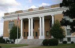 Sumter County Courthouse, Sumter | |
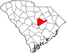 Location in the U.S. state of South Carolina | |
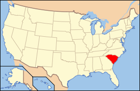 South Carolina's location in the U.S. | |
| Founded | 1800 |
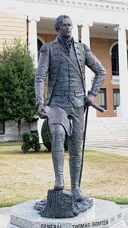
| Named for | Thomas Sumter |
| Seat | Sumter |
| Largest city | Sumter |
| Area | |
| • Total | 682 sq mi (1,766 km2) |
| • Land | 665 sq mi (1,722 km2) |
| • Water | 17 sq mi (44 km2), 2.5% |
| Population (est.) | |
| • (2015) | 107,480 |
| • Density | 162/sq mi (63/km2) |
| Congressional districts | 5th, 6th |
| Time zone | Eastern: UTC−5/−4 |
| Website |
www |
Sumter County is a county located in the U.S. state of South Carolina. As of the 2010 census, the population was 107,456; in a 2013 census estimate, the population was at 108,123.[1] Its county seat is Sumter.[2] The county was created in 1800.[3]
Sumter County comprises the Sumter, South Carolina Metropolitan Statistical Area.
It is the home of Shaw AFB, headquarters to the 9th Air Force, AFCENT, United States Army Central, with a number of other tenant units. It is one of largest bases in the USAF's Air Combat Command.
Geography
According to the U.S. Census Bureau, the county has a total area of 682 square miles (1,770 km2), of which 665 square miles (1,720 km2) is land and 17 square miles (44 km2) (2.5%) is water.[4] It is drained by the Black River and its tributaries.[5] Its western border is formed by the Wateree River. One of South Carolina's most famous areas are the High Hills of Santee comprising the western part of the county.The county is one of five that borders Lake Marion, also known as South Carolina's "Inland Sea."
Adjacent counties
- Lee County - north
- Florence County - northeast
- Clarendon County - south
- Calhoun County - southwest
- Richland County - west
- Kershaw County - northwest
Major highways
Demographics
| Historical population | |||
|---|---|---|---|
| Census | Pop. | %± | |
| 1800 | 3,571 | — | |
| 1810 | 19,054 | 433.6% | |
| 1820 | 25,269 | 32.6% | |
| 1830 | 28,277 | 11.9% | |
| 1840 | 27,892 | −1.4% | |
| 1850 | 33,220 | 19.1% | |
| 1860 | 23,859 | −28.2% | |
| 1870 | 25,268 | 5.9% | |
| 1880 | 37,037 | 46.6% | |
| 1890 | 43,605 | 17.7% | |
| 1900 | 51,237 | 17.5% | |
| 1910 | 38,472 | −24.9% | |
| 1920 | 43,040 | 11.9% | |
| 1930 | 45,902 | 6.6% | |
| 1940 | 52,463 | 14.3% | |
| 1950 | 57,634 | 9.9% | |
| 1960 | 74,941 | 30.0% | |
| 1970 | 79,425 | 6.0% | |
| 1980 | 88,243 | 11.1% | |
| 1990 | 102,637 | 16.3% | |
| 2000 | 104,646 | 2.0% | |
| 2010 | 107,456 | 2.7% | |
| Est. 2016 | 107,396 | [6] | −0.1% |
| U.S. Decennial Census[7] 1790-1960[8] 1900-1990[9] 1990-2000[10] 2010-2013[1] | |||
As of the 2010 United States Census, there were 107,456 people, 40,398 households, and 28,311 families residing in the county.[11] The population density was 161.6 inhabitants per square mile (62.4/km2). There were 46,011 housing units at an average density of 69.2 per square mile (26.7/km2).[12] The racial makeup of the county was 48.2% white, 46.9% black or African American, 1.1% Asian, 0.4% American Indian, 0.1% Pacific islander, 1.4% from other races, and 1.9% from two or more races. Those of Hispanic or Latino origin made up 3.3% of the population.[11] In terms of ancestry, 7.2% were Subsaharan African, 6.9% were American, 6.1% were English, 5.9% were German, and 5.7% were Irish.[13]
Of the 40,398 households, 36.5% had children under the age of 18 living with them, 44.6% were married couples living together, 20.2% had a female householder with no husband present, 29.9% were non-families, and 25.8% of all households were made up of individuals. The average household size was 2.59 and the average family size was 3.11. The median age was 35.4 years.[11]
The median income for a household in the county was $39,137 and the median income for a family was $45,460. Males had a median income of $36,101 versus $28,421 for females. The per capita income for the county was $18,944. About 15.5% of families and 19.4% of the population were below the poverty line, including 29.1% of those under age 18 and 14.7% of those age 65 or over.[14]
Communities
Cities
- Sumter (county seat)
Towns
Census-designated places
Unincorporated communities
Notable people
- Ray Allen, professional NBA basketball player is from Dalzell.
- Angelica Singleton Van Buren, U. S. president's daughter-in-law and from Wedgefield.
- Sloman Moody, born in Horatio.
- Bill Pinkney of The Drifters was born in Dalzell.
Politics
| Year | Republican | Democratic | Third parties |
|---|---|---|---|
| 2016 | 42.5% 18,745 | 54.6% 24,047 | 2.9% 1,294 |
| 2012 | 40.7% 19,274 | 58.3% 27,589 | 0.9% 446 |
| 2008 | 41.9% 18,581 | 57.3% 25,431 | 0.8% 346 |
| 2004 | 48.8% 18,074 | 50.5% 18,695 | 0.6% 234 |
| 2000 | 51.9% 15,915 | 46.8% 14,365 | 1.3% 392 |
| 1996 | 47.6% 12,080 | 48.0% 12,198 | 4.4% 1,114 |
| 1992 | 47.3% 12,576 | 44.6% 11,852 | 8.2% 2,168 |
| 1988 | 57.7% 13,161 | 41.7% 9,502 | 0.6% 138 |
| 1984 | 57.1% 12,909 | 42.4% 9,566 | 0.5% 115 |
| 1980 | 52.5% 10,557 | 45.7% 9,205 | 1.8% 364 |
| 1976 | 46.9% 9,332 | 52.6% 10,471 | 0.6% 109 |
| 1972 | 64.8% 10,892 | 34.5% 5,801 | 0.6% 107 |
| 1968 | 33.4% 5,451 | 37.4% 6,103 | 29.2% 4,754 |
| 1964 | 67.2% 7,729 | 32.8% 3,775 | |
| 1960 | 63.9% 4,633 | 36.1% 2,616 | |
| 1956 | 22.5% 1,356 | 15.5% 937 | 62.0% 3,741 |
| 1952 | 70.1% 4,726 | 29.9% 2,014 | |
| 1948 | 4.4% 154 | 17.4% 605 | 78.2% 2,718 |
| 1944 | 3.0% 73 | 87.9% 2,111 | 9.0% 217 |
| 1940 | 0.0% 0 | 0.0% 0 | |
| 1936 | 2.7% 58 | 97.3% 2,062 | |
| 1932 | 3.1% 59 | 96.4% 1,809 | 0.4% 8 |
| 1928 | 12.7% 174 | 87.4% 1,202 | |
| 1924 | 1.5% 18 | 93.4% 1,136 | 5.1% 62 |
| 1920 | 14.4% 194 | 85.6% 1,150 | |
| 1916 | 9.3% 142 | 89.3% 1,357 | 1.4% 21 |
| 1912 | 3.1% 31 | 91.6% 910 | 5.2% 52 |
| 1904 | 13.0% 137 | 87.0% 919 | |
| 1900 | 11.1% 150 | 88.9% 1,199 |
See also
References
- 1 2 "State & County QuickFacts". United States Census Bureau. Retrieved 14 Apr 2014.
- ↑ "Find a County". National Association of Counties. Retrieved 2011-06-07.
- ↑ "South Carolina: Individual County Chronologies". South Carolina Atlas of Historical County Boundaries. The Newberry Library. 2009. Retrieved March 21, 2015.
- ↑ "2010 Census Gazetteer Files". United States Census Bureau. August 22, 2012. Retrieved March 19, 2015.
- ↑

- ↑ "Population and Housing Unit Estimates". Retrieved June 9, 2017.
- ↑ "U.S. Decennial Census". United States Census Bureau. Retrieved March 19, 2015.
- ↑ "Historical Census Browser". University of Virginia Library. Retrieved March 19, 2015.
- ↑ Forstall, Richard L., ed. (March 27, 1995). "Population of Counties by Decennial Census: 1900 to 1990". United States Census Bureau. Retrieved March 19, 2015.
- ↑ "Census 2000 PHC-T-4. Ranking Tables for Counties: 1990 and 2000" (PDF). United States Census Bureau. April 2, 2001. Retrieved March 19, 2015.
- 1 2 3 "DP-1 Profile of General Population and Housing Characteristics: 2010 Demographic Profile Data". United States Census Bureau. Retrieved 2016-03-11.
- ↑ "Population, Housing Units, Area, and Density: 2010 - County". United States Census Bureau. Retrieved 2016-03-11.
- ↑ "DP02 SELECTED SOCIAL CHARACTERISTICS IN THE UNITED STATES – 2006-2010 American Community Survey 5-Year Estimates". United States Census Bureau. Retrieved 2016-03-11.
- ↑ "DP03 SELECTED ECONOMIC CHARACTERISTICS – 2006-2010 American Community Survey 5-Year Estimates". United States Census Bureau. Retrieved 2016-03-11.
- ↑ Leip, David. "Dave Leip's Atlas of U.S. Presidential Elections". uselectionatlas.org. Retrieved 2018-03-13.
External links
- Sumter County official website
- Central Carolina Technical College
- Sumter County SC Community
- Sumter Economic Development
Places adjacent to Sumter County, South Carolina | ||||||||||
|---|---|---|---|---|---|---|---|---|---|---|
| ||||||||||
Municipalities and communities of Sumter County, South Carolina, United States | ||
|---|---|---|
| City | | |
| Towns | ||
| CDPs | ||
| Unincorporated communities | ||