Upstate South Carolina
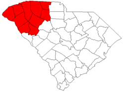
The Upstate is the region in the westernmost part of South Carolina, United States, also known as the Upcountry,[1] which is the historical term. Although loosely defined among locals, the general definition includes the ten counties of the commerce-rich I-85 corridor in the northwest corner of South Carolina. This definition coincides with the Greenville–Spartanburg–Anderson, SC Combined Statistical Area, as first defined by the Office of Management and Budget in 2015, and maintained as of 2017.[2] The region's population was 1,347,112 as of 2016. Situated between Atlanta and Charlotte, the Upstate is the fastest-growing region of South Carolina, and is the geographical center of the Charlanta mega-region. After BMW's initial investment, foreign companies, including others from Germany, have a substantial presence in the Upstate; several large corporations have established regional, national, or continental headquarters in the area. Greenville is the largest city in the region with a population of 67,453 and an urban-area population of 400,492, and it is the base of most commercial activity. Spartanburg, followed by Anderson, are next in population.
Counties
Ten counties are included in the Upstate of South Carolina: Greenville, Spartanburg, Anderson, Pickens, Oconee, Greenwood, Laurens, Cherokee, Union, Abbeville.
| County | Year founded | County seat | 2010 Census Population[3] |
July 1, 2016 Population Estimate.[4] |
Area (sq. mi.) |
Land area (sq. mi.) |
| Abbeville County | 1785 | Abbeville | 25,417 | 24,722 | 511 | 490 |
| Anderson County | 1826 | Anderson | 187,126 | 196,569 | 757 | 718 |
| Cherokee County | 1897 | Gaffney | 55,342 | 56,646 | 397 | 393 |
| Greenville County | 1786 | Greenville | 451,225 | 498,766 | 795 | 790 |
| Greenwood County | 1897 | Greenwood | 69,661 | 70,355 | 463 | 455 |
| Laurens County | 1785 | Laurens | 66,537 | 66,777 | 724 | 715 |
| Oconee County | 1868 | Walhalla | 74,275 | 76,355 | 674 | 625 |
| Pickens County | 1868 | Pickens | 119,224 | 122,863 | 512 | 497 |
| Spartanburg County | 1785 | Spartanburg | 284,307 | 301,463 | 819 | 811 |
| Union County | 1798 | Union | 28,961 | 27,673 | 516 | 514 |
| Total | 1,266,977 | 1,347,112 | 5,194 | 5,063 | ||
Metropolitan, Micropolitan, and Combined Statistical Areas
| Greenville CSA | |
|---|---|
| CSA | |
| Greenville–Spartanburg–Anderson, SC Combined Statistical Area | |
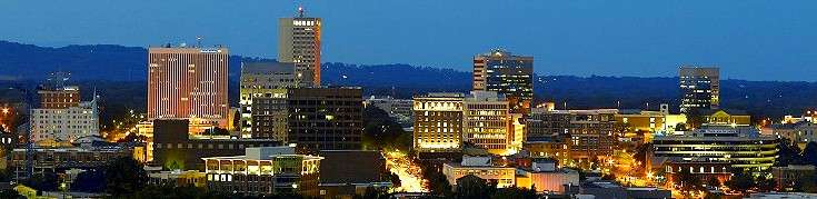 Greenville skyline | |
|
Greenville–Anderson–Mauldin Metropolitan Statistical Area
Spartanburg Metropolitan Statistical Area
Greenwood Micropolitan Statistical Area
Seneca Micropolitan Statistical Area
Gaffney Micropolitan Statistical Area
| |
| Country |
|
| State |
|
| Principal cities |
Greenville Spartanburg Anderson Mauldin Easley |
| Area | |
| • Total | 6,168 sq mi (15,980 km2) |
| • Land | 6,027 sq mi (15,610 km2) |
| • Water | 141 sq mi (370 km2) 2.2% |
| Population (2014) | |
| • CSA | 1,409,582[5] (40th) |
| Time zone | UTC−5 (EST) |
| • Summer (DST) | UTC−4 (EDT) |
| Area code(s) | 864 |
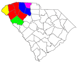
Within the Greenville–Spartanburg–Anderson CSA are a total of two Metropolitan Statistical Areas and three Micropolitan Statistical Areas.[2]
As of the 2010 Census, the Greenville–Spartanburg–Anderson CSA had a population of 1,362,073.
| MSA | County | Population (2010) |
|---|---|---|
| Greenville–Anderson–Mauldin | Greenville, Anderson, Pickens, Laurens | 824,112 |
| Spartanburg | Spartanburg, Union | 313,268 |
| Total: | 1,137,380 |
| μSA | County | Population (2010) |
|---|---|---|
| Greenwood | Greenwood, Abbeville | 95,078 |
| Seneca | Oconee | 74,273 |
| Gaffney | Cherokee | 55,342 |
| Total: | 224,693 |
Communities
The following population rankings are based on the 2010 Census[3]
Primary cities
Greenville, Spartanburg, and Anderson.
The Office of Management and Budget labels all these cities as principal cities in their respective MSA's.[2]
Other communities with at least 20,000 residents
Cities: Greenwood, Greer, and Mauldin.
In the 2016 Census population estimate, the cities of Easley and Simpsonville have populations that exceed 20,000.
The OMB has labelled Mauldin and Easley as principal cities.
CDPs: Taylors, Wade Hampton
Communities with more than 10,000 residents
If students from Clemson University are included, Clemson has close to 30,000 residents.
CDP's: Berea, Five Forks, Gantt, Parker
Communities with fewer than 10,000 residents
Communities in the Upstate with under 10,000 residents include:
Cities:
Towns:
According to the 2010 Census, no town in the Upstate has a population greater than 6000.
CDP's:
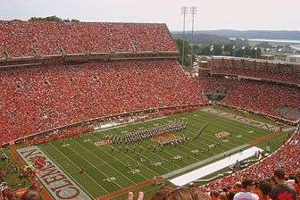
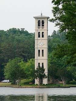
Institutions of higher education
The following table shows the major institutions of higher education in the Upstate.
In 2008, U.S. News ranked Furman as the 37th best liberal arts college, Wofford College as the 59th best, and Presbyterian College as the 101st best. Also, they ranked Clemson University as the 67th best national university. According to the Bob Jones University, its Museum and Gallery constitutes the largest collection of religious art in the Western Hemisphere.[6]
Economy
The majority of business and commerce in the Upstate takes place in Greenville County. Greenville has the largest concentration of businesses and financial institutions in its downtown area. In fact, the Greenville-Spartanburg-Anderson MSA was ranked seventh in the nation by site consultants considering the top markets for economic development. Many financial institutions have regional offices located in downtown Greenville. These include Bank of America and the now-defunct Wachovia. Other major industries of commerce in the Upstate include the auto industry which is concentrated mainly along the corridor between Greenville and Spartanburg around the BMW manufacturing facility in Greer. The other major industry in the Upstate is the healthcare and pharmaceuticals. Greenville Hospital System and Bon Secours St. Francis Health System are the area's largest in the healthcare sector, while the pharmaceutical corporation of Bausch & Lomb have set up regional operations alongside smaller recently developed local companies like IRIX Manufacturing, Incorporated and Pharmaceutical Associates. The Upstate is also home to a large amount of private sector and university-based research including R&D facilities for Michelin, Fuji and General Electric and research centers to support the automotive, life sciences, plastics and photonics industries. Clemson University, BMW, IBM, Microsoft, and Michelin have combined their resources to create International Center for Automotive Research (ICAR), a research park that specializes in the development of automotive technology.
Corporations based in or with a major presence in the Upstate
The following corporations have a major presence in the Upstate: Adidas, Advance America, Bank of America, BMW of North America, Bon Secours St. Francis Health System , Bosch North America, Bowater, Denny's Restaurants, Dunlop Slazenger Group, Ernst & Young, Fluor Corporation, Freightliner LLC, GE Power Systems, Greenville Hospital System , IBM, Kemet Corporation, Liberty Corporation, Mary Black Health System, Michelin of North America, Microsoft, Milliken & Co., Spartanburg Regional Health System, Spectrum Communications, SunTrust, Ovation Brands, Perrigo Company of South Carolina, Toronto-Dominion Bank, and Verizon.
• BMW's only North American manufacturing plant is located in Spartanburg County, with an investment of $3.7 billion.
• Fujifilm located their first manufacturing facility in the U.S. in Greenwood County.
• Michelin North America's headquarters is located in Greenville, along with seven manufacturing plants, R&D facility and test track located in the Upstate. Michelin employs more than 7,800 in South Carolina.
• Walgreens has their southeastern distribution center located in Anderson County, which employs mentally handicapped workers as nearly 40% of their workforce.
Transportation

The Upstate is served by two major interstate highways, I-85 and I-26. Other major interstate spurs include I-185, I-385, and I-585. The major airport in the region is Greenville-Spartanburg International Airport, located nearly halfway between Greenville and Spartanburg in suburban Greer. Greenville, Spartanburg, Anderson, Clemson, Pickens, Union, and Gaffney each have smaller airfields. AMTRAK service along the Crescent Line stops in Spartanburg, Greenville, and Clemson.
Media
The Upstate region is served by 3 regional newspapers: The Greenville News, the (Spartanburg) Herald-Journal and the Anderson Independent-Mail, each of which serves their individual city and surrounding area respectively.
The Upstate is part of the vastly larger Greenville-Spartanburg-Anderson-Asheville designated market area, which extends into western North Carolina and northeastern Georgia. The following television stations serve the region:
- WYFF Channel 4 – Greenville (NBC)
- WSPA-TV Channel 7 – Spartanburg (CBS)
- WLOS-TV Channel 13 – Asheville, North Carolina (ABC)
- WGGS-TV Channel 16 – Greenville (TBN)
- WHNS Channel 21 – Greenville (Fox)
- WNTV Channel 29 – Greenville (SCETV)
- WUNF-TV Channel 33 – Asheville (UNC-TV)
- WMYA-TV Channel 40 – Anderson (MNTV)
- WYCW Channel 62 – Asheville (CW)
See also
References
- ↑ Hollis, Daniel Walker, University of South Carolina, Volume I, South Carolina College, 1951, Columbia: University of South Carolina Press, p 342
- 1 2 3 "OMB Bulletin No. 17-01: Revised Delineations of Metropolitan Statistical Areas, Micropolitan Statistical Areas, and Combined Statistical Areas, and Guidance on Uses of the Delineations of These Areas" (PDF). United States Office of Management and Budget. August 15, 2017. Retrieved January 2, 2018.
- 1 2 See http://factfinder2.census.gov for population numbers and for municipality and CDP lists.
- ↑ "Table 1: Annual Estimates of the Resident Population by Sex, Race, and Hispanic Origin for the United States, States and Counties: April 1, 2010 to July 1, 2016". 2016 Population Estimates. United States Census Bureau, Population Division. 2016-07-01. Retrieved 2016-07-01.
- ↑ "Annual Estimates of the Resident Population: April 1, 2010 to July 1, 2014 – United States -- Combined Statistical Area; and for Puerto Rico". US Census Bureau. Retrieved 2016-01-07.
- ↑
External links
| Wikivoyage has a travel guide for Upstate South Carolina. |
- The Upcountry website – Six Upstate counties form the "Upcountry" tourism region
- South Carolina Appalachian Council of Governments – This council of governments covers the "Upcountry" counties.
- Old 96 Distrist – Three Upstate counties form a part of the Old 96 District tourism region.
- Union County is one of the seven counties in the Olde English District.
- Ten at the Top – A nonprofit organization promoting a shared vision between the political, business and community leaders of the Upstate
- The Greenville News – local newspaper of Greenville
- (Spartanburg) Herald Journal – local newspaper of Spartanburg
- Anderson Independent-Mail – local newspaper of Anderson
- Greenville Journal – a weekly newspaper
- Upstate International - Global Community of the Upstate