Parker, South Carolina
| Parker, South Carolina | |
|---|---|
| Census-designated place | |
 Parker  Parker | |
| Coordinates: 34°51′13″N 82°26′23″W / 34.85361°N 82.43972°WCoordinates: 34°51′13″N 82°26′23″W / 34.85361°N 82.43972°W | |
| Country | United States |
| State | South Carolina |
| County | Greenville |
| Area | |
| • Total | 6.9 sq mi (17.8 km2) |
| • Land | 6.8 sq mi (17.7 km2) |
| • Water | 0.04 sq mi (0.1 km2) |
| Elevation | 1,014 ft (309 m) |
| Population (2010) | |
| • Total | 11,431 |
| • Density | 1,676/sq mi (647.0/km2) |
| Time zone | UTC−5 (Eastern (EST)) |
| • Summer (DST) | UTC−4 (EDT) |
| FIPS code | 45-54535[1] |
| GNIS feature ID | 1867528[2] |
Parker is a census-designated place (CDP) in Greenville County, South Carolina, United States. The population was 11,431 at the 2010 census,[3] up from 10,760 in 2000. It is part of the Greenville–Mauldin–Easley Metropolitan Statistical Area.
Geography
Parker is located in west-central Greenville County at 34°51′13″N 82°26′23″W / 34.85361°N 82.43972°W (34.853637, -82.439776).[4] It is bordered to the east by the city of Greenville, to the northeast by City View and Sans Souci, to the north by Berea, to the west by Pickens County, and to the south by Welcome. The western border of the CDP, which serves as the county line, follows the Saluda River.
The southern border of the CDP follows U.S. Route 123, New Easley Highway/Easley Bridge Road. US 123 leads east 4 miles (6 km) to the center of Greenville and west 8 miles (13 km) to Easley. South Carolina Highway 124 (Old Easley Highway) leads through the center of Parker, leading east to Greenville and west to US 123 in Pickens County. U.S. Route 25 (White Horse Road) runs through the east side of Parker, leading north 10 miles (16 km) to Travelers Rest and south 3.5 miles (5.6 km) to Interstate 185.
According to the United States Census Bureau, the Parker CDP has a total area of 6.9 square miles (17.8 km2), of which 0.04 square miles (0.1 km2), or 0.66%, is water.[3]
Demographics
As of the census[1] of 2000, there were 10,760 people, 4,255 households, and 2,821 families residing in the CDP. The population density was 1,559.7 people per square mile (602.1/km²). There were 4,824 housing units at an average density of 699.3 per square mile (269.9/km²). The racial makeup of the CDP was 78.93% White, 16.62% African American, 0.28% Native American, 0.30% Asian, 0.06% Pacific Islander, 2.40% from other races, and 1.42% from two or more races. Hispanic or Latino of any race were 6.36% of the population.
There were 4,255 households out of which 28.9% had children under the age of 18 living with them, 42.3% were married couples living together, 16.9% had a female householder with no husband present, and 33.7% were non-families. 28.4% of all households were made up of individuals and 12.8% had someone living alone who was 65 years of age or older. The average household size was 2.48 and the average family size was 3.01.
In the CDP, the population was spread out with 24.8% under the age of 18, 9.5% from 18 to 24, 29.4% from 25 to 44, 20.9% from 45 to 64, and 15.4% who were 65 years of age or older. The median age was 36 years. For every 100 females, there were 91.3 males. For every 100 females age 18 and over, there were 87.7 males.
The median income for a household in the CDP was $25,991, and the median income for a family was $31,025. Males had a median income of $26,691 versus $20,143 for females. The per capita income for the CDP was $13,383. About 15.6% of families and 20.4% of the population were below the poverty line, including 27.4% of those under age 18 and 15.2% of those age 65 or over.
References
- 1 2 "American FactFinder". United States Census Bureau. Archived from the original on September 11, 2013. Retrieved 2008-01-31.
- ↑ "US Board on Geographic Names". United States Geological Survey. 2007-10-25. Retrieved 2008-01-31.
- 1 2 "Geographic Identifiers: 2010 Demographic Profile Data (G001): Parker CDP, South Carolina". American Factfinder. U.S. Census Bureau. Retrieved February 14, 2017.
- ↑ "US Gazetteer files: 2010, 2000, and 1990". United States Census Bureau. 2011-02-12. Retrieved 2011-04-23.
Municipalities and communities of Greenville County, South Carolina, United States | ||
|---|---|---|
| Cities | 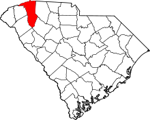 | |
| CDPs | ||
| Unincorporated communities | ||
| Footnotes | ‡This populated place also has portions in an adjacent county or counties | |