Garden City, South Carolina
| Garden City, South Carolina | |
|---|---|
| Census-designated place | |
 The Pier at Garden City Beach | |
| Nickname(s): Garden City Beach | |
 Location in South Carolina | |
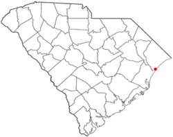
| Coordinates: 33°35′16″N 79°0′19″W / 33.58778°N 79.00528°WCoordinates: 33°35′16″N 79°0′19″W / 33.58778°N 79.00528°W | |
| Country | United States |
| State | South Carolina |
| County | Horry, Georgetown |
| Area | |
| • Total | 5.4 sq mi (14.1 km2) |
| • Land | 5.4 sq mi (13.9 km2) |
| • Water | 0.08 sq mi (0.2 km2) |
| Elevation | 20 ft (6 m) |
| Population (2010) | |
| • Total | 9,209 |
| • Density | 1,716/sq mi (662.4/km2) |
| Time zone | UTC−5 (EST) |
| • Summer (DST) | UTC−4 (EDT) |
| ZIP code | 29576 |
| Area code(s) | 843 |
| FIPS code | 45-28455[1] |
| GNIS feature ID | 1867521[2] |
Garden City, sometimes known as Garden City Beach, is a census-designated place (CDP) in Horry County, South Carolina, United States. Despite its name, Garden City is not incorporated and does not have a city council or mayor. The population was 9,209 at the 2010 census.[3] Garden City Beach is located directly south of Surfside Beach. The developed part of the beach extends south beyond the limits of the Garden City CDP, into Georgetown County, and ends on a peninsula at the mouth of Murrells Inlet.[4]
Geography
Garden City is located in southern Horry County at 33°35′16″N 79°0′19″W / 33.58778°N 79.00528°W (33.587760, -79.005221).[5] It is bordered to the northeast by the town of Surfside Beach, to the northwest by U.S. Route 17, to the south by unincorporated Murrells Inlet in Georgetown County, and to the southeast by the Atlantic Ocean. U.S. Route 17 Business is the main road through the center of the community, leading northeast 10 miles (16 km) to the center of Myrtle Beach. Georgetown is 25 miles (40 km) to the southwest via US 17.
According to the United States Census Bureau, the Garden City CDP has a total area of 5.4 square miles (14.1 km2), of which 5.4 square miles (13.9 km2) are land and 0.1 square miles (0.2 km2), or 1.47%, are water.[3]
Demographics
As of the census[1] of 2000, there were 9,357 people, 4,703 households, and 2,873 families residing in the CDP. The population density was 1,745.1 people per square mile (674.0/km²). There were 7,995 housing units at an average density of 1,491.1/sq mi (575.9/km²). The racial makeup of the CDP was 97.02% White, 1.00% African American, 0.28% Native American, 0.42% Asian, 0.10% Pacific Islander, 0.30% from other races, and 0.89% from two or more races. Hispanic or Latino of any race were 1.12% of the population.
There were 4,703 households out of which 12.8% had children under the age of 18 living with them, 52.2% were married couples living together, 6.9% had a female householder with no husband present, and 38.9% were non-families. 31.9% of all households were made up of individuals and 15.4% had someone living alone who was 65 years of age or older. The average household size was 1.96 and the average family size was 2.40.
In the CDP, the population was spread out with 11.2% under the age of 18, 5.6% from 18 to 24, 21.5% from 25 to 44, 27.6% from 45 to 64, and 34.2% who were 65 years of age or older. The median age was 54 years. For every 100 females, there were 91.5 males. For every 100 females age 18 and over, there were 89.1 males.
The median income for a household in the CDP was $34,967, and the median income for a family was $40,403. Males had a median income of $27,683 versus $22,904 for females. The per capita income for the CDP was $24,062. About 2.9% of families and 5.5% of the population were below the poverty line, including 7.4% of those under age 18 and 3.5% of those age 65 or over.
Attractions
The Pier at Garden City
Formally known as the Kingfisher Pier that was completely destroyed by Hurricane Hugo and replaced,[6] the Pier at Garden City is one of the most renowned attractions in the area. "The Best of the Beach Visitors' Poll" of the Grand Strand, conducted by The Sun News, voted the Pier at Garden City as the "Best Pier" in 2004, 2006, 2007, 2008, 2009 and 2010.[7] The pier is located 11 miles (18 km) southwest of Myrtle Beach in the heart of Garden City Beach at 110 St. Waccamaw Drive. It is approximately 668 feet (204 m) long, with a rain shelter at the end of the pier which includes a bar, nightly live music, and dancing during the summer months.[8] There is no charge to walk on the pier before midnight. You must be 21 or accompanied by an adult to walk to the end of the pier when the bar is open. Other activities on the pier include the tackle shop, fishing, the arcade, and the Pier Café which hosts breakfast, lunch, dinner, and karaoke and live music during certain hours in the summer months.
Garden City Golf Cart Parade
The Garden City Golf Cart Parade is a Fourth of July parade that features red, white and blue-decorated golf carts. It has been a community tradition for almost 30 years. It originally started at Calhoun Drive behind Willards Fireworks. After a brief hiatus, it was held again on July 4, 2009.[9]
Weather
Temperatures tend to be in the 80's during the summer months in Garden City, SC, and in the 40's during the winter. The warmest month of the year is July with an average maximum temperature of 90.40 degrees Fahrenheit, while the coldest month of the year is January with an average minimum temperature of 37.30 degrees Fahrenheit. The annual average precipitation at Garden City is 54.57 inches. Rainfall is fairly evenly distributed throughout the year. The wettest month of the year is September with an average rainfall of 6.44 inches.[10]
Hurricane Hazel
The worst disaster in the city's history occurred on 14 October 1954. Hurricane Hazel slammed into the city and left only two houses habitable.
Hurricane Hugo
In September 1989, Hurricane Hugo destroyed 43% of the beachfront structures along the coast in Garden City.[11] The Kingfisher Pier, as it was known at that time, was also destroyed by Hurricane Hugo. Reconstruction of the pier began in February 1992. The Pier at Garden City, as it is known today, was fully operational July 1992, and no significant damage has been reported since then.[12]
Transportation
Roads and highways
Mass transit
- The Coast RTA - Bus system operating seven days a week, 364 days a year. 15 routes throughout the Horry County/Grand Strand area, including Myrtle Beach, North Myrtle Beach, Surfside Beach, Garden City, Conway, Loris, and Aynor.
References
- 1 2 "American FactFinder". United States Census Bureau. Archived from the original on 2013-09-11. Retrieved 2008-01-31.
- ↑ "US Board on Geographic Names". United States Geological Survey. 2007-10-25. Retrieved 2008-01-31.
- 1 2 "Geographic Identifiers: 2010 Census Summary File 1 (G001): Garden City CDP, South Carolina". American Factfinder. U.S. Census Bureau. Retrieved January 26, 2018.
- ↑ "About the Myrtle Beach Area". Myrtle Beach Area Chamber of Commerce. Retrieved 15 November 2010.
- ↑ "US Gazetteer files: 2010, 2000, and 1990". United States Census Bureau. 2011-02-12. Retrieved 2011-04-23.
- ↑ Goldstein, Robert (2000), Coastal fishing in the Carolinas: from surf, pier, and jetty, Winston-Salem, North Carolina: John F. Blair
- ↑ "Best of the Beach: the 2010 Results". The Sun News. Retrieved 14 November 2010.
- ↑ "Garden City Beach". Archived from the original on 24 November 2010. Retrieved 14 November 2010.
- ↑ Floyd, Allyson (9 June 2009). "Golf cart parade comes back to Garden City". Myrtle Beach/Florence South Carolina market: Barrington Broadcasting Group, LLC. Retrieved 15 November 2010.
- ↑ "Garden City, SC Weather". IDcide. Retrieved 15 November 2010.
- ↑ National Research Council (U.S.). Committee on Natural Disasters (1994). Hurricane Hugo: Puerto Rico, the U.S. Virgin Islands, and South Carolina, September 17–22, 1989. Washington, DC: National Academies Press. p. 224.
- ↑ "The Pier at Garden City Weather". Archived from the original on 28 November 2010. Retrieved 15 November 2010.
External links
| Wikivoyage has a travel guide for Garden City (South Carolina). |
Municipalities and communities of Horry County, South Carolina, United States | ||
|---|---|---|
| Cities | 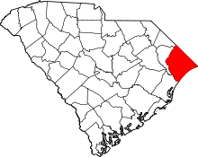 | |
| Towns | ||
| CDPs | ||
| Unincorporated communities | ||
Municipalities and communities of Georgetown County, South Carolina, United States | ||
|---|---|---|
| City | 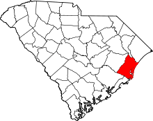 | |
| Towns | ||
| CDP | ||
| Unincorporated communities | ||
| Footnotes | ‡This populated place also has portions in an adjacent county or counties | |