Red Hill, South Carolina
| Red Hill, South Carolina | |
|---|---|
| Census-designated place | |
 Location in South Carolina | |
| Coordinates: 33°47′18″N 79°0′49″W / 33.78833°N 79.01361°WCoordinates: 33°47′18″N 79°0′49″W / 33.78833°N 79.01361°W | |
| Country | United States |
| State | South Carolina |
| County | Horry |
| Area | |
| • Total | 11.4 sq mi (29.4 km2) |
| • Land | 11.3 sq mi (29.2 km2) |
| • Water | 0.08 sq mi (0.2 km2) |
| Elevation | 33 ft (10 m) |
| Population (2010) | |
| • Total | 13,223 |
| • Density | 1,171/sq mi (452.2/km2) |
| Time zone | UTC−5 (EST) |
| • Summer (DST) | UTC−4 (EDT) |
| ZIP codes | 29020, 29021 |
| FIPS code | 45-59190[1] |
| GNIS feature ID | 1225782[2] |
Red Hill is a census-designated place (CDP) in Horry County, South Carolina, United States. The population was 13,223 at the 2010 census,[3] up from 10,509 at the 2000 census.
Geography
Red Hill is in south-central Horry County at 33°47′18″N 79°0′49″W / 33.78833°N 79.01361°W (33.788368, -79.013715).[4] It is bordered to the north by the city of Conway, the county seat, and to the south by Socastee. U.S. Route 501 passes through the northern part of Red Hill, connecting Conway to the north with Myrtle Beach, 12 miles (19 km) to the southeast. South Carolina Highway 544 runs north-south the length of Red Hill, connecting Conway with Socastee. The west side of Red Hill is bordered by the Waccamaw National Wildlife Refuge.
According to the United States Census Bureau, the CDP has a total area of 11.4 square miles (29.4 km2), of which 11.3 square miles (29.2 km2) are land and 0.1 square miles (0.2 km2), or 0.52%, are water.[3]
Demographics
As of the census[1] of 2000, there were 10,509 people, 4,189 households, and 3,066 families residing in the CDP. The population density was 961.4 people per square mile (371.2/km²). There were 5,026 housing units at an average density of 459.8 per square mile (177.5/km²). The racial makeup of the CDP was 88.70% White, 7.34% African American, 0.59% Native American, 0.78% Asian, 0.08% Pacific Islander, 1.22% from other races, and 1.30% from two or more races. Hispanic or Latino of any race were 3.11% of the population.
There were 4,189 households out of which 31.3% had children under the age of 18 living with them, 58.1% were married couples living together, 11.4% had a female householder with no husband present, and 26.8% were non-families. 19.4% of all households were made up of individuals and 6.4% had someone living alone who was 65 years of age or older. The average household size was 2.50 and the average family size was 2.83.
In the CDP, the population was spread out with 23.5% under the age of 18, 9.2% from 18 to 24, 29.3% from 25 to 44, 23.1% from 45 to 64, and 14.7% who were 65 years of age or older. The median age was 37 years. For every 100 females, there were 94.8 males. For every 100 females age 18 and over, there were 92.5 males.
The median income for a household in the CDP was $37,736, and the median income for a family was $44,085. Males had a median income of $30,123 versus $21,750 for females. The per capita income for the CDP was $20,036. About 8.2% of families and 12.0% of the population were below the poverty line, including 14.5% of those under age 18 and 6.9% of those age 65 or over.
References
- 1 2 "American FactFinder". United States Census Bureau. Retrieved 2008-01-31.
- ↑ "US Board on Geographic Names". United States Geological Survey. 2007-10-25. Retrieved 2008-01-31.
- 1 2 "Geographic Identifiers: 2010 Census Summary File 1 (G001): Red Hill CDP, South Carolina". American Factfinder. U.S. Census Bureau. Retrieved January 26, 2018.
- ↑ "US Gazetteer files: 2010, 2000, and 1990". United States Census Bureau. 2011-02-12. Retrieved 2011-04-23.
Municipalities and communities of Horry County, South Carolina, United States | ||
|---|---|---|
| Cities | 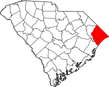 | |
| Towns | ||
| CDPs | ||
| Unincorporated communities | ||