Lexington, South Carolina
| Lexington, South Carolina | |
|---|---|
| Town | |
 | |
| Motto(s): "Town of Progress" | |
 Lexington, South Carolina Location of Lexington, South Carolina | |
| Coordinates: 33°58′52″N 81°13′51″W / 33.98111°N 81.23083°WCoordinates: 33°58′52″N 81°13′51″W / 33.98111°N 81.23083°W | |
| Country |
|
| State |
|
| County | Lexington County |
| Government | |
| • Type | Mayor-Council |
| • Body | Lexington Town Council[1] |
| • Mayor | Steve MacDougall[2] (since 2013) |
| Area | |
| • Total | 22.97 km2 (8.8 sq mi) |
| • Land | 22.95 km2 (8.7 sq mi) |
| • Water | 0.2 km2 (0.1[3] sq mi) |
| Elevation | 120 m (394 ft) |
| Population (2010)[4] | |
| • Total | 17,870 |
| • Rank | 23rd |
| • Density | 778/km2 (2,014/sq mi) |
| Time zone | UTC−5 (Eastern (EST)) |
| • Summer (DST) | UTC−4 (EDT) |
| ZIP codes | 29071, 29072, 29073 |
| Area code(s) | 803 |
| FIPS code | 45-41335[5] |
| GNIS feature ID | 1246349[6] |
| Website |
www |
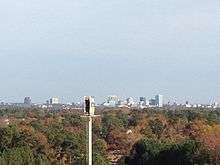
Lexington is the largest town in and the county seat of Lexington County, South Carolina, United States.[7] Lexington is a suburb of the state's capital and second-largest city, Columbia. The U.S. Census Bureau estimated 2017 population is 21,265,[8] and it is the second-largest municipality in the greater Columbia area.
History
In 1735, the colonial government of King George II established eleven townships in backcountry South Carolina, to encourage settlement, and to provide a buffer between Native American tribes to the West and colonial plantations in the Lowcountry. The townships included one named Saxe Gotha, which flourished with major crops of corn, wheat, tobacco, hemp, and flax, as well as beeswax and livestock.
The Battle of Tarrar Springs was fought nearby on November 16, 1781. In 1785, Saxe Gotha was replaced with Lexington County, in commemoration of the Battles of Lexington and Concord in Massachusetts. The county's first courthouse was built in Granby, but chronic flooding forced the courthouse to move in 1820 to its present location, establishing the community of Lexington Courthouse. The community was incorporated as the Town of Lexington in 1861.
In 1865 Union Army forces destroyed the courthouse and many buildings in the town. But local farms and the lumber industry helped stabilize the economy after Reconstruction. The town grew due to the Columbia to Augusta Railroad and the Lexington Textile Mill, constructed in 1890.
Many current brick buildings were built in the aftermath of severe fires in 1894 and 1916.[9]
Recent History
On August 16, 1994, Lexington was struck by an F-3 tornado, generated from the remnants of Tropical Storm Beryl, resulting in over 40 injuries and $50 million in damages. From the same tropical storm, 21 other tornados were reported throughout the state, including six in Lexington County.[10]
The Move Over Law, a law that requires drivers to change lanes when there is a stopped emergency vehicle on the side of the road, originated in Lexington, SC, after a South Carolina Paramedic, James D. Garcia, was struck and injured at an accident scene on Jan. 28, 1994. Garcia was listed at fault, leading to his work to create this law. SC's version (SC 56-5-1538) passed in 1996, and was revised in 2002.[11][12]
A Murphy Express gas station on Augusta Highway in Lexington, SC sold a $400 million winning Powerball ticket on September 18, 2013. This ticket was the fifth largest winning ticket of any United States lottery.[13][14][15]
On November 5, 2013, incumbent Lexington mayor Randy Halfacre lost a reelection bid to Councilman Steve MacDougall by only 18 votes.[16] A recount was initiated but the results remained the same.[2]
Buildings listed on the National Register of Historic Places.[17] include:
- The Ballentine-Shealy House
- Bank of Western Carolina
- W. Q. M. Berly House
- William Berly House
- Lemuel Boozer House
- C.E. Corley House
- Fox House
- Gunter-Summers House
- James Harman Building
- Ernest L. Hazelius House
- John Solomon Hendrix House
- John Jacob Hite Farm
- Home National Bank,
- Lexington County Courthouse
- Henry Lybrand Farm
- Maj. Henry A. Meetze House
- Old Batesburg-Leesville High School
- Charlton Rauch House
- David Rawl House
- Simmons-Harth House
- James Stewart House
- Vastine Wessinger House

Geography
Lexington is located at 33°58′52″N 81°13′51″W / 33.98111°N 81.23083°W (33.980975, -81.230839).[18]
According to the United States Census Bureau, the town has a total area of 8.8 square miles (23 km2), of which 8.7 square miles (23 km2) is land and 0.1 square miles (0.26 km2) (1.73%) is water.[3]
Lexington is 12 mi (19 km) away from South Carolina's state capital and second-largest city, Columbia.[19]
Climate
The lowest recorded temperature in Lexington was −2 °F (−19 °C) in February 1899. The warmest recorded temperature was 111 °F (44 °C) in June 2012.[20] July averages the most yearly precipitation.[21] Lexington averages 48 in (1.2 m) of rain per year; Lexington averages 4 in (10 cm) of snow per year.[22]
| Climate data for Columbia, South Carolina (Columbia Airport), 1981–2010 normals | |||||||||||||
|---|---|---|---|---|---|---|---|---|---|---|---|---|---|
| Month | Jan | Feb | Mar | Apr | May | Jun | Jul | Aug | Sep | Oct | Nov | Dec | Year |
| Record high °F (°C) | 84 (29) |
84 (29) |
93 (34) |
96 (36) |
101 (38) |
107 (42) |
109 (43) |
107 (42) |
106 (41) |
101 (38) |
90 (32) |
83 (28) |
109 (43) |
| Average high °F (°C) | 56.0 (13.3) |
61 (16) |
68 (20) |
76 (24) |
84 (29) |
90 (32) |
93 (34) |
91 (33) |
85 (29) |
76 (24) |
67 (19) |
58 (14) |
75 (24) |
| Average low °F (°C) | 30 (−1) |
33 (1) |
41 (5) |
50 (10) |
60 (16) |
68 (20) |
72 (22) |
71 (22) |
64 (18) |
52 (11) |
42 (6) |
32 (0) |
51 (11) |
| Record low °F (°C) | −1 (−18) |
−4 (−20) |
4 (−16) |
26 (−3) |
34 (1) |
44 (7) |
54 (12) |
53 (12) |
40 (4) |
23 (−5) |
12 (−11) |
4 (−16) |
−4 (−20) |
| Average precipitation inches (mm) | 3.58 (90.9) |
3.74 (95) |
3.73 (94.7) |
2.62 (66.5) |
2.97 (75.4) |
4.69 (119.1) |
5.46 (138.7) |
5.26 (133.6) |
3.54 (89.9) |
3.17 (80.5) |
2.74 (69.6) |
3.22 (81.8) |
44.56 (1,131.8) |
| Average snowfall inches (cm) | 0.1 (0.3) |
0.8 (2) |
0.1 (0.3) |
0 (0) |
0 (0) |
0 (0) |
0 (0) |
0 (0) |
0 (0) |
0 (0) |
0 (0) |
0.1 (0.3) |
1.6 (4.1) |
| Average precipitation days (≥ 0.01 in) | 9.9 | 9.1 | 8.6 | 8.0 | 7.7 | 10.5 | 11.8 | 10.5 | 7.3 | 7.0 | 7.3 | 9.0 | 106.8 |
| Average snowy days (≥ 0.1 in) | 0.5 | 0.3 | 0.1 | 0 | 0 | 0 | 0 | 0 | 0 | 0 | 0 | 0.1 | 1.0 |
| Mean monthly sunshine hours | 173.6 | 183.6 | 238.7 | 270.0 | 291.4 | 279.0 | 285.2 | 263.5 | 240.0 | 235.6 | 195.0 | 173.6 | 2,829.2 |
| Source: NOAA (extremes 1887–present),[23] | |||||||||||||
Economy
Top employers
According to the Town's 2017 Comprehensive Annual Financial Report,[24] the top employers in the city are:
| # | Employer | # of Employees |
|---|---|---|
| 1 | Lexington School District 1 | 967 |
| 2 | Lexington County | 850 |
| 3 | Walmart | 364 |
| 4 | Lowe's | 164 |
| 5 | Town of Lexington | 158 |
| 6 | Publix | 150 |
| 7 | Home Depot | 140 |
| 8 | Avtec | 129 |
| 9 | Kohl's | 119 |
| 10 | Target | 110 |
Transportation
The CMRTA no longer runs any stops within town limits. There are no public transportation options, but taxi services are available.
Roads and Highways
Interstates
.svg.png)
.svg.png)
U.S. Routes
S.C. Highways


Sights and entertainment
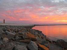
- Slightly north of the town of Lexington rests one of South Carolina's major lakes, Lake Murray. The lake is held by a 1.7 mile long dam on which people are free to drive, bike, run, or walk across. The Saluda Dam, or Lake Murray Dam, provides electricity for the surrounding. There is also a public swimming area that is open during the summer months on the Lexington side of the dam.[25]
- Lexington County Blowfish Baseball Stadium
- Lexington Community Band[26]
- Icehouse Amphitheater
- Three public parks: (Virginia Hilton Park, Gibson Pond Park, and Corely Street Water Park).
- Lexington County Museum
- Fourteen-Mile Creek Trail

Demographics
| Historical population | |||
|---|---|---|---|
| Census | Pop. | %± | |
| 1880 | 262 | — | |
| 1890 | 342 | 30.5% | |
| 1900 | 806 | 135.7% | |
| 1910 | 709 | −12.0% | |
| 1920 | 894 | 26.1% | |
| 1930 | 1,152 | 28.9% | |
| 1940 | 1,033 | −10.3% | |
| 1950 | 1,081 | 4.6% | |
| 1960 | 1,127 | 4.3% | |
| 1970 | 969 | −14.0% | |
| 1980 | 2,131 | 119.9% | |
| 1990 | 3,289 | 54.3% | |
| 2000 | 9,793 | 197.8% | |
| 2010 | 17,870 | 82.5% | |
| Est. 2016 | 20,988 | [27] | 17.4% |
| U.S. Decennial Census[28] 2012 Estimate[29] | |||
As of the census of 2010, there were 17,870 people, 8,101 households, and 2,558 families residing in the town. The population density was 1,724.4 people per square mile (665.7/km²). There were 4,025 housing units at an average density of 708.7 per square mile (273.6/km²). Since 2000, the town population grew from nearly 10,000 inhabitants to 25,000, a 166% increase. Since 2005, 3,200 new homes have been built within the town limits, as well as 130 new businesses.[30]
In the 2010 census, the racial makeup of the town was 83.88% White, 12.48% Black or African American, 0.18% Native American, 2.05% Asian, 0.03% Pacific Islander, 0.67% from other races, and 0.70% from two or more races. Hispanic or Latino of any race were 1.91% of the population.
There were 3,644 households out of which 40.5% had children under the age of 18 living with them, 55.9% were married couples living together, 12.3% had a female householder with no husband present, and 29.8% were non-families. 24.9% of all households were made up of individuals and 7.5% had someone living alone who was 65 years of age or older. The average household size was 2.51 and the average family size was 3.03.
In the town, the population was spread out with 27.1% under the age of 18, 7.5% from 18 to 24, 39.6% from 25 to 44, 18.3% from 45 to 64, and 7.5% who were 65 years of age or older. The median age was 33 years. For every 100 females, there were 97.6 males. For every 100 females age 18 and over, there were 96.3 males.
The median income for a household in the town was $53,865, and the median income for a family was $65,694. Males had a median income of $44,883 versus $29,020 for females. The per capita income for the town was $23,416. About 5.2% of families and 7.2% of the population were below the poverty line, including 7.3% of those under age 18 and 14.5% of those age 65 or over.
Schools
Listed below are public schools that have an address labeled in Lexington, South Carolina.[31]
Elementary Schools:
- Carolina Springs Elementary
- Lake Murray Elementary
- Lexington Elementary
- Midway Elementary
- Meadow Glen Elementary
- New Providence Elementary
- Oak Grove Elementary
- Pleasant Hill Elementary
- Red Bank Elementary
- Saxe Gotha Elementary
- Rocky Creek Elementary
- Deerfield Elementary
- White Knoll Elementary
Middle Schools:
- Carolina Springs Middle School
- Lexington Middle School
- Meadow Glen Middle School
- Pleasant Hill Middle School
- White Knoll Middle School
- New Middle School (Under Construction; opens 2019)[32]
High Schools:
- Lexington High School
- Lexington Technology Center
- River Bluff High School
- White Knoll High School
Neighboring towns and cities
This is a list of municipalities within 15 miles of the town center of Lexington, SC:
- Springdale (East 7.5 miles)
- Irmo (North 8 miles)
- South Congaree (Southeast 8.5 miles)
- Pine Ridge (Southeast 9 miles)
- Cayce (East 9.5 miles)
- West Columbia (East 9.5 miles)
- Columbia (East 12 miles)
- Summit (West 12 miles)
- Gilbert (West 12.5 miles)
- Chapin (Northwest 14.5 miles)
Notable people
- Preston Callison, lawyer and politician
- Nick Ciuffo, 2013 First-round pick by the Tampa Bay Rays
- Nikki Haley, current United States Ambassador to the United Nations and 116th Governor of South Carolina[note 1]
- Lacie Lybrand, Miss South Carolina USA 2006
- Bob Peeler, former lieutenant governor (1995–2003), trustee of Clemson University
- Shaq Roland, South Carolina University wide receiver for South Carolina Gamecocks
- Floyd Spence, Member of the United States House of Representatives from 1970 to 2001 and resident of Lexington while in office.[33]
- Demetris Summers, former Canadian football running back for the Calgary Stampeders
Notes
- ↑ While Haley officially resides in New York City, she has a home in Lexington. She served as the representative from Lexington's 87th District in the South Carolina House of Representatives from 2005-2011.
References
- ↑ "Archived copy". Archived from the original on 2013-05-11. Retrieved 2013-07-12.
- 1 2 "Archived copy". Archived from the original on 2013-12-11. Retrieved 2013-12-10.
- 1 2 "Lexington (town) QuickFacts from the US Census Bureau". Web.archive.org. Archived from the original on 2013-05-24.
- ↑ "2010 Census Redistricting Data (Public Law 94-171) Summary File". American FactFinder. United States Census Bureau. Archived from the original on July 21, 2011. Retrieved 4 August 2012.
- ↑ "American FactFinder". United States Census Bureau. Archived from the original on September 11, 2013. Retrieved 2008-01-31.
- ↑ "US Board on Geographic Names". United States Geological Survey. 2007-10-25. Retrieved 2008-01-31.
- ↑ "Find a County". National Association of Counties. Archived from the original on May 31, 2011. Retrieved 2011-06-07.
- ↑ "American FactFinder". United States Census Bureau. Retrieved 2018-07-05.
- ↑ "Archived copy". Archived from the original on 2014-12-07. Retrieved 2015-01-01.
- ↑ "South Carolina State Climatology Office". SC.gov. 17 July 2018.
- ↑ "South Carolina Code > Title 56 > Chapter 5 - Uniform Act Regulating Traffic On Highways - LawServer". LawServer.
- ↑ "Highway Patrol: People 'just not aware' of Move Over law". Aiken Standard.
- ↑ Saeed Ahmed and Chuck Johnston, CNN (19 September 2013). "$400 million Powerball lottery ticket sold in South Carolina - CNN.com". CNN.
- ↑ "Winner of $400M Powerball may remain anonymous". USA TODAY. 19 September 2013.
- ↑ Casey Vaughn (19 September 2013). "Winner of $399M Powerball ticket sold in Lexington unknown".
- ↑ "Archived copy". Archived from the original on 2013-11-09. Retrieved 2013-11-09.
- ↑ National Park Service (2010-07-09). "National Register Information System". National Register of Historic Places. National Park Service.
- ↑ "US Gazetteer files: 2010, 2000, and 1990". United States Census Bureau. 2011-02-12. Retrieved 2011-04-23.
- ↑ "Distance between Lexington, SC and Columbia, SC".
- ↑ "Lexington, SC (29072) 10-Day Weather Forecast - The Weather Channel". Weather.com. Retrieved 2 January 2018.
- ↑ "Archived copy". Archived from the original on March 6, 2014. Retrieved August 15, 2013.
- ↑ "Lexington County, South Carolina Climate". Bestplaces.net. Retrieved 2 January 2018.
- ↑ "The Weather Channel". The Weather Channel. Archived from the original on March 6, 2014. Retrieved 2013-08-15.
- ↑ "Town of Lexington 2018 Comprehensive Report". Retrieved 2018-07-12.
- ↑ "Lake Murray, South Carolina". Sciway.net. Retrieved 2 January 2017.
- ↑ "Our next performance... Tuesday, December 12, 2017, 7:30 p.m., Lexington One Performing Arts Center at Lexington HS". Lexingtoncommunityband.org. Retrieved 2 January 2018.
- ↑ "Population and Housing Unit Estimates". Retrieved June 9, 2017.
- ↑ United States Census Bureau. "Census of Population and Housing". Archived from the original on May 12, 2015. Retrieved August 14, 2013.
- ↑ "Annual Estimates of the Resident Population: April 1, 2010 to July 1, 2012". Archived from the original on October 19, 2013. Retrieved August 14, 2013.
- ↑ "The 15 fastest-growing cities in the US". Business Insider. Retrieved 2 January 2018.
- ↑ "Lexington One Schools". Lexington School District One. Archived from the original on 6 February 2012. Retrieved 5 February 2012.
- ↑ "Lexington District One breaks ground for new middle school this week". Wistv.com. Retrieved 2 January 2018.
- ↑ Barone, Michael; Ujifusa, Grant (1987). The Almanac of American Politics 1988. National Journal. p. 1084.
External links
- Official website
- Lexington County Chronicle and the Dispatch-News : Newspaper
- Radius Church Community Outreach
- Saxe Gotha Presbyterian Church
- First Baptist of Lexington
- Lexington Baptist Church
- Turning Pointe Center For The Arts