Dillon, South Carolina
| Dillon, South Carolina | |
|---|---|
| City | |
| Motto(s): "Your First Stop in SC" | |
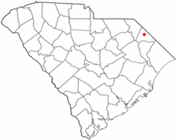 Location of Dillon in South Carolina | |
| Coordinates: 34°25′4″N 79°22′5″W / 34.41778°N 79.36806°WCoordinates: 34°25′4″N 79°22′5″W / 34.41778°N 79.36806°W | |
| Country | United States |
| State | South Carolina |
| County | Dillon |
| Government | |
| • Type | Council-Manager Form of Government |
| • Mayor | J. Todd Davis |
| Area | |
| • Total | 5.23 sq mi (13.56 km2) |
| • Land | 5.23 sq mi (13.53 km2) |
| • Water | 0.0 sq mi (0.03 km2) |
| Elevation | 112 ft (34 m) |
| Population (2016) | |
| • Total | 6,604 |
| • Density | 1,299/sq mi (501.6/km2) |
| Time zone | UTC−5 (EST) |
| • Summer (DST) | UTC−4 (EDT) |
| ZIP code | 29536 |
| Area code(s) | 843 |
| FIPS code | 45-19420[1] |
| GNIS feature ID | 1222024[2] |
| Website |
www |
Dillon is a city in Dillon County in eastern South Carolina, United States. It is the county seat and largest city of Dillon County. [3] It was established on December 22, 1888. Both the name of the city and county comes from John W. Dillon, an early settler and key figure in bringing a railroad through the area. The population was 6,788 in the 2010 U.S. census.[4]
Geography
Dillon is located near the center of Dillon County in the Pee Dee region of northeastern South Carolina. The Little Pee Dee River, a tributary of the Pee Dee River, runs just east of the city.
U.S. Routes 301 and 501 pass through the city as Second Avenue, leading northeast 7 miles (11 km) to Interstate 95 at South of the Border along the North Carolina line, and southwest 6.5 miles (10.5 km) to Latta. Interstate 95 passes northeast of the city, with access from Exits 190 and 193. I-95 leads northeast 25 miles (40 km) to Lumberton, North Carolina, and southwest 28 miles (45 km) to Florence. South Carolina Highway 9 passes through the center of town, leading northwest 26 miles (42 km) to Bennettsville and southeast 13 miles (21 km) to Lake View. South Carolina Highway 57 follows SC 9 through Dillon but leads north 14 miles (23 km) to the North Carolina border and south 17 miles (27 km) to Mullins. SC 9 and 57 follow Main Street southeast out of town. South Carolina Highway 34 follows Main Street northwest out of town, leading west 33 miles (53 km) to Darlington.
According to the U.S. Census Bureau, Dillon has a total area of 5.3 square miles (13.6 km2), of which 0.01 square miles (0.03 km2), or 0.21%, is water.[4] The Little Pee Dee River flows southwards 2 miles (3 km) east of the center of town.
Economy
Dillon prospered when the town's founding fathers granted the railroad to have access through it. Little Rock, a smaller, neighboring town, was the original choice, but residents believed the railroad would do more harm than good.
Dillon had good fortune of being located along a railway line, and was a prosperous town at one time, as seen by its large and ornate courthouse. The Dillon County Courthouse was designed by architect William Augustus Edwards. A federal grant in the early 2000s allowed for a significant renovation of the courthouse and led to the creation of the City of Dillon Historical Overlay District in 2003. For decades earlier in the 20th century, Dillon's economy was based on profitable tobacco and cotton production and sales industries, which has slowly shrunken over the years as production and transport systems for these commodities have become more efficient and less centralized. Now, outside of service industry and state jobs, gainful employment is scarce in Dillon. Despite this, the city infrastructure is well-maintained. There is a large, modern hospital and medical complex—formerly Saint Eugene Hospital, now McLeod Medical Center of Dillon, and a city-owned 40,000 sq ft (3,700 m2) Wellness Center that has over 900 members, which was opened in March 2007.
Dillon is home to the second largest yarn producing factory in the United States. In early 2007, Dillon Yarn Corporation sold the factory, and its textile division, was sold to yarn powerhouse Unifi. The other Dillon divisions continued to run in the factory. After Unifi shut the factory down, an affiliate of Dillon Yarn Corporation bought back the factory, keeping the existing Dillon divisions in place.
In 2001, Harbor Freight Tools, a California-based tool retailer, opened a large distribution center near Dillon, bringing many much-needed jobs to the city.
Interstate 95 and SC 9 intersect at Exit 193, with Highway 9 passing through the heart of downtown and becoming part of Main Street for a few miles. Exit 193 is the most used from the I-95 corridor, by travelers to Myrtle Beach, a popular vacation spot in South Carolina. Exit 193, Dillon's second and more-used exit on I-95, was named after the Honorable William James "Bill" McLeod, Sr., a World War II veteran, former state representative, and retired family court judge.
Dillon also is home to Twin Lakes Country Club. The overpass overlooking the golf course and once famous rail line is named after William Bledsoe (W.B.) Hawkins, a former state representative, WWII veteran, and respected attorney.
Demographics
| Historical population | |||
|---|---|---|---|
| Census | Pop. | %± | |
| 1890 | 82 | — | |
| 1900 | 1,015 | 1,137.8% | |
| 1910 | 1,757 | 73.1% | |
| 1920 | 2,205 | 25.5% | |
| 1930 | 2,731 | 23.9% | |
| 1940 | 3,867 | 41.6% | |
| 1950 | 5,171 | 33.7% | |
| 1960 | 6,173 | 19.4% | |
| 1970 | 6,391 | 3.5% | |
| 1980 | 7,060 | 10.5% | |
| 1990 | 6,829 | −3.3% | |
| 2000 | 6,316 | −7.5% | |
| 2010 | 6,788 | 7.5% | |
| Est. 2016 | 6,604 | [5] | −2.7% |
| U.S. Decennial Census[6] | |||
The population grew 7.5 percent from the 2000 to 2010. The city is 53.1% Black or African American, 42.8% White or Caucasian persons, 1.6% American Indian or Alaska Native persons, 1.2% persons of Hispanic or Latino origin, and 1.2% persons reporting two or more races.
There was a recorded 2,454 households, averaging between two and three (2.57) people per household, as well as 2,916 housing units within the city. Of the 2,916 housing units 13.7% were multi-unit structures. The average value of a housing unit was $101,800 for owner occupied units. The census also showed that the population density of Dillon was 1,299.1 persons per square mile. The land area of the city of Dillon was 5.23 square miles. The median household income was found to be $30,455 with a rate of 30.4% of people living in poverty.[7]
Government
Dillon's government is a city manager-concil type.
Todd Davis has been the mayor of Dillon since 2007.
Notable people
- Ben Bernanke, chairman of the Federal Reserve from 2006 to 2014[8]
- Alfred W. Bethea, farmer and businessman, member of the South Carolina House of Representatives from 1961 to 1966; American Independent Party gubernatorial nominee in 1970[9]
- John Chavis, defensive coordinator, Texas A&M
- Johnny Davis, two-time PKA kickboxing world champion
- Derrick Hamilton, football player
- Rufus R. Jones, professional wrestler
- Willie Jones, Major League Baseball player
- Kenneth Manning, professor of rhetoric and of the history of science at the Massachusetts Institute of Technology
- Kevin Steele, former defensive coordinator, Clemson University; LSU defensive coordinator
- Lieutenant General Jack C. Stultz, former Chief, Army Reserve; former Commanding General, U.S. Army Reserve Command
- Robin Tallon, former member of Congress
Attractions & historic landmarks
Hospitals
- McLeod Hospital
Wellness center
The city of Dillon offers a public wellness center, located at 1647 Commerce Drive. The $4.1 million facility was built in 2008. It is a 40,000-square-foot (3,700 m2) building that offers exercise equipment, a sauna, gymnasium, walking track, and meeting rooms. It also offers rooms for rental. The exercise facilities can be used for a fee of $5, or memberships are available at monthly rates.[10]
Education
Dillon District Four Schools consists of all public schools in the city of Dillon and the town of Lake View. The town of Latta has its own school district (District Three).
Public schools:
- East Elementary
- South Elementary
- Stewart Heights Elementary
- Lake View Elementary
- Gordon Elementary
- Dillon Middle School
- Dillon High School
- Lake View High School
Private schools:
- Dillon Christian School
Secondary education
- Northeastern Technical College
Transportation
Highways
Downtown Dillon is the intersection of US 301, US 501, SC 9, SC 34 and SC 57. I-95 has two exits to Dillon, and it is planned that I-73 will serve Dillon as part of a future southward expansion.
Rail
Amtrak, the national rail passenger carrier, provides daily service from Dillon with the Palmetto, which runs between Savannah, Georgia, and New York City. Trains stop at the Dillon station, originally opened for passenger use by the Atlantic Coast Line Railroad in 1904. CSX owns both railroad lines which cross Dillon.
Media
The Dillon Herald is the city of Dillon's newspaper. The paper was established in 1894 and is the oldest "continuously operated" business in Dillon County.[11]
Neighborhoods
|
References
- ↑ "American FactFinder". United States Census Bureau. Archived from the original on 2013-09-11. Retrieved 2008-01-31.
- ↑ "US Board on Geographic Names". United States Geological Survey. 2007-10-25. Retrieved 2008-01-31.
- ↑ "Find a County". National Association of Counties. Archived from the original on May 31, 2011. Retrieved June 7, 2011.
- 1 2 "Geographic Identifiers: 2010 Demographic Profile Data (G001): Dillon city, South Carolina". U.S. Census Bureau, American Factfinder. Retrieved January 5, 2016.
- ↑ "Population and Housing Unit Estimates". Retrieved June 9, 2017.
- ↑ "Census of Population and Housing". Census.gov. Archived from the original on May 12, 2015. Retrieved June 4, 2015.
- ↑ "Census Quickfacts". Archived from the original on 2011-11-04.
- ↑ Gabe Friedman. "11 Facts About Jewish South Carolina from Politicians to the Hebrew Hammer". forward.com. Retrieved September 15, 2014.
- ↑ "Alfred W. "Red" Bethea (information taken from gravestone)". findagrave.com. Retrieved May 2, 2014.
- ↑ http://www.dilloncitysc.com/pksrec_wellnesscenternew.html
- ↑ "The Dillon Herald".
External links
Municipalities and communities of Dillon County, South Carolina, United States | ||
|---|---|---|
| City | 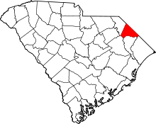 | |
| Towns | ||
| Unincorporated communities | ||