Sumner County, Tennessee
| Sumner County, Tennessee | ||
|---|---|---|
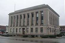 Sumner County Courthouse in Gallatin | ||
| ||
|
Location in the U.S. state of Tennessee | ||
 Tennessee's location in the U.S. | ||
| Founded | November 1786 | |
| Named for | Jethro Sumner[1] | |
| Seat | Gallatin | |
| Largest city | Hendersonville | |
| Area | ||
| • Total | 543 sq mi (1,406 km2) | |
| • Land | 529 sq mi (1,370 km2) | |
| • Water | 14 sq mi (36 km2), 2.5% | |
| Population (est.) | ||
| • (2018) | 183,545 | |
| • Density | 340/sq mi (130/km2) | |
| Congressional district | 6th | |
| Website |
www | |

Sumner County is a county located on the central northern border of the U.S. state of Tennessee. As of the 2010 census, the population was 160,645.[2] Its county seat is Gallatin,[3] and its largest city is Hendersonville. The county is named for American Revolutionary War hero General Jethro Sumner.
Sumner County is part of the Nashville-Davidson–Murfreesboro–Franklin, TN Metropolitan Statistical Area.
History
Prior to European colonization, the county had been inhabited by various cultures of Native Americans for several thousand years. Nomadic Paleo and Archaic hunter-gatherer campsites, as well as substantial Woodland and Mississippian-period occupation sites and burial grounds can be found scattered throughout the county.
The majority of these sites exist along natural waterways, with the highest concentration occurring along what is now known as the Cumberland River. Mississippian period earthwork mounds can still be seen in Hendersonville, and most notably, at Castalian Springs. British colonial longhunters traveled into the area as early as the 1760s, following existing Indian and buffalo trails.
By the early 1780s, several trading posts had been erected in the region. The most prominent was Mansker's Station, which was built by Kasper Mansker near a salt lick (modern Goodlettsville developed here); another was Bledsoe's Station, built by Isaac Bledsoe at Castilian Springs.[1] Sumner County was organized in 1786 after the American Revolutionary War, when Tennessee was still a part of the former colony of North Carolina.
Geography
According to the U.S. Census Bureau, the county has a total area of 543 square miles (1,410 km2), of which 529 square miles (1,370 km2) is land and 14 square miles (36 km2) (2.5%) is water.[4]
Sumner County is located in Middle Tennessee on the state's northern border with Kentucky. The Cumberland River was important in early trade and transportation for this area, as it flows into the Ohio River to the west. That leads to the Mississippi River, and downriver to the major port of New Orleans. Sumner County is in the Greater Nashville metropolitan area.
Adjacent counties
- Davidson County (southwest)
- Macon County (east)
- Robertson County (west)
- Trousdale County (southeast)
- Wilson County (south)
- Allen County, Kentucky (northeast)
- Simpson County, Kentucky (northwest)
State protected areas
- Bledsoe Creek State Park
- Cragfont State Historic Site
- Gallatin Steam Plant Wildlife Management Area
- Old Hickory Lock and Dam Wildlife Management Area (part)
- Rock Castle State Historic Site
- Taylor Hollow State Natural Area
- Wynnewood State Historic Site
Demographics
| Historical population | |||
|---|---|---|---|
| Census | Pop. | %± | |
| 1800 | 4,616 | — | |
| 1810 | 13,792 | 198.8% | |
| 1820 | 19,211 | 39.3% | |
| 1830 | 20,569 | 7.1% | |
| 1840 | 22,415 | 9.0% | |
| 1850 | 22,717 | 1.3% | |
| 1860 | 22,030 | −3.0% | |
| 1870 | 23,711 | 7.6% | |
| 1880 | 23,625 | −0.4% | |
| 1890 | 23,668 | 0.2% | |
| 1900 | 26,072 | 10.2% | |
| 1910 | 25,621 | −1.7% | |
| 1920 | 27,708 | 8.1% | |
| 1930 | 28,622 | 3.3% | |
| 1940 | 32,719 | 14.3% | |
| 1950 | 33,533 | 2.5% | |
| 1960 | 36,217 | 8.0% | |
| 1970 | 56,106 | 54.9% | |
| 1980 | 85,790 | 52.9% | |
| 1990 | 103,281 | 20.4% | |
| 2000 | 130,449 | 26.3% | |
| 2010 | 160,645 | 23.1% | |
| Est. 2016 | 180,063 | [5] | 12.1% |
| U.S. Decennial Census[6] 1790-1960[7] 1900-1990[8] 1990-2000[9] 2010-2014[2] | |||
As of the census[11] of 2000, there were 130,449 people, 48,941 households, and 37,048 families residing in the county. The population density was 246 people per square mile (95/km²). There were 51,657 housing units at an average density of 98 per square mile (38/km²). The racial makeup of the county was 91.49% White, 5.78% Black or African American, 0.29% Native American, 0.66% Asian, 0.03% Pacific Islander, 0.80% from other races, and 0.96% from two or more races. 1.76% of the population were Hispanic or Latino of any race.
In 2000 there were 48,941 households out of which 36.30% had children under the age of 18 living with them, 61.10% were married couples living together, 10.80% had a female householder with no husband present, and 24.30% were non-families. 20.30% of all households were made up of individuals and 7.20% had someone living alone who was 65 years of age or older. The average household size was 2.64 and the average family size was 3.04.
In the county, the population was spread out with 26.30% under the age of 18, 8.00% from 18 to 24, 30.70% from 25 to 44, 24.30% from 45 to 64, and 10.70% who were 65 years of age or older. The median age was 36 years. For every 100 females, there were 95.90 males. For every 100 females age 18 and over, there were 92.30 males.
The median income for a household in the county was $46,030, and the median income for a family was $52,125. Males had a median income of $36,875 versus $25,720 for females. The per capita income for the county was $21,164. About 6.20% of families and 8.10% of the population were below the poverty line, including 10.50% of those under age 18 and 10.00% of those age 65 or over.
Education
Board of Education
Schools in the county are governed by the Sumner County Board of Education. The twelve-member group consists of eleven elected representatives from each of the eleven educational districts in the county, as well as the Director of Schools. The members serve staggered four-year terms; the Director serves under contract with the Board of Education. The board conducts monthly meetings that are open to the public.
Schools
Elementary schools (K–5)
Middle schools (6–8)
|
High schools (9–12)
Magnet schools
Alternative schools
Private schools
Colleges
|
Communities
Cities
- Gallatin (county seat)
- Goodlettsville (partly in Davidson County)
- Hendersonville
- Millersville (partly in Robertson County)
- Mitchellville
- Portland (partly in Robertson County)
- White House (small part in Robertson County)
Town
Census-designated places
Unincorporated communities
Notable people
Submarine innovator Horace Lawson Hunley was born in Sumner County on June 20, 1823. On October 15, 1863, Hunley, along with seven other crewmen, drowned while making a test dive in Charleston Harbor near Fort Pinckney. Following his death, the submarine, unofficially known as the "Fish Boat," was renamed the H.L. Hunley in his honor. On the night of February 17, 1864, the Hunley sank the USS Housatonic, making it the first submarine to sink an enemy vessel.
Watergate prosecutor and criminal defense trial lawyer James F. Neal was born and raised in Oak Grove and graduated from Sumner High School in Portland.
R&B National Recording Artist Nacole Rice was born in Sumner County.[12]
Politics
| Year | Republican | Democratic | Third Parties |
|---|---|---|---|
| 2016 | 70.1% 50,129 | 25.4% 18,161 | 4.5% 3,215 |
| 2012 | 70.3% 46,003 | 28.4% 18,579 | 1.3% 875 |
| 2008 | 66.7% 44,949 | 31.9% 21,487 | 1.4% 926 |
| 2004 | 64.8% 40,181 | 34.6% 21,458 | 0.5% 329 |
| 2000 | 54.7% 27,601 | 43.8% 22,118 | 1.5% 758 |
| 1996 | 48.4% 20,863 | 44.5% 19,205 | 7.2% 3,086 |
| 1992 | 41.3% 17,401 | 46.0% 19,387 | 12.7% 5,344 |
| 1988 | 62.2% 19,523 | 37.3% 11,702 | 0.5% 164 |
| 1984 | 61.1% 18,442 | 38.2% 11,535 | 0.7% 209 |
| 1980 | 44.4% 11,876 | 52.9% 14,150 | 2.7% 709 |
| 1976 | 36.1% 7,946 | 62.9% 13,848 | 1.0% 213 |
| 1972 | 66.1% 10,020 | 30.3% 4,596 | 3.6% 541 |
| 1968 | 27.4% 4,519 | 26.5% 4,376 | 46.1% 7,592 |
| 1964 | 27.4% 3,437 | 72.6% 9,102 | |
| 1960 | 34.0% 3,491 | 65.2% 6,687 | 0.8% 83 |
| 1956 | 22.3% 2,123 | 77.3% 7,368 | 0.4% 36 |
| 1952 | 28.1% 2,233 | 71.4% 5,674 | 0.5% 40 |
| 1948 | 15.8% 793 | 73.7% 3,688 | 10.5% 525 |
| 1944 | 19.5% 990 | 80.3% 4,076 | 0.2% 10 |
| 1940 | 18.8% 834 | 80.8% 3,591 | 0.5% 22 |
| 1936 | 14.1% 517 | 85.8% 3,146 | 0.1% 3 |
| 1932 | 8.9% 382 | 90.5% 3,893 | 0.7% 28 |
| 1928 | 29.1% 1,045 | 70.8% 2,541 | 0.1% 2 |
| 1924 | 13.9% 435 | 84.3% 2,631 | 1.8% 57 |
| 1920 | 25.6% 1,268 | 74.0% 3,674 | 0.4% 21 |
| 1916 | 19.3% 612 | 78.3% 2,487 | 2.4% 76 |
| 1912 | 22.6% 769 | 72.9% 2,477 | 4.4% 150 |
See also
References
- 1 2 Dee Gee Lester, "Sumner County," Tennessee Encyclopedia of History and Culture. Retrieved: 7 April 2013.
- 1 2 "State & County QuickFacts". United States Census Bureau. Retrieved December 7, 2013.
- ↑ "Find a County". National Association of Counties. Retrieved 2011-06-07.
- ↑ "2010 Census Gazetteer Files". United States Census Bureau. August 22, 2012. Retrieved April 14, 2015.
- ↑ "Population and Housing Unit Estimates". Retrieved June 9, 2017.
- ↑ "U.S. Decennial Census". United States Census Bureau. Retrieved April 14, 2015.
- ↑ "Historical Census Browser". University of Virginia Library. Retrieved April 14, 2015.
- ↑ Forstall, Richard L., ed. (March 27, 1995). "Population of Counties by Decennial Census: 1900 to 1990". United States Census Bureau. Retrieved April 14, 2015.
- ↑ "Census 2000 PHC-T-4. Ranking Tables for Counties: 1990 and 2000" (PDF). United States Census Bureau. April 2, 2001. Retrieved April 14, 2015.
- ↑ Based on 2000 census data
- ↑ "American FactFinder". United States Census Bureau. Retrieved 2011-05-14.
- ↑ Biography, Nacole Rice official site; retrieved April 7, 2013.
- ↑ Leip, David. "Dave Leip's Atlas of U.S. Presidential Elections". uselectionatlas.org. Retrieved 2018-03-12.
Further reading
- Cisco, Jay Guy (1909). Historic Sumner County, Tennessee, with Genealogies of the Bledsoe, Cage and Douglass Families and Genealogical Notes of Other Sumner Families. Nashville, Tennessee: Folk-Keelin Printing Company. OCLC 5692694972.
External links
| Wikimedia Commons has media related to Sumner County, Tennessee. |
- Official site
- Sumner County Schools
- TNGenWeb
- Tennessee Central Economic Alliance for Sumner County
- Sumner County at Curlie (based on DMOZ)
Places adjacent to Sumner County, Tennessee | ||||||||||
|---|---|---|---|---|---|---|---|---|---|---|
| ||||||||||
Municipalities and communities of Sumner County, Tennessee, United States | ||
|---|---|---|
| Cities | ||
| Town | ||
| CDPs | ||
| Unincorporated communities | ||
| Footnotes | ‡This populated place also has portions in an adjacent county or counties | |
| Principal City | ||
|---|---|---|
| Other Major Cities | ||
| Counties | ||
