Maharajganj, Siwan
| Maharajganj महाराजगंज | |
|---|---|
| Town (Nagar Panchayat) | |
 Maharajganj Location in Bihar, India | |
| Coordinates: 26°06′27″N 84°30′09″E / 26.1075°N 84.5025°ECoordinates: 26°06′27″N 84°30′09″E / 26.1075°N 84.5025°E | |
| Country |
|
| State | Bihar |
| District | Siwan |
| Subdivision | Maharajganj |
| Block | Maharajganj |
| Government | |
| • Type | City council |
| • Body | Maharajganj city council |
| Area | |
| • Total | 7.60 km2 (2.93 sq mi) |
| Elevation | 66 m (217 ft) |
| Population (2001) | |
| • Total | 24,282 |
| • Density | 3,200/km2 (8,300/sq mi) |
| Languages | |
| • Official | Bhojpuri, Hindi And ENGLISH |
| Time zone | UTC+5:30 (IST) |
| PIN | 841238 |
| Lok Sabha constituency | Maharajganj |
| Vidhan Sabha constituency | Maharajganj |
Maharajganj City Council (Hindi: महाराजगंज नगर पंचायत; transliteration: Maharajganj Nagar Panchayat) is a Nagar Panchayat (City council) located in Siwan district of Bihar in India.
The total area of the Council is 7.60 square kilometres (2.93 sq mi) and total population as of 2011 census of India is 23,565 individuals.[1] The city is divided into total 14 wards. It is the block headquarter of Maharajganj block.[2]
Geography
Maharajganj is located at 26°06′27″N 84°30′09″E / 26.1075°N 84.5025°E.[3] It has an average elevation of 66 metres (216 feet).
Demographics
As of 2001 India census,[4] Maharajganj had a population of 20,878. Males constitute 50% of the population and females 50%. Maharajganj has an average literacy rate of 50%, lower than the national average of 59.5%: male literacy is 61%, and female literacy is 40%. In Maharajganj, 19% of the population is under 6 years of age.Bhojpuri is the Local Language here. It is dominated by [RAJPUT'S].[5]
How to reach Maharajganj
By Rail-Maharajganj Railway Station is well connected to nearby Siwan Junction which is connected directly to all the major cities of India, passenger trains from Duraundha junction serves as good transportation for the local people to connect with nearby cities like Siwan and Chapra. New Railway route from Maharajganj to Mashrakh is under construction. By Road-Maharajganj is well connected by roads to the nearby cities like Siwan and Chapra, many private and state transport Buses facilitates people mobility for the day to day work.
History
Maharajganj is a Sub-divisional area in Siwan district (Bihar). At the time of british it was well connected with MG railway line. Those days people used to come here for business purpose as it was one of the big (MANDI) market for near by areas. Maharajganj is located at 20 km from Siwan (District Town). Gud (made from sugarcane), Galla market (Anaj Mandi) and cloth market are very old here. But now these days this town is also moving towards and the same time the old identifications of this town are disappearing day by day. Famous cultural event of this town is "Maunia Baba Mela" which is very popular among the local population. Now it is well connected from Roadways and Railways too from Chhapra, Siwan, & Duraundha.
Banks in Maharajganj
Many famous banks situated in town area. Punjab National Bank,Near Indian Post Office. Canara Bank, State Bank of India, IDBI Bank, Bank of India, Central Bank, Bank Of Baroda, HDFC bank.
Bank of Baroda, Bank of India, By Mohammad Khaliquzzama, Mohan Bazar, Siwan
References
- ↑ "DISTRICT CENSUS HANDBOOK - Census of India" (PDF). www.censusindia.gov.in. Retrieved 27 June 2018.
- ↑ "Maharajganj Nagar Panchayat". www.indikosh.com. Retrieved 29 June 2018.
- ↑ Falling Rain Genomics, Inc - Maharajganj
- ↑ "Census of India 2001: Data from the 2001 Census, including cities, villages and towns (Provisional)". Census Commission of India. Archived from the original on 2004-06-16. Retrieved 2008-11-01.
- ↑ http://www.ndtv.com/article/cheat-sheet/blog-10-reasons-why-nitish-kumar-lost-an-important-election-to-lalu-yadav-375818
- ↑ "Maharajganj Pincode". citypincode.in. Retrieved 2014-05-19.
Headquarter: Siwan | ||
| Siwan Subdivision | 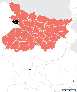 | |
| Maharajganj Subdivision | ||
| Municipalities | ||