Climbing Hill, Iowa
| Climbing Hill, Iowa | |
|---|---|
| Unincorporated community | |
| Nickname(s): Home of the Hancock’s | |
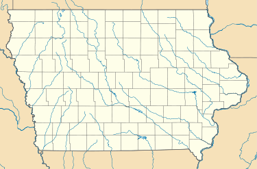
 Climbing Hill, Iowa Location within the state of Iowa | |
| Coordinates: 42°20′30″N 96°4′40″W / 42.34167°N 96.07778°WCoordinates: 42°20′30″N 96°4′40″W / 42.34167°N 96.07778°W | |
| Country | United States |
| State | Iowa |
| County | Woodbury |
| Elevation | 1,135 ft (346 m) |
| Population (2010) | |
| • Total | 97 |
| Time zone | UTC-6 (Central (CST)) |
| • Summer (DST) | UTC-5 (CDT) |
| ZIP codes | 51015 |
| GNIS feature ID | 455477 |
Climbing Hill is an unincorporated community in West Fork Township, and Woodbury County, Iowa, United States. Climbing Hill is located about 5 miles North of the City of Hornick, Iowa. Its elevation is 1,135 feet (346 m). The community was named by C. E. Ostrander, the first settler and postmaster, whose home was on high ground and could not be reached except by climbing a hill.[1] The name was kept, though the community was moved several times and was finally located on level land around 1867.[2] Although it is unincorporated, it had a post office for more than 130 years, with the ZIP code of 51015.[3]
The community is part of the Sioux City, IA–NE–SD Metropolitan Statistical Area.
References
- ↑ "A tribute to those little places from the past that are no more: like Odd, Dodds, Wolfdale, Lozier". Moville Record. Oct 16, 2003. p. 1. Retrieved 3 November 2015.
- ↑ U.S. Geological Survey Geographic Names Information System: Climbing Hill, Iowa, Geographic Names Information System, 1979-04-30. Accessed 2008-04-08.
- ↑ Zip Code Lookup Archived 2011-05-17 at the Wayback Machine.
This article is issued from
Wikipedia.
The text is licensed under Creative Commons - Attribution - Sharealike.
Additional terms may apply for the media files.