Sers, Hautes-Pyrénées
| Sers | ||
|---|---|---|
| Commune | ||
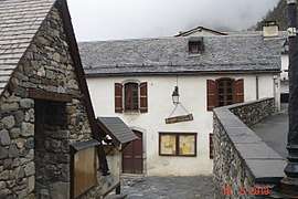 The town hall | ||
| ||
 Sers Location within Occitanie region  Sers | ||
| Coordinates: 42°53′17″N 0°02′21″E / 42.8881°N 0.0392°ECoordinates: 42°53′17″N 0°02′21″E / 42.8881°N 0.0392°E | ||
| Country | France | |
| Region | Occitanie | |
| Department | Hautes-Pyrénées | |
| Arrondissement | Argelès-Gazost | |
| Canton | La Vallée des Gaves | |
| Area1 | 29.91 km2 (11.55 sq mi) | |
| Population (1999)2 | 102 | |
| • Density | 3.4/km2 (8.8/sq mi) | |
| Time zone | UTC+1 (CET) | |
| • Summer (DST) | UTC+2 (CEST) | |
| INSEE/Postal code | 65424 /65120 | |
| Elevation |
928–2,872 m (3,045–9,423 ft) (avg. 1,100 m or 3,600 ft) | |
|
1 French Land Register data, which excludes lakes, ponds, glaciers > 1 km2 (0.386 sq mi or 247 acres) and river estuaries. 2 Population without double counting: residents of multiple communes (e.g., students and military personnel) only counted once. | ||
.svg.png)
Sers is a commune in the Hautes-Pyrénées department in south-western France.
See also
Gallery
 église Saint-Vincent
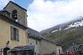
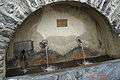 Fontaine 1616
 Croix
Croix Croix Saint-Justin
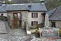 Monument aux morts
 L'animal laboureur
 Le renard de Rozette
References
| Wikimedia Commons has media related to Sers, Hautes-Pyrénées. |
This article is issued from
Wikipedia.
The text is licensed under Creative Commons - Attribution - Sharealike.
Additional terms may apply for the media files.