Génos, Hautes-Pyrénées
| Génos | ||
|---|---|---|
| Commune | ||
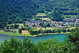 Génos, on the Génos-Loudenvielle lake. | ||
| ||
 Génos Location within Occitanie region  Génos | ||
| Coordinates: 42°48′38″N 0°24′10″E / 42.8106°N 0.4028°ECoordinates: 42°48′38″N 0°24′10″E / 42.8106°N 0.4028°E | ||
| Country | France | |
| Region | Occitanie | |
| Department | Hautes-Pyrénées | |
| Arrondissement | Bagnères-de-Bigorre | |
| Canton | Neste, Aure et Louron | |
| Intercommunality | EPIVAL | |
| Government | ||
| • Mayor (2001–2008) | Olivier CARTAN | |
| Area1 | 23.63 km2 (9.12 sq mi) | |
| Population (1999)2 | 127 | |
| • Density | 5.4/km2 (14/sq mi) | |
| Time zone | UTC+1 (CET) | |
| • Summer (DST) | UTC+2 (CEST) | |
| INSEE/Postal code | 65195 /65510 | |
| Elevation |
939–3,022 m (3,081–9,915 ft) (avg. 950 m or 3,120 ft) | |
|
1 French Land Register data, which excludes lakes, ponds, glaciers > 1 km2 (0.386 sq mi or 247 acres) and river estuaries. 2 Population without double counting: residents of multiple communes (e.g., students and military personnel) only counted once. | ||
.svg.png)
Génos is a commune in the Hautes-Pyrénées department in south-western France.
See also
References
| Wikimedia Commons has media related to Génos, Hautes-Pyrénées. |
This article is issued from
Wikipedia.
The text is licensed under Creative Commons - Attribution - Sharealike.
Additional terms may apply for the media files.