Galan, Hautes-Pyrénées
| Galan | ||
|---|---|---|
| Commune | ||
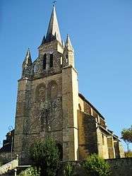 The church of Saint-Julien | ||
| ||
 Galan Location within Occitanie region  Galan | ||
| Coordinates: 43°13′20″N 0°24′30″E / 43.2222°N 0.4083°ECoordinates: 43°13′20″N 0°24′30″E / 43.2222°N 0.4083°E | ||
| Country | France | |
| Region | Occitanie | |
| Department | Hautes-Pyrénées | |
| Arrondissement | Bagnères-de-Bigorre | |
| Canton | La Vallée de l'Arros et des Baïses | |
| Intercommunality | Communauté de communes des Baïses | |
| Government | ||
| • Mayor (2008–2014) | Alain Ducasse | |
| Area1 | 14.05 km2 (5.42 sq mi) | |
| Population (2006)2 | 769 | |
| • Density | 55/km2 (140/sq mi) | |
| Time zone | UTC+1 (CET) | |
| • Summer (DST) | UTC+2 (CEST) | |
| INSEE/Postal code | 65183 /65330 | |
| Elevation |
310–501 m (1,017–1,644 ft) (avg. 381 m or 1,250 ft) | |
|
1 French Land Register data, which excludes lakes, ponds, glaciers > 1 km2 (0.386 sq mi or 247 acres) and river estuaries. 2 Population without double counting: residents of multiple communes (e.g., students and military personnel) only counted once. | ||
.svg.png)
Galan is a commune in the Hautes-Pyrénées department in south-western France.
Geography
The Petite Baïse flows northward through the middle of the commune.
See also
References
| Wikimedia Commons has media related to Galan, Hautes-Pyrénées. |
This article is issued from
Wikipedia.
The text is licensed under Creative Commons - Attribution - Sharealike.
Additional terms may apply for the media files.