Sarrancolin
| Sarrancolin | |||
|---|---|---|---|
| Commune | |||
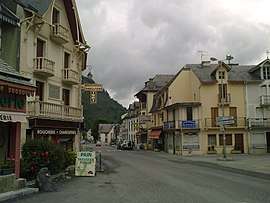 The village of Sarrancolin | |||
| |||
 Sarrancolin Location within Occitanie region  Sarrancolin | |||
| Coordinates: 42°58′03″N 0°22′41″E / 42.9675°N 0.3781°ECoordinates: 42°58′03″N 0°22′41″E / 42.9675°N 0.3781°E | |||
| Country | France | ||
| Region | Occitanie | ||
| Department | Hautes-Pyrénées | ||
| Arrondissement | Bagnères-de-Bigorre | ||
| Canton | Neste, Aure et Louron | ||
| Intercommunality | Communauté de communes d'Aure | ||
| Government | |||
| • Mayor (2008–2014) | Robert Marquié | ||
| Area1 | 32.1 km2 (12.4 sq mi) | ||
| Population (2006)2 | 677 | ||
| • Density | 21/km2 (55/sq mi) | ||
| Time zone | UTC+1 (CET) | ||
| • Summer (DST) | UTC+2 (CEST) | ||
| INSEE/Postal code | 65408 /65410 | ||
| Elevation |
600–1,890 m (1,970–6,200 ft) (avg. 630 m or 2,070 ft) | ||
|
1 French Land Register data, which excludes lakes, ponds, glaciers > 1 km2 (0.386 sq mi or 247 acres) and river estuaries. 2 Population without double counting: residents of multiple communes (e.g., students and military personnel) only counted once. | |||

.svg.png)
Sarrancolin is a commune in the Hautes-Pyrénées department in south-western France.
See also
References
| Wikimedia Commons has media related to Sarrancolin. |
This article is issued from
Wikipedia.
The text is licensed under Creative Commons - Attribution - Sharealike.
Additional terms may apply for the media files.