Lézignan, Hautes-Pyrénées
| Lézignan | ||
|---|---|---|
| Commune | ||
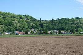 A general view of Lézignan | ||
| ||
 Lézignan Location within Occitanie region  Lézignan | ||
| Coordinates: 43°05′59″N 0°00′11″W / 43.0997°N 0.0031°WCoordinates: 43°05′59″N 0°00′11″W / 43.0997°N 0.0031°W | ||
| Country | France | |
| Region | Occitanie | |
| Department | Hautes-Pyrénées | |
| Arrondissement | Argelès-Gazost | |
| Canton | Lourdes-2 | |
| Intercommunality | Communauté de communes de la Baronnie des Angles | |
| Government | ||
| • Mayor (2008–2014) | Jean-Claude Cousin | |
| Area1 | 2.56 km2 (0.99 sq mi) | |
| Population (1999)2 | 390 | |
| • Density | 150/km2 (390/sq mi) | |
| Time zone | UTC+1 (CET) | |
| • Summer (DST) | UTC+2 (CEST) | |
| INSEE/Postal code | 65271 /65100 | |
| Elevation |
398–602 m (1,306–1,975 ft) (avg. 420 m or 1,380 ft) | |
|
1 French Land Register data, which excludes lakes, ponds, glaciers > 1 km2 (0.386 sq mi or 247 acres) and river estuaries. 2 Population without double counting: residents of multiple communes (e.g., students and military personnel) only counted once. | ||

Lézignan is a commune in the Hautes-Pyrénées department in south-western France.
See also
References
| Wikimedia Commons has media related to Lézignan (Hautes-Pyrénées). |
This article is issued from
Wikipedia.
The text is licensed under Creative Commons - Attribution - Sharealike.
Additional terms may apply for the media files.