Ibos, Hautes-Pyrénées
| Ibos | ||
|---|---|---|
| Commune | ||
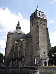 The Saint-Laurent Collegiate Church | ||
| ||
 Ibos Location within Occitanie region  Ibos | ||
| Coordinates: 43°14′03″N 0°00′09″E / 43.2342°N 0.0025°ECoordinates: 43°14′03″N 0°00′09″E / 43.2342°N 0.0025°E | ||
| Country | France | |
| Region | Occitanie | |
| Department | Hautes-Pyrénées | |
| Arrondissement | Tarbes | |
| Canton | Bordères-sur-l'Échez | |
| Intercommunality | Communauté d'agglomération du Grand Tarbes | |
| Government | ||
| • Mayor (2008–2014) | Daniel Frossard | |
| Area1 | 32.88 km2 (12.70 sq mi) | |
| Population (2008)2 | 3,113 | |
| • Density | 95/km2 (250/sq mi) | |
| Time zone | UTC+1 (CET) | |
| • Summer (DST) | UTC+2 (CEST) | |
| INSEE/Postal code | 65226 /65420 | |
| Elevation |
293–432 m (961–1,417 ft) (avg. 321 m or 1,053 ft) | |
|
1 French Land Register data, which excludes lakes, ponds, glaciers > 1 km2 (0.386 sq mi or 247 acres) and river estuaries. 2 Population without double counting: residents of multiple communes (e.g., students and military personnel) only counted once. | ||
.svg.png)
Ibos is a commune in the Hautes-Pyrénées department in south-western France.
See also
References
| Wikimedia Commons has media related to Ibos. |
This article is issued from
Wikipedia.
The text is licensed under Creative Commons - Attribution - Sharealike.
Additional terms may apply for the media files.