Cieutat
| Cieutat | ||
|---|---|---|
| Commune | ||
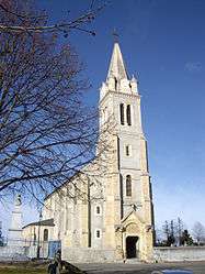 The church of Saint-Barthélémy | ||
| ||
 Cieutat Location within Occitanie region  Cieutat | ||
| Coordinates: 43°07′23″N 0°12′56″E / 43.1231°N 0.2156°ECoordinates: 43°07′23″N 0°12′56″E / 43.1231°N 0.2156°E | ||
| Country | France | |
| Region | Occitanie | |
| Department | Hautes-Pyrénées | |
| Arrondissement | Bagnères-de-Bigorre | |
| Canton | La Vallée de l'Arros et des Baïses | |
| Intercommunality | Communauté de communes Haute-Bigorre | |
| Government | ||
| • Mayor (2008–2014) | Marie-José Darre-Cabarrou | |
| Area1 | 18.78 km2 (7.25 sq mi) | |
| Population (1999)2 | 518 | |
| • Density | 28/km2 (71/sq mi) | |
| Time zone | UTC+1 (CET) | |
| • Summer (DST) | UTC+2 (CEST) | |
| INSEE/Postal code | 65147 /65200 | |
| Elevation |
327–589 m (1,073–1,932 ft) (avg. 584 m or 1,916 ft) | |
|
1 French Land Register data, which excludes lakes, ponds, glaciers > 1 km2 (0.386 sq mi or 247 acres) and river estuaries. 2 Population without double counting: residents of multiple communes (e.g., students and military personnel) only counted once. | ||
.svg.png)
Cieutat is a commune in the Hautes-Pyrénées department in south-western France.
Its name comes from the Latin word civitas because in the Early Middle Ages it was the capital of the former French province of Bigorre.
See also
References
| Wikimedia Commons has media related to Cieutat. |
This article is issued from
Wikipedia.
The text is licensed under Creative Commons - Attribution - Sharealike.
Additional terms may apply for the media files.