Bordères-Louron
| Bordères-Louron | ||
|---|---|---|
| Commune | ||
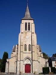 Church our Lady of the Assumption | ||
| ||
 Bordères-Louron Location within Occitanie region  Bordères-Louron | ||
| Coordinates: 42°52′21″N 0°23′46″E / 42.8725°N 0.3961°ECoordinates: 42°52′21″N 0°23′46″E / 42.8725°N 0.3961°E | ||
| Country | France | |
| Region | Occitanie | |
| Department | Hautes-Pyrénées | |
| Arrondissement | Bagnères-de-Bigorre | |
| Canton | Neste, Aure et Louron | |
| Government | ||
| • Mayor (2008–2014) | Alain Marsalle | |
| Area1 | 17.41 km2 (6.72 sq mi) | |
| Population (2006)2 | 157 | |
| • Density | 9.0/km2 (23/sq mi) | |
| Time zone | UTC+1 (CET) | |
| • Summer (DST) | UTC+2 (CEST) | |
| INSEE/Postal code | 65099 /65590 | |
| Elevation |
810–2,173 m (2,657–7,129 ft) (avg. 847 m or 2,779 ft) | |
|
1 French Land Register data, which excludes lakes, ponds, glaciers > 1 km2 (0.386 sq mi or 247 acres) and river estuaries. 2 Population without double counting: residents of multiple communes (e.g., students and military personnel) only counted once. | ||
.svg.png)
Bordères-Louron is a commune in the Hautes-Pyrénées department in southwestern France.
Population
| Historical population | ||
|---|---|---|
| Year | Pop. | ±% |
| 1975 | 132 | — |
| 1982 | 132 | +0.0% |
| 1990 | 115 | −12.9% |
| 1999 | 148 | +28.7% |
| 2006 | 151 | +2.0% |
| 2009 | 157 | +4.0% |
See also
References
| Wikimedia Commons has media related to Bordères-Louron. |
This article is issued from
Wikipedia.
The text is licensed under Creative Commons - Attribution - Sharealike.
Additional terms may apply for the media files.