Aspin-en-Lavedan
| Aspin-en-Lavedan | ||
|---|---|---|
| Commune | ||
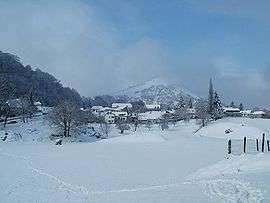 Aspin-en-Lavedan in winter | ||
| ||
 Aspin-en-Lavedan Location within Occitanie region  Aspin-en-Lavedan | ||
| Coordinates: 43°04′34″N 0°02′45″W / 43.0761°N 0.0458°WCoordinates: 43°04′34″N 0°02′45″W / 43.0761°N 0.0458°W | ||
| Country | France | |
| Region | Occitanie | |
| Department | Hautes-Pyrénées | |
| Arrondissement | Argelès-Gazost | |
| Canton | Lourdes-1 | |
| Intercommunality | CA Tarbes-Lourdes-Pyrénées | |
| Government | ||
| • Mayor (2014-2020) | André Laborde | |
| Area1 | 1.77 km2 (0.68 sq mi) | |
| Population (2015)2 | 294 | |
| • Density | 170/km2 (430/sq mi) | |
| Time zone | UTC+1 (CET) | |
| • Summer (DST) | UTC+2 (CEST) | |
| INSEE/Postal code | 65040 /65100 | |
| Elevation |
370–622 m (1,214–2,041 ft) (avg. 500 m or 1,600 ft) | |
|
1 French Land Register data, which excludes lakes, ponds, glaciers > 1 km2 (0.386 sq mi or 247 acres) and river estuaries. 2 Population without double counting: residents of multiple communes (e.g., students and military personnel) only counted once. | ||
.svg.png)
Aspin-en-Lavedan is a commune in the Hautes-Pyrénées department in southwestern France.
Population
| Historical population | ||
|---|---|---|
| Year | Pop. | ±% |
| 1962 | 161 | — |
| 1968 | 173 | +7.5% |
| 1975 | 227 | +31.2% |
| 1982 | 257 | +13.2% |
| 1990 | 256 | −0.4% |
| 1999 | 223 | −12.9% |
| 2006 | 236 | +5.8% |
| 2009 | 238 | +0.8% |
| 2015 | 294 | +23.5% |
See also
References
| Wikimedia Commons has media related to Aspin-en-Lavedan. |
This article is issued from
Wikipedia.
The text is licensed under Creative Commons - Attribution - Sharealike.
Additional terms may apply for the media files.