Artigues, Hautes-Pyrénées
| Artigues | ||
|---|---|---|
| Commune | ||
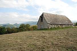 A barn adjacent to the Artigues airstrip | ||
| ||
 Artigues Location within Occitanie region  Artigues | ||
| Coordinates: 43°04′32″N 0°00′11″E / 43.0756°N 0.0031°ECoordinates: 43°04′32″N 0°00′11″E / 43.0756°N 0.0031°E | ||
| Country | France | |
| Region | Occitanie | |
| Department | Hautes-Pyrénées | |
| Arrondissement | Argelès-Gazost | |
| Canton | Lourdes-2 | |
| Intercommunality | CA Tarbes-Lourdes-Pyrénées | |
| Government | ||
| • Mayor (2014-2020) | Marie Plane | |
| Area1 | 1.46 km2 (0.56 sq mi) | |
| Population (2015)2 | 19 | |
| • Density | 13/km2 (34/sq mi) | |
| Time zone | UTC+1 (CET) | |
| • Summer (DST) | UTC+2 (CEST) | |
| INSEE/Postal code | 65038 /65100 | |
| Elevation |
485–860 m (1,591–2,822 ft) (avg. 600 m or 2,000 ft) | |
|
1 French Land Register data, which excludes lakes, ponds, glaciers > 1 km2 (0.386 sq mi or 247 acres) and river estuaries. 2 Population without double counting: residents of multiple communes (e.g., students and military personnel) only counted once. | ||
.svg.png)
Artigues is a commune in the Hautes-Pyrénées department in southwestern France.
It is a small village retaining traditional architecture of the region. The commune is at the end of a steep dead-end road from the outskirts of Luchon.
Population
| Historical population | ||
|---|---|---|
| Year | Pop. | ±% |
| 1962 | 23 | — |
| 1968 | 30 | +30.4% |
| 1975 | 30 | +0.0% |
| 1982 | 27 | −10.0% |
| 1990 | 24 | −11.1% |
| 1999 | 29 | +20.8% |
| 2007 | 23 | −20.7% |
| 2009 | 24 | +4.3% |
| 2015 | 19 | −20.8% |
See also
References
| Wikimedia Commons has media related to Artigues, Hautes-Pyrénées. |
This article is issued from
Wikipedia.
The text is licensed under Creative Commons - Attribution - Sharealike.
Additional terms may apply for the media files.