Estaing, Hautes-Pyrénées
| Estaing | ||
|---|---|---|
| Commune | ||
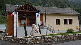 The town hall | ||
| ||
 Estaing Location within Occitanie region  Estaing | ||
| Coordinates: 42°56′17″N 0°10′41″W / 42.9381°N 0.1781°WCoordinates: 42°56′17″N 0°10′41″W / 42.9381°N 0.1781°W | ||
| Country | France | |
| Region | Occitanie | |
| Department | Hautes-Pyrénées | |
| Arrondissement | Argelès-Gazost | |
| Canton | La Vallée des Gaves | |
| Intercommunality | Communauté de communes du Val d'Azun | |
| Government | ||
| • Mayor (2008–2014) | Marie-Frédérique Boré | |
| Area1 | 71.53 km2 (27.62 sq mi) | |
| Population (1999)2 | 67 | |
| • Density | 0.94/km2 (2.4/sq mi) | |
| Time zone | UTC+1 (CET) | |
| • Summer (DST) | UTC+2 (CEST) | |
| INSEE/Postal code | 65169 /65400 | |
| Elevation |
906–2,960 m (2,972–9,711 ft) (avg. 1,000 m or 3,300 ft) | |
|
1 French Land Register data, which excludes lakes, ponds, glaciers > 1 km2 (0.386 sq mi or 247 acres) and river estuaries. 2 Population without double counting: residents of multiple communes (e.g., students and military personnel) only counted once. | ||
.svg.png)
Estaing is a commune in the Hautes-Pyrénées department in south-western France.
See also
References
| Wikimedia Commons has media related to Estaing (Hautes-Pyrénées). |
This article is issued from
Wikipedia.
The text is licensed under Creative Commons - Attribution - Sharealike.
Additional terms may apply for the media files.