Sabalos
| Sabalos | ||
|---|---|---|
| Commune | ||
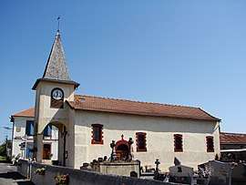 Church with the town hall in the background | ||
| ||
 Sabalos Location within Occitanie region  Sabalos | ||
| Coordinates: 43°17′11″N 0°08′25″E / 43.2864°N 0.1403°ECoordinates: 43°17′11″N 0°08′25″E / 43.2864°N 0.1403°E | ||
| Country | France | |
| Region | Occitanie | |
| Department | Hautes-Pyrénées | |
| Arrondissement | Tarbes | |
| Canton | Les Coteaux | |
| Intercommunality | Communauté de communes Riou de Loules | |
| Government | ||
| • Mayor (2001–2009) | Albert Da Silva | |
| Area1 | 2.2 km2 (0.8 sq mi) | |
| Population (1999)2 | 106 | |
| • Density | 48/km2 (120/sq mi) | |
| Time zone | UTC+1 (CET) | |
| • Summer (DST) | UTC+2 (CEST) | |
| INSEE/Postal code | 65380 /65350 | |
| Elevation |
286–365 m (938–1,198 ft) (avg. 390 m or 1,280 ft) | |
|
1 French Land Register data, which excludes lakes, ponds, glaciers > 1 km2 (0.386 sq mi or 247 acres) and river estuaries. 2 Population without double counting: residents of multiple communes (e.g., students and military personnel) only counted once. | ||
.svg.png)
Sabalos is a commune in the Hautes-Pyrénées department in south-western France.
See also
References
| Wikimedia Commons has media related to Sabalos. |
This article is issued from
Wikipedia.
The text is licensed under Creative Commons - Attribution - Sharealike.
Additional terms may apply for the media files.