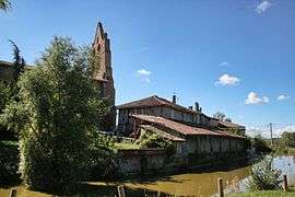
Sabonnères
| Sabonnères | |
|---|---|
| Commune | |
 | |
 Sabonnères Location within Occitanie region  Sabonnères | |
| Coordinates: 43°28′01″N 1°03′53″E / 43.4669°N 1.0647°ECoordinates: 43°28′01″N 1°03′53″E / 43.4669°N 1.0647°E | |
| Country | France |
| Region | Occitanie |
| Department | Haute-Garonne |
| Arrondissement | Muret |
| Canton | Plaisance-du-Touch |
| Intercommunality | Coteaux du Savès et de l'Aussonelle |
| Government | |
| • Mayor (2008–2014) | Michel Valette |
| Area1 | 12.3 km2 (4.7 sq mi) |
| Population (2008)2 | 285 |
| • Density | 23/km2 (60/sq mi) |
| Time zone | UTC+1 (CET) |
| • Summer (DST) | UTC+2 (CEST) |
| INSEE/Postal code | 31464 /31370 |
| Elevation |
196–331 m (643–1,086 ft) (avg. 320 m or 1,050 ft) |
|
1 French Land Register data, which excludes lakes, ponds, glaciers > 1 km2 (0.386 sq mi or 247 acres) and river estuaries. 2 Population without double counting: residents of multiple communes (e.g., students and military personnel) only counted once. | |
Sabonnères is a commune in the Haute-Garonne department in southwestern France.
Population
| Historical population | ||
|---|---|---|
| Year | Pop. | ±% |
| 1962 | 139 | — |
| 1968 | 181 | +30.2% |
| 1975 | 200 | +10.5% |
| 1982 | 192 | −4.0% |
| 1990 | 178 | −7.3% |
| 1999 | 218 | +22.5% |
| 2008 | 285 | +30.7% |
See also
References
| Wikimedia Commons has media related to Sabonnères. |
This article is issued from
Wikipedia.
The text is licensed under Creative Commons - Attribution - Sharealike.
Additional terms may apply for the media files.