Mascarville
| Mascarville | |
|---|---|
| Commune | |
 | |
 Mascarville Location within Occitanie region  Mascarville | |
| Coordinates: 43°33′18″N 1°45′33″E / 43.555°N 1.7592°ECoordinates: 43°33′18″N 1°45′33″E / 43.555°N 1.7592°E | |
| Country | France |
| Region | Occitanie |
| Department | Haute-Garonne |
| Arrondissement | Toulouse |
| Canton | Revel |
| Intercommunality | Cœur Lauragais |
| Government | |
| • Mayor (2008–2014) | Serge Cazeneuve |
| Area1 | 5.27 km2 (2.03 sq mi) |
| Population (2008)2 | 204 |
| • Density | 39/km2 (100/sq mi) |
| Time zone | UTC+1 (CET) |
| • Summer (DST) | UTC+2 (CEST) |
| INSEE/Postal code | 31325 /31460 |
| Elevation |
175–281 m (574–922 ft) (avg. 232 m or 761 ft) |
|
1 French Land Register data, which excludes lakes, ponds, glaciers > 1 km2 (0.386 sq mi or 247 acres) and river estuaries. 2 Population without double counting: residents of multiple communes (e.g., students and military personnel) only counted once. | |
Mascarville is a commune in the Haute-Garonne department in southwestern France.
Population
| Historical population | ||
|---|---|---|
| Year | Pop. | ±% |
| 1962 | 132 | — |
| 1968 | 117 | −11.4% |
| 1975 | 82 | −29.9% |
| 1982 | 74 | −9.8% |
| 1990 | 98 | +32.4% |
| 1999 | 139 | +41.8% |
| 2008 | 204 | +46.8% |
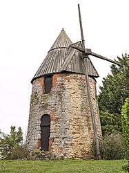
Monuments
 Town hall
 Church Saint-Étienne
 Bell gable
See also
References
| Wikimedia Commons has media related to Mascarville. |
This article is issued from
Wikipedia.
The text is licensed under Creative Commons - Attribution - Sharealike.
Additional terms may apply for the media files.