Lanta, Haute-Garonne
| Lanta | ||
|---|---|---|
| Commune | ||
 | ||
| ||
 Lanta Location within Occitanie region  Lanta | ||
| Coordinates: 43°33′37″N 1°39′20″E / 43.5603°N 1.6556°ECoordinates: 43°33′37″N 1°39′20″E / 43.5603°N 1.6556°E | ||
| Country | France | |
| Region | Occitanie | |
| Department | Haute-Garonne | |
| Arrondissement | Toulouse | |
| Canton | Revel | |
| Government | ||
| • Mayor (2008–2014) | Marc Mengaud | |
| Area1 | 30.12 km2 (11.63 sq mi) | |
| Population (2008)2 | 1,542 | |
| • Density | 51/km2 (130/sq mi) | |
| Time zone | UTC+1 (CET) | |
| • Summer (DST) | UTC+2 (CEST) | |
| INSEE/Postal code | 31271 /31570 | |
| Elevation |
159–275 m (522–902 ft) (avg. 230 m or 750 ft) | |
|
1 French Land Register data, which excludes lakes, ponds, glaciers > 1 km2 (0.386 sq mi or 247 acres) and river estuaries. 2 Population without double counting: residents of multiple communes (e.g., students and military personnel) only counted once. | ||
.svg.png)
Lanta is a commune in the Haute-Garonne department in southwestern France.
History
The attempt of the capitoul Pierre Hunault, sieur de Lanta, to seize control of Toulouse's Capitol was the immediate cause of the 1562 riots there.
Population
| Historical population | ||
|---|---|---|
| Year | Pop. | ±% |
| 1962 | 835 | — |
| 1968 | 874 | +4.7% |
| 1975 | 908 | +3.9% |
| 1982 | 1,026 | +13.0% |
| 1990 | 1,144 | +11.5% |
| 1999 | 1,175 | +2.7% |
| 2008 | 1,542 | +31.2% |
Monument
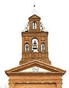 The bell gable
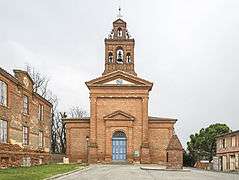 The Church of Our Lady of Lanta
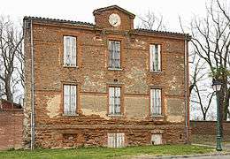 The facade of the old rectory.
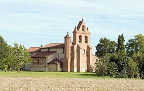 Lanta - Saint Anatoly
 Saint Anatoly de Lanta
 Dovecote.
See also
References
| Wikimedia Commons has media related to Lanta. |
This article is issued from
Wikipedia.
The text is licensed under Creative Commons - Attribution - Sharealike.
Additional terms may apply for the media files.