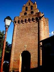
Montgeard
| Montgeard | ||
|---|---|---|
| Commune | ||
 | ||
| ||
 Montgeard Location within Occitanie region  Montgeard | ||
| Coordinates: 43°20′23″N 1°38′05″E / 43.3397°N 1.6347°ECoordinates: 43°20′23″N 1°38′05″E / 43.3397°N 1.6347°E | ||
| Country | France | |
| Region | Occitanie | |
| Department | Haute-Garonne | |
| Arrondissement | Toulouse | |
| Canton | Escalquens | |
| Intercommunality | Côteaux du Lauragais Sud | |
| Government | ||
| • Mayor (2008–2014) | Marie-Claire Garofalo | |
| Area1 | 9.32 km2 (3.60 sq mi) | |
| Population (2008)2 | 434 | |
| • Density | 47/km2 (120/sq mi) | |
| Time zone | UTC+1 (CET) | |
| • Summer (DST) | UTC+2 (CEST) | |
| INSEE/Postal code | 31380 /31560 | |
| Elevation |
195–290 m (640–951 ft) (avg. 278 m or 912 ft) | |
|
1 French Land Register data, which excludes lakes, ponds, glaciers > 1 km2 (0.386 sq mi or 247 acres) and river estuaries. 2 Population without double counting: residents of multiple communes (e.g., students and military personnel) only counted once. | ||
.svg.png)
Montgeard is a commune in the Haute-Garonne department of southwestern France.
Population
| Historical population | ||
|---|---|---|
| Year | Pop. | ±% |
| 1962 | 209 | — |
| 1968 | 228 | +9.1% |
| 1975 | 256 | +12.3% |
| 1982 | 223 | −12.9% |
| 1990 | 290 | +30.0% |
| 1999 | 323 | +11.4% |
| 2008 | 434 | +34.4% |
See also
References
| Wikimedia Commons has media related to Montgeard. |
This article is issued from
Wikipedia.
The text is licensed under Creative Commons - Attribution - Sharealike.
Additional terms may apply for the media files.