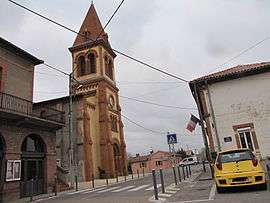
Labastide-Clermont
| Labastide-Clermont | |
|---|---|
| Commune | |
 | |
 Labastide-Clermont Location within Occitanie region  Labastide-Clermont | |
| Coordinates: 43°20′58″N 1°07′19″E / 43.3494°N 1.1219°ECoordinates: 43°20′58″N 1°07′19″E / 43.3494°N 1.1219°E | |
| Country | France |
| Region | Occitanie |
| Department | Haute-Garonne |
| Arrondissement | Muret |
| Canton | Cazères |
| Intercommunality | Savès |
| Government | |
| • Mayor (2008–2014) | Pierre-Alain Dintilhac |
| Area1 | 14.58 km2 (5.63 sq mi) |
| Population (2008)2 | 647 |
| • Density | 44/km2 (110/sq mi) |
| Time zone | UTC+1 (CET) |
| • Summer (DST) | UTC+2 (CEST) |
| INSEE/Postal code | 31250 /31370 |
| Elevation |
222–349 m (728–1,145 ft) (avg. 294 m or 965 ft) |
|
1 French Land Register data, which excludes lakes, ponds, glaciers > 1 km2 (0.386 sq mi or 247 acres) and river estuaries. 2 Population without double counting: residents of multiple communes (e.g., students and military personnel) only counted once. | |
Labastide-Clermont is a commune in the Haute-Garonne department in southwestern France.
Population
| Historical population | ||
|---|---|---|
| Year | Pop. | ±% |
| 1962 | 283 | — |
| 1968 | 291 | +2.8% |
| 1975 | 275 | −5.5% |
| 1982 | 325 | +18.2% |
| 1990 | 347 | +6.8% |
| 1999 | 416 | +19.9% |
| 2008 | 647 | +55.5% |
See also
References
| Wikimedia Commons has media related to Labastide-Clermont. |
I
This article is issued from
Wikipedia.
The text is licensed under Creative Commons - Attribution - Sharealike.
Additional terms may apply for the media files.