Saint-Julien-sur-Garonne
| Saint-Julien-sur-Garonne | |
|---|---|
| Commune | |
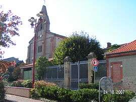 | |
 Saint-Julien-sur-Garonne Location within Occitanie region  Saint-Julien-sur-Garonne | |
| Coordinates: 43°14′37″N 1°09′11″E / 43.2436°N 1.1531°ECoordinates: 43°14′37″N 1°09′11″E / 43.2436°N 1.1531°E | |
| Country | France |
| Region | Occitanie |
| Department | Haute-Garonne |
| Arrondissement | Muret |
| Canton | Auterive |
| Intercommunality | Volvestre |
| Government | |
| • Mayor (2008–2014) | Daniel Icart |
| Area1 | 8.15 km2 (3.15 sq mi) |
| Population (2008)2 | 459 |
| • Density | 56/km2 (150/sq mi) |
| Time zone | UTC+1 (CET) |
| • Summer (DST) | UTC+2 (CEST) |
| INSEE/Postal code | 31492 /31220 |
| Elevation |
205–241 m (673–791 ft) (avg. 223 m or 732 ft) |
|
1 French Land Register data, which excludes lakes, ponds, glaciers > 1 km2 (0.386 sq mi or 247 acres) and river estuaries. 2 Population without double counting: residents of multiple communes (e.g., students and military personnel) only counted once. | |
Saint-Julien-sur-Garonne is a commune in the Haute-Garonne department in southwestern France. Prior to 2005, it was known as Saint-Julien.
Population
| Historical population | ||
|---|---|---|
| Year | Pop. | ±% |
| 1962 | 303 | — |
| 1968 | 341 | +12.5% |
| 1975 | 285 | −16.4% |
| 1982 | 282 | −1.1% |
| 1990 | 291 | +3.2% |
| 1999 | 342 | +17.5% |
| 2008 | 459 | +34.2% |
See also
References
| Wikimedia Commons has media related to Saint-Julien-sur-Garonne. |
This article is issued from
Wikipedia.
The text is licensed under Creative Commons - Attribution - Sharealike.
Additional terms may apply for the media files.