Gragnague
| Gragnague | ||
|---|---|---|
| Commune | ||
 | ||
| ||
 Gragnague Location within Occitanie region  Gragnague | ||
| Coordinates: 43°41′39″N 1°35′02″E / 43.6942°N 1.5839°ECoordinates: 43°41′39″N 1°35′02″E / 43.6942°N 1.5839°E | ||
| Country | France | |
| Region | Occitanie | |
| Department | Haute-Garonne | |
| Arrondissement | Toulouse | |
| Canton | Pechbonnieu | |
| Intercommunality | Coteaux du Girou | |
| Government | ||
| • Mayor (2008–2014) | Daniel Calas | |
| Area1 | 13.04 km2 (5.03 sq mi) | |
| Population (2008)2 | 1,588 | |
| • Density | 120/km2 (320/sq mi) | |
| Time zone | UTC+1 (CET) | |
| • Summer (DST) | UTC+2 (CEST) | |
| INSEE/Postal code | 31228 /31380 | |
| Elevation |
136–233 m (446–764 ft) (avg. 144 m or 472 ft) | |
|
1 French Land Register data, which excludes lakes, ponds, glaciers > 1 km2 (0.386 sq mi or 247 acres) and river estuaries. 2 Population without double counting: residents of multiple communes (e.g., students and military personnel) only counted once. | ||
.svg.png)
Gragnague is a commune in the Haute-Garonne department in southwestern France.
Population
| Historical population | ||
|---|---|---|
| Year | Pop. | ±% |
| 1962 | 401 | — |
| 1968 | 422 | +5.2% |
| 1975 | 596 | +41.2% |
| 1982 | 723 | +21.3% |
| 1990 | 889 | +23.0% |
| 1999 | 1,437 | +61.6% |
| 2008 | 1,588 | +10.5% |
Transport
Monument
 Town hall
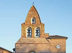 Bell gable
 Psot office
See also
References
| Wikimedia Commons has media related to Gragnague. |
This article is issued from
Wikipedia.
The text is licensed under Creative Commons - Attribution - Sharealike.
Additional terms may apply for the media files.