Aignes
| Aignes | |
|---|---|
| Commune | |
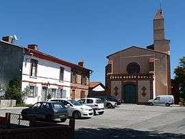 The church in Aignes | |
 Aignes Location within Occitanie region  Aignes | |
| Coordinates: 43°19′16″N 1°35′22″E / 43.3211°N 1.5894°ECoordinates: 43°19′16″N 1°35′22″E / 43.3211°N 1.5894°E | |
| Country | France |
| Region | Occitanie |
| Department | Haute-Garonne |
| Arrondissement | Toulouse |
| Canton | Escalquens |
| Intercommunality | Côteaux Lauragais Sud |
| Government | |
| • Mayor (2014-2020) | Jude Mathe |
| Area1 | 21.81 km2 (8.42 sq mi) |
| Population (2014)2 | 249 |
| • Density | 11/km2 (30/sq mi) |
| Time zone | UTC+1 (CET) |
| • Summer (DST) | UTC+2 (CEST) |
| INSEE/Postal code | 31002 /31550 |
| Elevation |
198–323 m (650–1,060 ft) (avg. 300 m or 980 ft) |
|
1 French Land Register data, which excludes lakes, ponds, glaciers > 1 km2 (0.386 sq mi or 247 acres) and river estuaries. 2 Population without double counting: residents of multiple communes (e.g., students and military personnel) only counted once. | |
Aignes is a commune in the Haute-Garonne department in southwestern France.
Population
| Historical population | ||
|---|---|---|
| Year | Pop. | ±% |
| 1962 | 105 | — |
| 1968 | 219 | +108.6% |
| 1975 | 184 | −16.0% |
| 1982 | 176 | −4.3% |
| 1990 | 168 | −4.5% |
| 1999 | 193 | +14.9% |
| 2008 | 233 | +20.7% |
See also
References
| Wikimedia Commons has media related to Aignes. |
This article is issued from
Wikipedia.
The text is licensed under Creative Commons - Attribution - Sharealike.
Additional terms may apply for the media files.