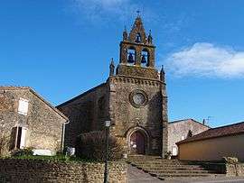
Mourvilles-Hautes
| Mourvilles-Hautes | ||
|---|---|---|
| Commune | ||
 | ||
| ||
 Mourvilles-Hautes Location within Occitanie region  Mourvilles-Hautes | ||
| Coordinates: 43°25′38″N 1°49′03″E / 43.4272°N 1.8175°ECoordinates: 43°25′38″N 1°49′03″E / 43.4272°N 1.8175°E | ||
| Country | France | |
| Region | Occitanie | |
| Department | Haute-Garonne | |
| Arrondissement | Toulouse | |
| Canton | Revel | |
| Government | ||
| • Mayor | Alain Itier | |
| Area1 | 6.59 km2 (2.54 sq mi) | |
| Population (2008)2 | 160 | |
| • Density | 24/km2 (63/sq mi) | |
| Time zone | UTC+1 (CET) | |
| • Summer (DST) | UTC+2 (CEST) | |
| INSEE/Postal code | 31393 /31540 | |
| Elevation |
223–311 m (732–1,020 ft) (avg. 250 m or 820 ft) | |
|
1 French Land Register data, which excludes lakes, ponds, glaciers > 1 km2 (0.386 sq mi or 247 acres) and river estuaries. 2 Population without double counting: residents of multiple communes (e.g., students and military personnel) only counted once. | ||

Mourvilles-Hautes is a commune in the Haute-Garonne department of southwestern France.
Population
| Historical population | ||
|---|---|---|
| Year | Pop. | ±% |
| 1962 | 98 | — |
| 1968 | 119 | +21.4% |
| 1975 | 120 | +0.8% |
| 1982 | 122 | +1.7% |
| 1990 | 134 | +9.8% |
| 1999 | 167 | +24.6% |
| 2008 | 160 | −4.2% |
See also
References
| Wikimedia Commons has media related to Mourvilles-Hautes. |
This article is issued from
Wikipedia.
The text is licensed under Creative Commons - Attribution - Sharealike.
Additional terms may apply for the media files.