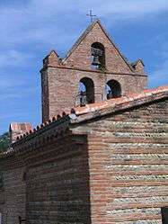
Rebigue
| Rebigue | ||
|---|---|---|
| Commune | ||
 | ||
| ||
 Rebigue Location within Occitanie region  Rebigue | ||
| Coordinates: 43°29′23″N 1°28′55″E / 43.4897°N 1.4819°ECoordinates: 43°29′23″N 1°28′55″E / 43.4897°N 1.4819°E | ||
| Country | France | |
| Region | Occitanie | |
| Department | Haute-Garonne | |
| Arrondissement | Toulouse | |
| Canton | Castanet-Tolosan | |
| Intercommunality | Sicoval | |
| Government | ||
| • Mayor (2008–2014) | Jean-Louis Echavidre | |
| Area1 | 5.16 km2 (1.99 sq mi) | |
| Population (2008)2 | 515 | |
| • Density | 100/km2 (260/sq mi) | |
| Time zone | UTC+1 (CET) | |
| • Summer (DST) | UTC+2 (CEST) | |
| INSEE/Postal code | 31448 /31320 | |
| Elevation |
182–281 m (597–922 ft) (avg. 250 m or 820 ft) | |
|
1 French Land Register data, which excludes lakes, ponds, glaciers > 1 km2 (0.386 sq mi or 247 acres) and river estuaries. 2 Population without double counting: residents of multiple communes (e.g., students and military personnel) only counted once. | ||
.svg.png)
Rebigue is a commune in the Haute-Garonne department in southwestern France.
Population
| Historical population | ||
|---|---|---|
| Year | Pop. | ±% |
| 1962 | 96 | — |
| 1968 | 118 | +22.9% |
| 1975 | 223 | +89.0% |
| 1982 | 317 | +42.2% |
| 1990 | 355 | +12.0% |
| 1999 | 444 | +25.1% |
| 2008 | 515 | +16.0% |
See also
References
| Wikimedia Commons has media related to Rebigue. |
This article is issued from
Wikipedia.
The text is licensed under Creative Commons - Attribution - Sharealike.
Additional terms may apply for the media files.