Bonrepos-Riquet
| Bonrepos-Riquet | ||
|---|---|---|
| Commune | ||
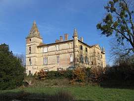 Chateau | ||
| ||
 Bonrepos-Riquet Location within Occitanie region  Bonrepos-Riquet | ||
| Coordinates: 43°40′39″N 1°37′28″E / 43.6775°N 1.6244°ECoordinates: 43°40′39″N 1°37′28″E / 43.6775°N 1.6244°E | ||
| Country | France | |
| Region | Occitanie | |
| Department | Haute-Garonne | |
| Arrondissement | Toulouse | |
| Canton | Pechbonnieu | |
| Government | ||
| • Mayor (2008–2014) | Jean-Paul Maronèse | |
| Area1 | 5.69 km2 (2.20 sq mi) | |
| Population (2015)2 | 285 | |
| • Density | 50/km2 (130/sq mi) | |
| Time zone | UTC+1 (CET) | |
| • Summer (DST) | UTC+2 (CEST) | |
| INSEE/Postal code | 31074 /31590 | |
| Elevation |
142–253 m (466–830 ft) (avg. 200 m or 660 ft) | |
|
1 French Land Register data, which excludes lakes, ponds, glaciers > 1 km2 (0.386 sq mi or 247 acres) and river estuaries. 2 Population without double counting: residents of multiple communes (e.g., students and military personnel) only counted once. | ||
.svg.png)
Bonrepos-Riquet is a commune in the Haute-Garonne department in southwestern France.
Population
Its inhabitants are called Riquetois.
| Historical population | ||
|---|---|---|
| Year | Pop. | ±% |
| 1962 | 152 | — |
| 1968 | 153 | +0.7% |
| 1975 | 140 | −8.5% |
| 1982 | 158 | +12.9% |
| 1990 | 195 | +23.4% |
| 1999 | 247 | +26.7% |
| 2008 | 234 | −5.3% |
See also
References
| Wikimedia Commons has media related to Bonrepos-Riquet. |
This article is issued from
Wikipedia.
The text is licensed under Creative Commons - Attribution - Sharealike.
Additional terms may apply for the media files.