Le Fousseret
| Le Fousseret | ||
|---|---|---|
| Commune | ||
 | ||
| ||
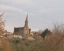
 Le Fousseret Location within Occitanie region  Le Fousseret | ||
| Coordinates: 43°16′57″N 1°03′59″E / 43.2825°N 1.0664°ECoordinates: 43°16′57″N 1°03′59″E / 43.2825°N 1.0664°E | ||
| Country | France | |
| Region | Occitanie | |
| Department | Haute-Garonne | |
| Arrondissement | Muret | |
| Canton | Cazères | |
| Intercommunality | Louge et le Touch | |
| Government | ||
| • Mayor (2008–2014) | Alain Condis | |
| Area1 | 38.31 km2 (14.79 sq mi) | |
| Population (2008)2 | 1,611 | |
| • Density | 42/km2 (110/sq mi) | |
| Time zone | UTC+1 (CET) | |
| • Summer (DST) | UTC+2 (CEST) | |
| INSEE/Postal code | 31193 /31430 | |
| Elevation |
238–372 m (781–1,220 ft) (avg. 320 m or 1,050 ft) | |
|
1 French Land Register data, which excludes lakes, ponds, glaciers > 1 km2 (0.386 sq mi or 247 acres) and river estuaries. 2 Population without double counting: residents of multiple communes (e.g., students and military personnel) only counted once. | ||
.svg.png)
Le Fousseret is a commune in the Haute-Garonne department in southwestern France.
Geography
The village lies in the middle of the commune, on the left bank of the Louge, which flows northeast through the middle of the commune.
Population
| Historical population | ||
|---|---|---|
| Year | Pop. | ±% |
| 1962 | 1,410 | — |
| 1968 | 1,460 | +3.5% |
| 1975 | 1,412 | −3.3% |
| 1982 | 1,375 | −2.6% |
| 1990 | 1,370 | −0.4% |
| 1999 | 1,434 | +4.7% |
| 2008 | 1,611 | +12.3% |
International relations
Le Fousseret is twinned with:
See also
References
| Wikimedia Commons has media related to Le Fousseret. |
This article is issued from
Wikipedia.
The text is licensed under Creative Commons - Attribution - Sharealike.
Additional terms may apply for the media files.