Launaguet
| Launaguet | ||
|---|---|---|
| Commune | ||
 Château de Launaguet - Current City Hall. | ||
| ||
 Launaguet Location within Occitanie region  Launaguet | ||
| Coordinates: 43°40′30″N 1°27′28″E / 43.675°N 1.4578°ECoordinates: 43°40′30″N 1°27′28″E / 43.675°N 1.4578°E | ||
| Country | France | |
| Region | Occitanie | |
| Department | Haute-Garonne | |
| Arrondissement | Toulouse | |
| Canton | Toulouse-8 | |
| Intercommunality | Toulouse Métropole | |
| Government | ||
| • Mayor (2008–2014) | Arlette Sylvestre | |
| Area1 | 7.02 km2 (2.71 sq mi) | |
| Population (2008)2 | 6,953 | |
| • Density | 990/km2 (2,600/sq mi) | |
| Time zone | UTC+1 (CET) | |
| • Summer (DST) | UTC+2 (CEST) | |
| INSEE/Postal code | 31282 /31140 | |
| Elevation |
126–203 m (413–666 ft) (avg. 135 m or 443 ft) | |
|
1 French Land Register data, which excludes lakes, ponds, glaciers > 1 km2 (0.386 sq mi or 247 acres) and river estuaries. 2 Population without double counting: residents of multiple communes (e.g., students and military personnel) only counted once. | ||
.svg.png)
Launaguet is a commune in the Haute-Garonne department in southwestern France.
Population
| Historical population | ||
|---|---|---|
| Year | Pop. | ±% |
| 1962 | 1,160 | — |
| 1968 | 1,407 | +21.3% |
| 1975 | 2,771 | +96.9% |
| 1982 | 2,842 | +2.6% |
| 1990 | 3,768 | +32.6% |
| 1999 | 5,086 | +35.0% |
| 2008 | 6,953 | +36.7% |
Sights
 Chateau facade
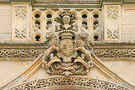 Chateau entrance
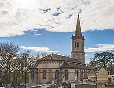 Saint Barthélemy apse
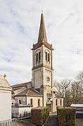 Bell tower
See also
References
| Wikimedia Commons has media related to Launaguet. |
This article is issued from
Wikipedia.
The text is licensed under Creative Commons - Attribution - Sharealike.
Additional terms may apply for the media files.