Cadours
| Cadours | ||
|---|---|---|
| Commune | ||
 Cadours | ||
| ||
 Cadours Location within Occitanie region  Cadours | ||
| Coordinates: 43°43′45″N 1°03′02″E / 43.7292°N 1.0506°ECoordinates: 43°43′45″N 1°03′02″E / 43.7292°N 1.0506°E | ||
| Country | France | |
| Region | Occitanie | |
| Department | Haute-Garonne | |
| Arrondissement | Toulouse | |
| Canton | Léguevin | |
| Intercommunality | Canton de Cadours | |
| Government | ||
| • Mayor (2008–2014) | Alain Julian | |
| Area1 | 10.58 km2 (4.08 sq mi) | |
| Population (2008)2 | 1,045 | |
| • Density | 99/km2 (260/sq mi) | |
| Time zone | UTC+1 (CET) | |
| • Summer (DST) | UTC+2 (CEST) | |
| INSEE/Postal code | 31098 /31480 | |
| Elevation |
147–242 m (482–794 ft) (avg. 250 m or 820 ft) | |
|
1 French Land Register data, which excludes lakes, ponds, glaciers > 1 km2 (0.386 sq mi or 247 acres) and river estuaries. 2 Population without double counting: residents of multiple communes (e.g., students and military personnel) only counted once. | ||
.svg.png)
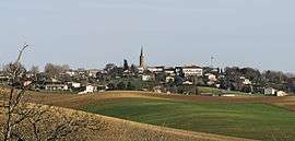
Cadours is a commune in the Haute-Garonne department in southwestern France.
Population
| Historical population | ||
|---|---|---|
| Year | Pop. | ±% |
| 1962 | 687 | — |
| 1968 | 737 | +7.3% |
| 1975 | 776 | +5.3% |
| 1982 | 687 | −11.5% |
| 1990 | 694 | +1.0% |
| 1999 | 696 | +0.3% |
| 2008 | 1,045 | +50.1% |
Monuments
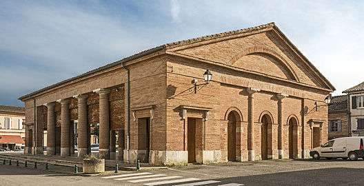 Market hall.
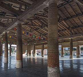 Inside the market hall.
 The church.
 The War Memorial.
See also
References
| Wikimedia Commons has media related to Cadours. |
This article is issued from
Wikipedia.
The text is licensed under Creative Commons - Attribution - Sharealike.
Additional terms may apply for the media files.